2 Cane Creek Campground
Community Reviews
Been here? Share the conditions.
Reviews, ratings & photos are added in the free Snoflo iOS app — rate a spot, tag the conditions, and your visit is verified by location. Add or manage your reviews from the app.
2 Cane Creek
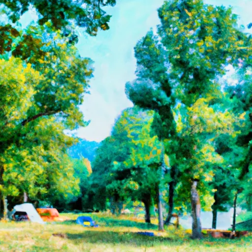
The best time to visit Cane Creek Camping Area is during the spring and fall seasons when the weather is mild, allowing for enjoyable outdoor activities. It is recommended to avoid camping during the peak summer months due to the higher temperatures and potential for bugs. While exploring the campground, campers should be cautious of the nearby creek, ensuring that children remain supervised and safe. Additionally, it is essential to follow all rules and regulations set by the campground management to preserve the natural beauty of the area and ensure a pleasant experience for all visitors.
What's on-site at 2 Cane Creek
Key facilities Snoflo tracks for this campground. Confirm with the operator before booking -- amenities can change seasonally.
Plan your trip down to the hour
Same weather feed Snoflo's iOS app uses -- updated continuously from NOAA / yr.no.
Next 5 days, hour by hour
Temperature line with weather symbols on top, snow + rain accumulation as columns, humidity as a dotted line.
5-day forecast table
Every 3 hours, broken out across temperature, snow, rain, humidity, and wind. Each cell is colour-coded relative to the column min/max so trends jump out at a glance.
| Time | Condition | Temp (°F) | Snow (in) | Rain (in) | Humidity (%) | Wind (mps) | Wind dir |
|---|---|---|---|---|---|---|---|
| Loading detailed forecast… | |||||||
15-day temperature & precipitation
Daily temperatures, snow, and rain projected over the next two weeks. Hover any point for the full breakdown.
Other campgrounds in the area
Snoflo-tracked campsites within driving distance of 2 Cane Creek, with reservations status.
| Campground | Reservations | Toilets | View |
|---|---|---|---|
| #02 Cane Creek | ✗ | ✗ | → |
| 11 Beard Cane | ✗ | ✗ | → |
| Look Rock - Great Smoky Mountains National Park | ✗ | ✗ | → |
| 17 Little Bottoms | ✗ | ✗ | → |
| #01 Cooper Road | ✗ | ✗ | → |
Nearby streamflow
USGS streamgauges within reach of 2 Cane Creek -- pulled live from the National Water Information System.
| Streamgauge | Discharge | View |
|---|---|---|
| Little River Near Maryville | 327 cfs | → |
| Little River Above Townsend | 437 cfs | → |
| Little River Near Alcoa | 369 cfs | → |
| Cheoah River Nr Bearpen Gap Nr Tapoco | 128 cfs | → |
| Little Pigeon River At Sevierville | 708 cfs | → |
| Beaver Creek At Solway | 65 cfs | → |
Nearby snow depths
NRCS SNOTEL stations within reach of 2 Cane Creek -- relevant when planning a shoulder-season or alpine trip.
| SNOTEL station | Snowpack | 24h Snowfall | View |
|---|---|---|---|
| Gatlinburg | 0.0 in | 0.0 in | → |
| New Found Gap | 14.9 in | 0.0 in | → |
| Bryson City 4 | 0.0 in | 0.0 in | → |
| Kingston | 0.0 in | 0.0 in | → |
Plan a longer trip
The closest parks, lakes, boat launches, and paddle runs so a camping night can grow into a full weekend.
Parks
- Sandy Springs Park
- John Sevier Park
- Pole Climbers Park
- Rock Gardens Park
- Charles M Park
- Eagleton Park
Boat launches
- Peery's Mill Park
- Calderwood Highway 6676, Blount County
- Tabcat Creek
- Calderwood Highway Blount County
- Alcoa Water Plant Boat Ramp
- Tallassee
Fishing spots
Points of interest
- Dunlap Branch Overlook
- Wolfpen Gap Overlook
- Emerine Gap Overlook
- Murray Gap Overlook
- Look Rock Overlook
- Happy Valley Overlook
Paddle runs
- Polecat Branch To Snowbird Picnic Area
- Owlcamp Branch To Polecat Branch
- Headwaters Near Mitchell Lick To Owlcamp Branch
- Natahala Powerhouse To Lake Fontana (River Mile 4)
- Headwaters Near Graham County Line To Nc/Tn State Line
- Tn/Nc State Line (Rm 48.0) To Tn360 Bridge (Rm 30.0)
Camping essentials & Leave No Trace
- Pack it in, pack it out
- Take all trash, food scraps, and gear back with you to keep campsites clean and protect wildlife.
- Respect wildlife
- Observe animals from a distance, store food securely, and never feed wildlife to maintain natural behavior and safety.
- Know before you go
- Check weather, fire restrictions, trail conditions, and permit requirements to ensure a safe and well-planned trip.
- Minimize campfire impact
- Use established fire rings, keep fires small, fully extinguish them, or opt for a camp stove when fires are restricted.
- Leave what you find
- Preserve natural and cultural features by avoiding removal of plants, rocks, artifacts, or other elements of the environment.
Set push alerts in the Snoflo app
Save 2 Cane Creek as a favorite, set a custom threshold (precipitation, snowpack, freezing temperatures), and the iOS app will push the moment conditions cross.
About 2 Cane Creek
Can I make reservations at 2 Cane Creek?
This campground does not appear to accept reservations -- it's typically first-come, first-served. Arrive early on summer weekends.
How fresh is the weather data on this page?
The hourly forecast updates throughout the day from the NOAA / yr.no public feeds. Streamflow data is pulled live from USGS streamgauges and snowpack from the NRCS SNOTEL network.
What's the best time of year to visit?
Use the 15-day temperature & precipitation outlook on this page to plan -- pick a window with comfortable temperatures and low precipitation. For longer trips, the 5-day hourly meteogram shows snow + rain accumulation hour-by-hour.
How do I get to 2 Cane Creek?
Tap Directions in the hero above to open driving directions in Google Maps, or Open in map to center the Snoflo interactive map on the campground.
Can I get alerts when conditions change?
Yes -- alerts are managed through the Snoflo iOS app. Favorite this campground, set a threshold (temperature, snowpack, precipitation), and you'll get a push the moment it crosses.
Other campgrounds near here
Snoflo-tracked campgrounds within driving distance of 2 Cane Creek.