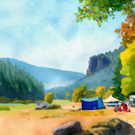
Lincoln Rock State Park Campground
Community Reviews
Been here? Share the conditions.
Reviews, ratings & photos are added in the free Snoflo iOS app — rate a spot, tag the conditions, and your visit is verified by location. Add or manage your reviews from the app.
Lincoln Rock State Park
What's on-site at Lincoln Rock State Park
Key facilities Snoflo tracks for this campground. Confirm with the operator before booking -- amenities can change seasonally.
Plan your trip down to the hour
Same weather feed Snoflo's iOS app uses -- updated continuously from NOAA / yr.no.
Next 5 days, hour by hour
Temperature line with weather symbols on top, snow + rain accumulation as columns, humidity as a dotted line.
5-day forecast table
Every 3 hours, broken out across temperature, snow, rain, humidity, and wind. Each cell is colour-coded relative to the column min/max so trends jump out at a glance.
| Time | Condition | Temp (°F) | Snow (in) | Rain (in) | Humidity (%) | Wind (mps) | Wind dir |
|---|---|---|---|---|---|---|---|
| Loading detailed forecast… | |||||||
15-day temperature & precipitation
Daily temperatures, snow, and rain projected over the next two weeks. Hover any point for the full breakdown.
Other campgrounds in the area
Snoflo-tracked campsites within driving distance of Lincoln Rock State Park, with reservations status.
| Campground | Reservations | Toilets | View |
|---|---|---|---|
| Wenatchee Confluence State Park | ✓ | ✗ | → |
| Wenatchee River County Park | ✗ | ✗ | → |
| Entiat City Park | ✗ | ✗ | → |
| Daroga State Park | ✗ | ✗ | → |
| Duffy / Douglas Creek | ✗ | ✗ | → |
Nearby streamflow
USGS streamgauges within reach of Lincoln Rock State Park -- pulled live from the National Water Information System.
| Streamgauge | Discharge | View |
|---|---|---|
| Wenatchee River At Monitor | 1,050 cfs | → |
| Entiat River Near Entiat | 196 cfs | → |
| Mad River At Ardenvoir | 24 cfs | → |
| Wenatchee River At Peshastin | 1,030 cfs | → |
| Icicle Creek Above Snow Creek Near Leavenworth | 209 cfs | → |
| Entiat River Near Ardenvoir | 166 cfs | → |
Nearby snow depths
NRCS SNOTEL stations within reach of Lincoln Rock State Park -- relevant when planning a shoulder-season or alpine trip.
| SNOTEL station | Snowpack | 24h Snowfall | View |
|---|---|---|---|
| Entiat Fish Hatchery | 0.0 in | 0.0 in | → |
| Upper Wheeler | 1.0 in | 0.0 in | → |
| Upper Wheeler | 0.0 in | 0.0 in | → |
| Leavenworth | 0.0 in | 0.0 in | → |
| Blewett Pass | 0.0 in | 0.0 in | → |
| Blewett Pass Nwac Station | 0.0 in | 0.0 in | → |
Plan a longer trip
The closest parks, lakes, boat launches, and paddle runs so a camping night can grow into a full weekend.
Parks
- Lincoln Rock State Park
- Confluence State Park
- Walla Walla Point Park
- Kenzie's Landing
- Pennsylvania Park
- Kiwanis Methow Park
Boat launches
- U.S. 2 13253, East Wenatchee
- Chelan County
- Apple Capital Recreation Loop Trail, Wenatchee
- Lower Monitor
- Apple Capitol Recreational Loop Trail, Wenatchee
- Riverside Park Picnic Area
Points of interest
- Rocky Reach Dam Discovery Center
- Apple Visitor Center
- Wenatchee Valley Museum And Cultural Center
- Great Northern Steam Locomotive
- Columbia Breaks Fire Interpretive Center
- Douglas County Historical Museum
Paddle runs
- Outlet Of Lake Wenatchee To Wenatchee Nf Boundary
- Douglas Creek
- Alpine Lakes Wilderness Boundary To City Of Leavenworth Water Intake In Se1/4 Of Sec 28, T24n, R17e
- Glacier Peak Wilderness Boundary To Confluence With Wenatchee River
- Rock Island Campground To Ida Creek
- Point At East Section Line Of Sec 13, T28n, R15e To Lake Wenatchee
Camping essentials & Leave No Trace
- Pack it in, pack it out
- Take all trash, food scraps, and gear back with you to keep campsites clean and protect wildlife.
- Respect wildlife
- Observe animals from a distance, store food securely, and never feed wildlife to maintain natural behavior and safety.
- Know before you go
- Check weather, fire restrictions, trail conditions, and permit requirements to ensure a safe and well-planned trip.
- Minimize campfire impact
- Use established fire rings, keep fires small, fully extinguish them, or opt for a camp stove when fires are restricted.
- Leave what you find
- Preserve natural and cultural features by avoiding removal of plants, rocks, artifacts, or other elements of the environment.
Set push alerts in the Snoflo app
Save Lincoln Rock State Park as a favorite, set a custom threshold (precipitation, snowpack, freezing temperatures), and the iOS app will push the moment conditions cross.
About Lincoln Rock State Park
Can I make reservations at Lincoln Rock State Park?
Yes -- this campground accepts reservations. Snoflo recommends booking early for peak season; check the operator (Recreation.gov / state park system / private operator) for the booking window and cancellation policy.
How fresh is the weather data on this page?
The hourly forecast updates throughout the day from the NOAA / yr.no public feeds. Streamflow data is pulled live from USGS streamgauges and snowpack from the NRCS SNOTEL network.
What's the best time of year to visit?
Use the 15-day temperature & precipitation outlook on this page to plan -- pick a window with comfortable temperatures and low precipitation. For longer trips, the 5-day hourly meteogram shows snow + rain accumulation hour-by-hour.
How do I get to Lincoln Rock State Park?
Tap Directions in the hero above to open driving directions in Google Maps, or Open in map to center the Snoflo interactive map on the campground.
Can I get alerts when conditions change?
Yes -- alerts are managed through the Snoflo iOS app. Favorite this campground, set a threshold (temperature, snowpack, precipitation), and you'll get a push the moment it crosses.
Other campgrounds near here
Snoflo-tracked campgrounds within driving distance of Lincoln Rock State Park.