Upper Comanche Campground
Community Reviews
Been here? Share the conditions.
Reviews, ratings & photos are added in the free Snoflo iOS app — rate a spot, tag the conditions, and your visit is verified by location. Add or manage your reviews from the app.
Upper Comanche
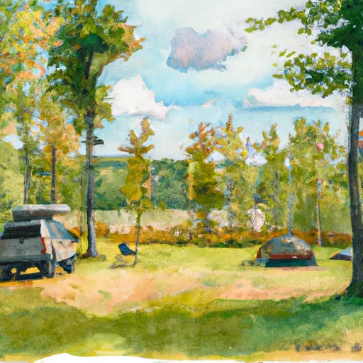
The campground amenities include 22 campsites, each of which is equipped with picnic tables and fire pits. There are also vault toilets, hand pumps, and garbage cans on site. The camping area is first-come-first-serve, so it is advisable to arrive early to secure a spot.
An interesting fact about the Upper Comanche Camping Area is that it is named after the Comanche people, who were a nomadic tribe that once roamed the Great Plains of North America. They were known for their expert horsemanship and their resistance against European colonization.
The best time to visit the Upper Comanche Camping Area is during the summer months between mid-June and mid-September. During this time, the average temperature ranges from 60°F to 80°F. However, visitors should be prepared for sudden changes in weather conditions, as the area is known for its unpredictable weather patterns. Overall, the Upper Comanche Camping Area is a great destination for nature lovers and wilderness enthusiasts looking to escape the hustle and bustle of city life.
What's on-site at Upper Comanche
Key facilities Snoflo tracks for this campground. Confirm with the operator before booking -- amenities can change seasonally.
Plan your trip down to the hour
Same weather feed Snoflo's iOS app uses -- updated continuously from NOAA / yr.no.
Next 5 days, hour by hour
Temperature line with weather symbols on top, snow + rain accumulation as columns, humidity as a dotted line.
5-day forecast table
Every 3 hours, broken out across temperature, snow, rain, humidity, and wind. Each cell is colour-coded relative to the column min/max so trends jump out at a glance.
| Time | Condition | Temp (°F) | Snow (in) | Rain (in) | Humidity (%) | Wind (mps) | Wind dir |
|---|---|---|---|---|---|---|---|
| Loading detailed forecast… | |||||||
15-day temperature & precipitation
Daily temperatures, snow, and rain projected over the next two weeks. Hover any point for the full breakdown.
Other campgrounds in the area
Snoflo-tracked campsites within driving distance of Upper Comanche, with reservations status.
| Campground | Reservations | Toilets | View |
|---|---|---|---|
| Lower Comanche | ✗ | ✗ | → |
| Winnebago | ✗ | ✗ | → |
| Upper Apache | ✗ | ✗ | → |
| Cherokee | ✗ | ✗ | → |
| Lower Apache | ✗ | ✗ | → |
Nearby streamflow
USGS streamgauges within reach of Upper Comanche -- pulled live from the National Water Information System.
| Streamgauge | Discharge | View |
|---|---|---|
| Black River Near Galesville | 562 cfs | → |
| La Crosse River Near La Crosse | 381 cfs | → |
| Trempealeau River At Dodge | 530 cfs | → |
| Mississippi River At Winona | 13,000 cfs | → |
| Trempealeau River At Arcadia | 446 cfs | → |
| Root River Near Houston | 966 cfs | → |
Nearby snow depths
NRCS SNOTEL stations within reach of Upper Comanche -- relevant when planning a shoulder-season or alpine trip.
| SNOTEL station | Snowpack | 24h Snowfall | View |
|---|---|---|---|
| Galesville 2wsw | 0.0 in | 0.0 in | → |
| Holmen 2s | 0.0 in | 0.0 in | → |
| La Crosse | 0.0 in | 0.0 in | → |
| Cashton 3nnw | 0.0 in | 0.0 in | → |
| Caledonia | 0.0 in | 0.0 in | → |
| Genoa Dam 8 | 0.0 in | 0.0 in | → |
Plan a longer trip
The closest parks, lakes, boat launches, and paddle runs so a camping night can grow into a full weekend.
Parks
- Van Loon Wildlife Area
- Perrot State Park
- Tamarack Creek Wildlife Area
- Great River Bluffs State Park
- Trempealeau National Wildlife Refuge
- Thomas G Rowe Park
Boat launches
- Marinuka Lake -- Access
- Black River -- Access Nr State Hwy 35
- Third Lake - South
- Mississippi River -- Round Lake -- Access
- Second Lake
- Long Lake -- Landing
Camping essentials & Leave No Trace
- Pack it in, pack it out
- Take all trash, food scraps, and gear back with you to keep campsites clean and protect wildlife.
- Respect wildlife
- Observe animals from a distance, store food securely, and never feed wildlife to maintain natural behavior and safety.
- Know before you go
- Check weather, fire restrictions, trail conditions, and permit requirements to ensure a safe and well-planned trip.
- Minimize campfire impact
- Use established fire rings, keep fires small, fully extinguish them, or opt for a camp stove when fires are restricted.
- Leave what you find
- Preserve natural and cultural features by avoiding removal of plants, rocks, artifacts, or other elements of the environment.
Set push alerts in the Snoflo app
Save Upper Comanche as a favorite, set a custom threshold (precipitation, snowpack, freezing temperatures), and the iOS app will push the moment conditions cross.
About Upper Comanche
Can I make reservations at Upper Comanche?
This campground does not appear to accept reservations -- it's typically first-come, first-served. Arrive early on summer weekends.
How fresh is the weather data on this page?
The hourly forecast updates throughout the day from the NOAA / yr.no public feeds. Streamflow data is pulled live from USGS streamgauges and snowpack from the NRCS SNOTEL network.
What's the best time of year to visit?
Use the 15-day temperature & precipitation outlook on this page to plan -- pick a window with comfortable temperatures and low precipitation. For longer trips, the 5-day hourly meteogram shows snow + rain accumulation hour-by-hour.
How do I get to Upper Comanche?
Tap Directions in the hero above to open driving directions in Google Maps, or Open in map to center the Snoflo interactive map on the campground.
Can I get alerts when conditions change?
Yes -- alerts are managed through the Snoflo iOS app. Favorite this campground, set a threshold (temperature, snowpack, precipitation), and you'll get a push the moment it crosses.
Other campgrounds near here
Snoflo-tracked campgrounds within driving distance of Upper Comanche.