Baring

Climate Recreation Community Catastrophe

Baring
Eden Index

Climate 8.1 Recreation 0.6 Community Safeguard

3.4/10

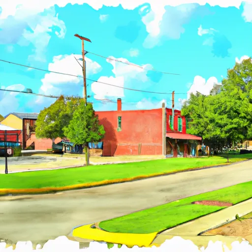
Baring, Missouri is a small town located in Knox County in the northeastern part of the state. The climate in Baring is characterized by hot summers, cold winters, and moderate precipitation throughout the year. Hydrology constituents in the area include numerous creeks and streams, with the South Fabius River running nearby. Outdoor recreation opportunities in the area include hunting, fishing, camping, and hiking. The nearby Mark Twain National Forest offers over 1.5 million acres of public land for outdoor enthusiasts to explore. Baring is a quiet and peaceful community, making it an ideal location for those looking to enjoy nature and the outdoors.

What is the Eden Index?

The Snoflo Eden Index serves as a comprehensive rating system for regions, evaluating their desirability through a holistic assessment of climate health, outdoor recreation opportunities, and natural disaster risk, acknowledging the profound impact of these factors on livability and well-being.


Climate Health Indicator (CHI): 8.1


Baring receives approximately 989mm of rain per year, with humidity levels near 82% and air temperatures averaging around 12°C. Baring has a plant hardyness factor of 5, meaning plants and agriculture in this region thrive during a short period during spring and early summer. Most plants will die off during the colder winter months. By considering the ideal temperature range, reliable water supplies, clean air, and stable seasonal rain or snowpacks, the Climate Health Indicator (CHI) underscores the significance of a healthy climate as the foundation for quality living.

A healthy climate is paramount for ensuring a high quality of life and livability in a region, fostering both physical well-being and environmental harmony. This can be characterized by ideal temperatures, reliable access to water supplies, clean air, and consistent seasonal rain or snowpacks.


Weather Forecast


Streamflow Conditions

Upper Mississippi-Salt

Area Rivers

Upper Mississippi-Salt


Snowpack Depths

Upper Mississippi-Salt


Reservoir Storage Capacity

Upper Mississippi-Salt


Groundwater Levels


Recreational Opportunity Index (ROI): 0.6


The Recreational Opportunity Index (ROI) recognizes the value of outdoor recreational options, such as parks, hiking trails, camping sites, and fishing spots, while acknowledging that climate plays a pivotal role in ensuring the comfort and consistency of these experiences. Access to outdoor recreational opportunities, encompassing activities such as parks, hiking, camping, and fishing, is crucial for overall well-being, and the climate plays a pivotal role in enabling and enhancing these experiences, ensuring that individuals can engage in nature-based activities comfortably and consistently.


Camping Areas

Campground Campsites Reservations Toilets Showers Elevation
Twin Ponds Co Park - West None 1,070 ft
Finger Lakes State Park None 725 ft
Henderson - Norfolk Lake None 590 ft
Cutshall Area None 921 ft
Gunner Pool 40 492 ft
George Wyth State Park 70 849 ft
Gamaliel - Norfolk Lake None 648 ft
Siggelkov County Park None 945 ft
Maumelle None 281 ft
Camp Robinson RV Military None 512 ft
Patrick Bridge Access - MDC 12 613 ft
Barkshed 6 559 ft
Pine Ridge 8 770 ft
Quarry Cove - Norfolk Lake None 628 ft
Manhattan Bridge Access None 644 ft
North Woods Park None 1,080 ft
Roubidoux Springs None 775 ft
Alcock Park 40 1,018 ft
Highland Ridge - Eau Galle Reservoir None 1,130 ft
Lake Iowa County Park 122 892 ft
Eau Galle Lake Spring Valley None 957 ft
Robinson Point - Norfolk Lake None 605 ft
Belva - Deer Rec Area 56 828 ft
Waubonsie Trail Park 7 784 ft
Deerwood City Park None 838 ft
Big Woods Lake None 859 ft
Clear Lake City Park None 1,164 ft
Woolly Hollow State Park None 483 ft
Binder Park 17 655 ft
Turtle Lake City Park 18 1,265 ft
Little Rock AFB Military None 352 ft
McGowen Rec Area 12 857 ft
Shelbina Lake City Park None 722 ft
Hickory Hills Park - La Porte City 80 911 ft
Piney River Military - Fort Leonard Wood None 768 ft
Glen Hills County Park 61 1,183 ft
Blanchard Springs 254 638 ft
Panther Bay - Norfolk Lake None 639 ft
Lake Fisher 6 840 ft
McFarlane Park None 804 ft
Downing County Park None 1,028 ft
Rodgers County Park 50 832 ft
Cranfield - Norfolk Lake None 566 ft
Woods Point - Norfolk Lake 11 548 ft
Split Rock County Park 54 1,069 ft
Paddy Creek 36 1,008 ft
Chacauqua River Access None 721 ft
Yenruogis County Park None 799 ft
Nugget Lake County Park 55 1,022 ft
Highland Ridge 45 1,105 ft
Georges Cove - Norfolk Lake None 633 ft
Minne Estema Park 30 870 ft
Jordan - Norfolk Lake None 683 ft
T. F. Clark Co Park 13 891 ft
Sycamore Loop Dispersed - Noblett Lake None 905 ft
Twin Ponds Co Park - East None 1,053 ft
Downtown Riverside RV Park 69 250 ft
Bidwell Point - Norfolk Lake None 549 ft
Dry Fork 18 763 ft
Hannen County Park 90 817 ft
Burns Park 38 280 ft

Catastrophe Safeguard Index (CSI):


The Catastrophe Safeguard Index (CSI) recognizes that natural disaster risk, encompassing floods, fires, hurricanes, and tornadoes, can drastically affect safety and the overall appeal of an area. The level of natural disaster risk in a region significantly affects safety and the overall livability, with climate change amplifying these risks by potentially increasing the frequency and intensity of events like floods, fires, hurricanes, and tornadoes, thereby posing substantial challenges to community resilience and well-being.


Community Resilience Indicator (CRI):


The Community Resilience Indicator (CRI) recognizes that education, healthcare, and socioeconomics are crucial to the well-being of a region. The CRI acknowledges the profound impact of these elements on residents' overall quality of life. By evaluating educational resources, healthcare accessibility, and economic inclusivity, the index captures the essential aspects that contribute to a thriving community, fostering resident satisfaction, equity, and social cohesion.


Log Your Visit

When was your last visit to ?

Add a Photo

How was it? How were conditions?

Rate the


Submit

Leave A Review


Submit

Upload an Image


Favorite Limit Reached