Belle-Plaine

Climate Recreation Community Catastrophe

Belle-Plaine
Eden Index

Climate 7.4 Recreation 3.1 Community 1.8 Safeguard

4.5/10

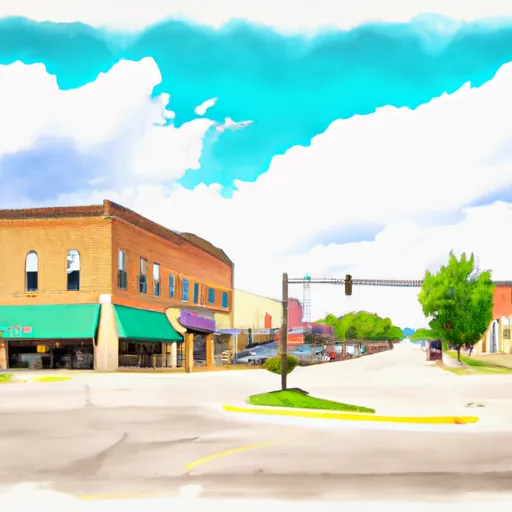
Belle-Plaine is a small city located in Benton County, Iowa. The climate in Belle-Plaine is characterized by warm summers and cold winters. The town is situated near the Iowa River, which is a major hydrological constituent in the area. The river provides opportunities for fishing, boating, and kayaking. Other outdoor recreation opportunities include hiking and biking on the nearby trails. Belle-Plaine is also home to several parks, including the Belle-Plaine City Park and the Franklin Street Park. The town is known for its friendly community and small-town charm, making it a great place to call home or visit for a relaxing outdoor getaway.

What is the Eden Index?

The Snoflo Eden Index serves as a comprehensive rating system for regions, evaluating their desirability through a holistic assessment of climate health, outdoor recreation opportunities, and natural disaster risk, acknowledging the profound impact of these factors on livability and well-being.


Climate Health Indicator (CHI): 7.4


Belle-Plaine receives approximately 918mm of rain per year, with humidity levels near 83% and air temperatures averaging around 9°C. Belle-Plaine has a plant hardyness factor of 5, meaning plants and agriculture in this region thrive during a short period during spring and early summer. Most plants will die off during the colder winter months. By considering the ideal temperature range, reliable water supplies, clean air, and stable seasonal rain or snowpacks, the Climate Health Indicator (CHI) underscores the significance of a healthy climate as the foundation for quality living.

A healthy climate is paramount for ensuring a high quality of life and livability in a region, fostering both physical well-being and environmental harmony. This can be characterized by ideal temperatures, reliable access to water supplies, clean air, and consistent seasonal rain or snowpacks.


Weather Forecast


Streamflow Conditions

Iowa

Area Rivers

Iowa


Snowpack Depths

Iowa


Reservoir Storage Capacity

Iowa


Groundwater Levels


Recreational Opportunity Index (ROI): 3.1


The Recreational Opportunity Index (ROI) recognizes the value of outdoor recreational options, such as parks, hiking trails, camping sites, and fishing spots, while acknowledging that climate plays a pivotal role in ensuring the comfort and consistency of these experiences. Access to outdoor recreational opportunities, encompassing activities such as parks, hiking, camping, and fishing, is crucial for overall well-being, and the climate plays a pivotal role in enabling and enhancing these experiences, ensuring that individuals can engage in nature-based activities comfortably and consistently.


Camping Areas

Campground Campsites Reservations Toilets Showers Elevation
Deerwood City Park None 838 ft
Big Woods Lake None 859 ft
Twin Ponds Co Park - East None 1,053 ft
Rippee Conserrvation Area - MDC None 793 ft
Boulder - St Croix State Forest 21 999 ft
Belva - Deer Rec Area 56 828 ft
Chacauqua River Access None 721 ft
Waubonsie Trail Park 7 784 ft
Rothwell Park None 858 ft
George Wyth State Park 70 849 ft
Rodgers County Park 50 832 ft
Finger Lakes State Park None 725 ft
Garfvert - Nemadji State Forest 18 1,162 ft
T. F. Clark Co Park 13 891 ft
Binder Park 17 655 ft
Highland Ridge 45 1,105 ft
Yenruogis County Park None 799 ft
Twin Ponds Co Park - West None 1,070 ft
Cutshall Area None 921 ft
Glen Hills County Park 61 1,183 ft
Siggelkov County Park None 945 ft
Piney River Military - Fort Leonard Wood None 768 ft
Eau Galle Lake Spring Valley None 957 ft
Hannen County Park 90 817 ft
Macon Co Park None 873 ft
Namekagon Trail Bridge - St. Croix National Scenic River None 933 ft
North Woods Park None 1,080 ft
Roubidoux Springs None 775 ft
Lake Fisher 6 840 ft
Gamaliel - Norfolk Lake None 648 ft
Clear Lake City Park None 1,164 ft
Sycamore Loop Dispersed - Noblett Lake None 905 ft
Balsam Lake Pine Park - Town 15 1,144 ft
Hickory Hills Park - La Porte City 80 911 ft
Pine Ridge 8 770 ft
Dry Fork 18 763 ft
Nugget Lake County Park 55 1,022 ft
Split Rock County Park 54 1,069 ft
Alcock Park 40 1,018 ft
Whiteface Reservoir 58 1,489 ft
Manhattan Bridge Access None 644 ft
Drakesville City Park 6 886 ft
Highland Ridge - Eau Galle Reservoir None 1,130 ft
Black Hawk County Park None 858 ft
Lake Iowa County Park 122 892 ft
McFarlane Park None 804 ft
Patrick Bridge Access - MDC 12 613 ft
Turtle Lake City Park 18 1,265 ft
McGowen Rec Area 12 857 ft
Bay City 25 676 ft
Riverside Landing - St. Croix National Scenic River None 896 ft

Catastrophe Safeguard Index (CSI):


The Catastrophe Safeguard Index (CSI) recognizes that natural disaster risk, encompassing floods, fires, hurricanes, and tornadoes, can drastically affect safety and the overall appeal of an area. The level of natural disaster risk in a region significantly affects safety and the overall livability, with climate change amplifying these risks by potentially increasing the frequency and intensity of events like floods, fires, hurricanes, and tornadoes, thereby posing substantial challenges to community resilience and well-being.


Community Resilience Indicator (CRI): 1.8


The Community Resilience Indicator (CRI) recognizes that education, healthcare, and socioeconomics are crucial to the well-being of a region. The CRI acknowledges the profound impact of these elements on residents' overall quality of life. By evaluating educational resources, healthcare accessibility, and economic inclusivity, the index captures the essential aspects that contribute to a thriving community, fostering resident satisfaction, equity, and social cohesion.


Log Your Visit

When was your last visit to ?

Add a Photo

How was it? How were conditions?

Rate the


Submit

Leave A Review


Submit

Upload an Image


Favorite Limit Reached