Castor

Climate Recreation Community Catastrophe

Castor
Eden Index

Climate 7.7 Recreation 1.4 Community Safeguard

3.6/10

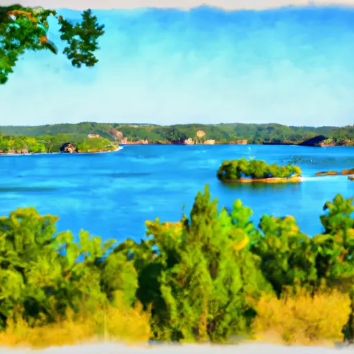
Castor, Louisiana is a small community located in Bienville Parish, Louisiana. The climate in Castor is classified as humid subtropical, with hot summers and mild winters. The area is mostly rural and is surrounded by forests and wetlands. The hydrology constituents of Castor include several streams, creeks, and small ponds. Outdoor recreation opportunities in the area include fishing, hunting, hiking, and camping. Castor is located near several state parks, such as Lake Bistineau State Park and Kisatchie National Forest, which offer additional opportunities for outdoor recreation. Overall, Castor is a great destination for those looking to enjoy the natural beauty of Louisiana.

What is the Eden Index?

The Snoflo Eden Index serves as a comprehensive rating system for regions, evaluating their desirability through a holistic assessment of climate health, outdoor recreation opportunities, and natural disaster risk, acknowledging the profound impact of these factors on livability and well-being.


Climate Health Indicator (CHI): 7.7


Castor receives approximately 1384mm of rain per year, with humidity levels near 87% and air temperatures averaging around 18°C. Castor has a plant hardyness factor of 8, meaning plants and agriculture in this region tend to thrive here all year round. By considering the ideal temperature range, reliable water supplies, clean air, and stable seasonal rain or snowpacks, the Climate Health Indicator (CHI) underscores the significance of a healthy climate as the foundation for quality living.

A healthy climate is paramount for ensuring a high quality of life and livability in a region, fostering both physical well-being and environmental harmony. This can be characterized by ideal temperatures, reliable access to water supplies, clean air, and consistent seasonal rain or snowpacks.


Weather Forecast


Streamflow Conditions

Red-Saline

Area Rivers

Red-Saline


Snowpack Depths

Red-Saline


Reservoir Storage Capacity

Red-Saline


Groundwater Levels


Recreational Opportunity Index (ROI): 1.4


The Recreational Opportunity Index (ROI) recognizes the value of outdoor recreational options, such as parks, hiking trails, camping sites, and fishing spots, while acknowledging that climate plays a pivotal role in ensuring the comfort and consistency of these experiences. Access to outdoor recreational opportunities, encompassing activities such as parks, hiking, camping, and fishing, is crucial for overall well-being, and the climate plays a pivotal role in enabling and enhancing these experiences, ensuring that individuals can engage in nature-based activities comfortably and consistently.


Camping Areas

Campground Campsites Reservations Toilets Showers Elevation
Stephens - Lake Ouachita 9 420 ft
Bayou Bluff 28 634 ft
Riverview - Lake Dardanelle None 363 ft
Oak Camp Complex 23 300 ft
Caddo Drive - De Gray Lake 72 415 ft
Arlie Moore - De Gray Lake 87 517 ft
Turtle Slide None 223 ft
Alpine Ridge - De Gray Lake 49 473 ft
Lotus Camp 20 215 ft
Carter Cove None 358 ft
DeGray Lake State Park 113 403 ft
White Oak Lake State Park None 208 ft
Lake Catherine State Park None 396 ft
Kisatchie Bayou Complex 30 167 ft
Turkey Trot Complex 25 261 ft
Iron Mountain - De Gray Lake 69 456 ft
Quarry Cove None 372 ft
Custis Camp Complex 10 302 ft
White Oak Park 7 12 ft
Coyote Camp Complex 13 367 ft
Long Pool 77 615 ft
Lake Claiborne State Park None 337 ft
Fullerton Complex 36 307 ft
Gulpha Gorge - Hot Springs National Park 44 540 ft
Point Cedar - De Gray Lake 62 417 ft
Shouse Ford - De Gray Lake 99 401 ft
Bucktail Camp Complex 40 296 ft
Lake Dardanelle State Park None 344 ft
Cedar Fourche - Lake Ouachita None 587 ft
Piney Bay - Lake Dardanelle None 365 ft
Lake Ouachita State Park None 759 ft
Logoly State Park None 327 ft
Mount Nebo State Park None 1,404 ft
Cedar Glades Park None 562 ft
Lena Landing - Lake Ouachita 10 599 ft
Lorrain Parish Park 15 5 ft
Enduro Complex 35 269 ft
Red Bluff Camp Complex 10 205 ft
Ozark - Buffalo National River None 865 ft
County Line None 359 ft
Ozan Point - De Gray Lake 50 422 ft
Sam Houston Jones State Park 40 18 ft
Brady Mountain - Lake Ouachita 74 616 ft
Richland Creek 13 1,034 ft
Cloud Crossing Complex 13 130 ft
Haw Creek Falls 9 791 ft
Petit Jean State Park None 900 ft
Holbrook Parish Park None 20 ft
Erbie - Buffalo National River None 847 ft
Dogwood Complex 12 174 ft
Edgewood - De Gray Lake 51 409 ft
River Road None 355 ft
Carver - Buffalo National River None 710 ft

Catastrophe Safeguard Index (CSI):


The Catastrophe Safeguard Index (CSI) recognizes that natural disaster risk, encompassing floods, fires, hurricanes, and tornadoes, can drastically affect safety and the overall appeal of an area. The level of natural disaster risk in a region significantly affects safety and the overall livability, with climate change amplifying these risks by potentially increasing the frequency and intensity of events like floods, fires, hurricanes, and tornadoes, thereby posing substantial challenges to community resilience and well-being.


Community Resilience Indicator (CRI):


The Community Resilience Indicator (CRI) recognizes that education, healthcare, and socioeconomics are crucial to the well-being of a region. The CRI acknowledges the profound impact of these elements on residents' overall quality of life. By evaluating educational resources, healthcare accessibility, and economic inclusivity, the index captures the essential aspects that contribute to a thriving community, fostering resident satisfaction, equity, and social cohesion.


Log Your Visit

When was your last visit to ?

Add a Photo

How was it? How were conditions?

Rate the


Submit

Leave A Review


Submit

Upload an Image


Favorite Limit Reached