Collins

Climate Recreation Community Catastrophe

Collins
Eden Index

Climate 7.4 Recreation 1.2 Community 2.1 Safeguard

3.9/10

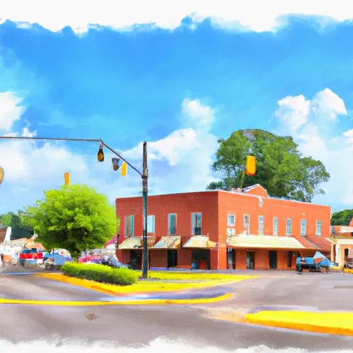
Collins, Mississippi has a humid subtropical climate with hot summers and mild winters. The area receives ample rainfall, and the Bouie River runs through the town, providing opportunities for fishing and canoeing. The Bouie River also serves as a source of drinking water for the town. The area is primarily forested with pine and hardwood trees, making it a popular destination for hunters and outdoor enthusiasts. One notable recreational opportunity is the Okatibbee Water Park, which offers swimming, fishing, and boating on a nearby lake. Overall, Collins provides a great mix of outdoor recreation and natural resources.

What is the Eden Index?

The Snoflo Eden Index serves as a comprehensive rating system for regions, evaluating their desirability through a holistic assessment of climate health, outdoor recreation opportunities, and natural disaster risk, acknowledging the profound impact of these factors on livability and well-being.


Climate Health Indicator (CHI): 7.4


Collins receives approximately 1477mm of rain per year, with humidity levels near 85% and air temperatures averaging around 19°C. Collins has a plant hardyness factor of 8, meaning plants and agriculture in this region tend to thrive here all year round. By considering the ideal temperature range, reliable water supplies, clean air, and stable seasonal rain or snowpacks, the Climate Health Indicator (CHI) underscores the significance of a healthy climate as the foundation for quality living.

A healthy climate is paramount for ensuring a high quality of life and livability in a region, fostering both physical well-being and environmental harmony. This can be characterized by ideal temperatures, reliable access to water supplies, clean air, and consistent seasonal rain or snowpacks.


Weather Forecast


Streamflow Conditions

Pascagoula. Mississippi

Area Rivers

Pascagoula. Mississippi


Snowpack Depths

Pascagoula. Mississippi


Reservoir Storage Capacity

Pascagoula. Mississippi


Groundwater Levels


Recreational Opportunity Index (ROI): 1.2


The Recreational Opportunity Index (ROI) recognizes the value of outdoor recreational options, such as parks, hiking trails, camping sites, and fishing spots, while acknowledging that climate plays a pivotal role in ensuring the comfort and consistency of these experiences. Access to outdoor recreational opportunities, encompassing activities such as parks, hiking, camping, and fishing, is crucial for overall well-being, and the climate plays a pivotal role in enabling and enhancing these experiences, ensuring that individuals can engage in nature-based activities comfortably and consistently.


Camping Areas

Campground Campsites Reservations Toilets Showers Elevation
Otter Lake 25 1,643 ft
Rib Mountain State Park 30 1,850 ft
McLeod Water Park None 22 ft
Riverside/Fern's Edge - Kakabeka Falls Provincial Park 75 859 ft
Langford Lake 11 1,681 ft
Lake Ross Barnett 22 402 ft
Pomeroy Lake 17 1,643 ft
Washington County Lake State Conservation Area 150 503 ft
Okatoma Water Park None 396 ft
Dry Creek Water Park None 514 ft
Hugh White State Park None 310 ft
General Watkins Conservation Area - MDC 5 466 ft
Lake Murphysboro State Park 75 403 ft
Choctaw - Grenada Lake 5 289 ft
Carl Spindler None 456 ft
Hennepin Canal Parkway State Park None 667 ft
Marathon Lake 71 481 ft
North Abutment - Grenada Lake 88 251 ft
Pyramid State Park 80 475 ft
Lake Gogebic State Park 165 1,304 ft
Trail of Tears State Park None 441 ft
Coal Bluff Park 60 335 ft
Sherwood Forest None 625 ft
Low Head Dam None 310 ft
Skuna/Turkey Creek - Grenada Lake None 246 ft
Devils Backbone Park 20 362 ft
Trail of Tears State Forest None 525 ft
Bergland Town Park 15 1,320 ft
North Graysport - Grenada Lake 51 279 ft
Dam West - Lake Carlyle 110 453 ft
Little Black Creek Waterpark None 296 ft
Johnson Creek 20 644 ft
Veterans Memorial Field - Portage None 784 ft
Lake Mike Conner 20 314 ft
Lake Gogebic County Park None 1,296 ft
Shockaloe Base Camp I 10 578 ft
Bryant - Grenada Lake 6 210 ft
Sara Park None 1,443 ft
Ontonagon County Park 43 1,301 ft
Jamison Town Park 18 823 ft
Lake Columbia 12 212 ft
Turkey Bayou None 371 ft
Whispering Hills - Kakabeka Falls Provincial Park 94 991 ft
Roosevelt State Park None 562 ft
Pine Hills 13 460 ft
Sangchris Lake State Park 185 586 ft
Green River State Wildlife Area 50 677 ft
Woodford State Conservation Area None 472 ft
Lake Lou Yaeger None 691 ft
Council Grounds State Park 55 1,300 ft
Marathon Park None 1,268 ft
Leake County Water Park None 324 ft
Old Fort - Grenada Lake 21 279 ft
Buccaneer State Park 276 5 ft

Catastrophe Safeguard Index (CSI):


The Catastrophe Safeguard Index (CSI) recognizes that natural disaster risk, encompassing floods, fires, hurricanes, and tornadoes, can drastically affect safety and the overall appeal of an area. The level of natural disaster risk in a region significantly affects safety and the overall livability, with climate change amplifying these risks by potentially increasing the frequency and intensity of events like floods, fires, hurricanes, and tornadoes, thereby posing substantial challenges to community resilience and well-being.


Community Resilience Indicator (CRI): 2.1


The Community Resilience Indicator (CRI) recognizes that education, healthcare, and socioeconomics are crucial to the well-being of a region. The CRI acknowledges the profound impact of these elements on residents' overall quality of life. By evaluating educational resources, healthcare accessibility, and economic inclusivity, the index captures the essential aspects that contribute to a thriving community, fostering resident satisfaction, equity, and social cohesion.


Log Your Visit

When was your last visit to ?

Add a Photo

How was it? How were conditions?

Rate the


Submit

Leave A Review


Submit

Upload an Image


Favorite Limit Reached