Dewar

Climate Recreation Community Catastrophe

Dewar
Eden Index

Climate 7.1 Recreation 4.0 Community Safeguard

4.2/10

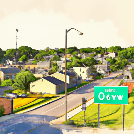
Dewar, Iowa is a small rural town located in Black Hawk County. The climate in the area is classified as humid continental, with cold winters and warm summers. The town is situated near several bodies of water, including the Cedar River and Wolf Creek, which provide hydrology constituents. Outdoor recreation opportunities in the area include fishing, hunting, and hiking in nearby parks such as Cedar Valley Nature Trail and Big Woods Lake Recreation Area. Dewar is also home to a community park that features a playground and baseball field.

What is the Eden Index?

The Snoflo Eden Index serves as a comprehensive rating system for regions, evaluating their desirability through a holistic assessment of climate health, outdoor recreation opportunities, and natural disaster risk, acknowledging the profound impact of these factors on livability and well-being.


Climate Health Indicator (CHI): 7.1


Dewar receives approximately 895mm of rain per year, with humidity levels near 83% and air temperatures averaging around 9°C. Dewar has a plant hardyness factor of 5, meaning plants and agriculture in this region thrive during a short period during spring and early summer. Most plants will die off during the colder winter months. By considering the ideal temperature range, reliable water supplies, clean air, and stable seasonal rain or snowpacks, the Climate Health Indicator (CHI) underscores the significance of a healthy climate as the foundation for quality living.

A healthy climate is paramount for ensuring a high quality of life and livability in a region, fostering both physical well-being and environmental harmony. This can be characterized by ideal temperatures, reliable access to water supplies, clean air, and consistent seasonal rain or snowpacks.


Weather Forecast


Streamflow Conditions

Iowa

Area Rivers

Iowa


Snowpack Depths

Iowa


Reservoir Storage Capacity

Iowa


Groundwater Levels


Recreational Opportunity Index (ROI): 4.0


The Recreational Opportunity Index (ROI) recognizes the value of outdoor recreational options, such as parks, hiking trails, camping sites, and fishing spots, while acknowledging that climate plays a pivotal role in ensuring the comfort and consistency of these experiences. Access to outdoor recreational opportunities, encompassing activities such as parks, hiking, camping, and fishing, is crucial for overall well-being, and the climate plays a pivotal role in enabling and enhancing these experiences, ensuring that individuals can engage in nature-based activities comfortably and consistently.


Camping Areas

Campground Campsites Reservations Toilets Showers Elevation
Paddy Creek 36 1,008 ft
Roubidoux Springs None 775 ft
Rodgers County Park 50 832 ft
Twin Ponds Co Park - West None 1,070 ft
Split Rock County Park 54 1,069 ft
Chacauqua River Access None 721 ft
Boulder - St Croix State Forest 21 999 ft
Siggelkov County Park None 945 ft
McKinley City Park 80 1,396 ft
Alcock Park 40 1,018 ft
Yenruogis County Park None 799 ft
Lake Jeanette 12 1,375 ft
Piney River Military - Fort Leonard Wood None 768 ft
Clear Lake City Park None 1,164 ft
Manhattan Bridge Access None 644 ft
Minne Estema Park 30 870 ft
Twin Ponds Co Park - East None 1,053 ft
Glen Hills County Park 61 1,183 ft
Highland Ridge 45 1,105 ft
Nugget Lake County Park 55 1,022 ft
Fishermans Point City Campground 70 1,441 ft
Milroy Access 95 783 ft
Highland Ridge - Eau Galle Reservoir None 1,130 ft
Riverside Landing - St. Croix National Scenic River None 896 ft
Cutshall Area None 921 ft
Finger Lakes State Park None 725 ft
Vermilion Trail 40 1,430 ft
McGowen Rec Area 12 857 ft
Hoodoo Point City Campground 85 1,362 ft
T. F. Clark Co Park 13 891 ft
Dry Fork 18 763 ft
Binder Park 17 655 ft
McFarlane Park None 804 ft
Downing County Park None 1,028 ft
North Woods Park None 1,080 ft
Bear Head Lake State Park 75 1,523 ft
Belva - Deer Rec Area 56 828 ft
Hannen County Park 90 817 ft
Whiteface Reservoir 58 1,489 ft
Eau Galle Lake Spring Valley None 957 ft
Waubonsie Trail Park 7 784 ft
Pine Ridge 8 770 ft
Big Woods Lake None 859 ft
Heritage City Park 18 1,439 ft
Turtle Lake City Park 18 1,265 ft
Lake Iowa County Park 122 892 ft
Namekagon Trail Bridge - St. Croix National Scenic River None 933 ft
Shelbina Lake City Park None 722 ft
George Wyth State Park 70 849 ft
Deerwood City Park None 838 ft
Hickory Hills Park - La Porte City 80 911 ft
Howell Landing - St. Croix National Scenic River None 950 ft

Catastrophe Safeguard Index (CSI):


The Catastrophe Safeguard Index (CSI) recognizes that natural disaster risk, encompassing floods, fires, hurricanes, and tornadoes, can drastically affect safety and the overall appeal of an area. The level of natural disaster risk in a region significantly affects safety and the overall livability, with climate change amplifying these risks by potentially increasing the frequency and intensity of events like floods, fires, hurricanes, and tornadoes, thereby posing substantial challenges to community resilience and well-being.


Community Resilience Indicator (CRI):


The Community Resilience Indicator (CRI) recognizes that education, healthcare, and socioeconomics are crucial to the well-being of a region. The CRI acknowledges the profound impact of these elements on residents' overall quality of life. By evaluating educational resources, healthcare accessibility, and economic inclusivity, the index captures the essential aspects that contribute to a thriving community, fostering resident satisfaction, equity, and social cohesion.


Log Your Visit

When was your last visit to ?

Add a Photo

How was it? How were conditions?

Rate the


Submit

Leave A Review


Submit

Upload an Image


Favorite Limit Reached