Donaldsonville

Climate Recreation Community Catastrophe

Donaldsonville
Eden Index

Climate 7.2 Recreation 0.9 Community 2.3 Safeguard

3.8/10

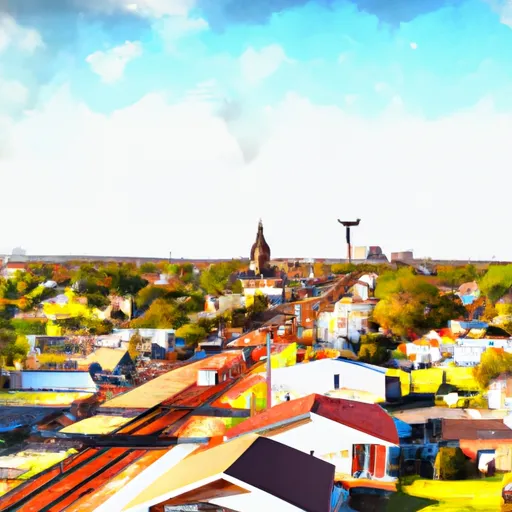
Donaldsonville, Louisiana is located on the west bank of the Mississippi River and has a humid subtropical climate. Summers are hot and humid with highs in the 90s, while winters are mild with temperatures in the 60s. The area experiences high precipitation throughout the year, with an average annual rainfall of around 60 inches. Donaldsonville is also susceptible to hurricanes and flooding due to its proximity to the Gulf of Mexico and the Mississippi River.

The hydrology of Donaldsonville is dominated by the Mississippi River, which provides a source of water for the community. The river also offers outdoor recreation opportunities such as fishing, boating, and kayaking.

Other outdoor recreation opportunities in the area include visiting the Lake Verret Wildlife Refuge, which offers opportunities for hunting and fishing, as well as hiking and birdwatching. The nearby Bogue Chitto State Park also offers hiking, camping, and fishing opportunities in a scenic natural setting.

What is the Eden Index?

The Snoflo Eden Index serves as a comprehensive rating system for regions, evaluating their desirability through a holistic assessment of climate health, outdoor recreation opportunities, and natural disaster risk, acknowledging the profound impact of these factors on livability and well-being.


Climate Health Indicator (CHI): 7.2


Donaldsonville receives approximately 1545mm of rain per year, with humidity levels near 87% and air temperatures averaging around 20°C. Donaldsonville has a plant hardyness factor of 9, meaning plants and agriculture in this region tend to thrive here all year round. By considering the ideal temperature range, reliable water supplies, clean air, and stable seasonal rain or snowpacks, the Climate Health Indicator (CHI) underscores the significance of a healthy climate as the foundation for quality living.

A healthy climate is paramount for ensuring a high quality of life and livability in a region, fostering both physical well-being and environmental harmony. This can be characterized by ideal temperatures, reliable access to water supplies, clean air, and consistent seasonal rain or snowpacks.


Weather Forecast


Streamflow Conditions

Central Louisiana Coastal

Area Rivers

Central Louisiana Coastal


Snowpack Depths

Central Louisiana Coastal


Reservoir Storage Capacity

Central Louisiana Coastal


Groundwater Levels


Recreational Opportunity Index (ROI): 0.9


The Recreational Opportunity Index (ROI) recognizes the value of outdoor recreational options, such as parks, hiking trails, camping sites, and fishing spots, while acknowledging that climate plays a pivotal role in ensuring the comfort and consistency of these experiences. Access to outdoor recreational opportunities, encompassing activities such as parks, hiking, camping, and fishing, is crucial for overall well-being, and the climate plays a pivotal role in enabling and enhancing these experiences, ensuring that individuals can engage in nature-based activities comfortably and consistently.


Camping Areas

Campground Campsites Reservations Toilets Showers Elevation
Shady Creek - Mississippi River 50 554 ft
Robertsville State Park 27 502 ft
Weinberg - King State Park 19 590 ft
Leroy Percy State Park None 108 ft
Dupont Reservation Conservation Area - MDC 20 460 ft
Central Park 100 978 ft
Red Bluff 109 821 ft
Fourth Pumping Plant Rec Area 22 531 ft
Great River Road Campground None 451 ft
Powder Mill - Ozark National Scenic River 8 561 ft
Berryman 19 1,009 ft
Lake Bruin State Park None 75 ft
Natchez State Park None 236 ft
Owls Bend - Powder Mill None 556 ft
Clear Spgs Rec Area 45 317 ft
Lake End City Park 74 4 ft
Deer Leap 46 338 ft
Flaming Prairie Park 24 541 ft
Lamar Dixon Expo RV Center 300 11 ft
Klondike County Park None 530 ft
Wapello Fairgrounds Park None 587 ft
Little Sunflower River None 107 ft
South Recreation Composite 100 140 ft
Fairport State Rec Area 40 566 ft
Saulsbury Bridge 35 614 ft
Ferry Landing 50 604 ft
Council Bluff - Wild Boar Ridge 100 1,268 ft
Blanchard Island - Mississippi River 35 556 ft
Keithsburg Riverside Campground 60 541 ft
Siloam Springs State Park 180 690 ft
Lake Chicot State Park None 128 ft
Lake Charlie Capps None 146 ft
Grand Gulf Military Park 42 238 ft
Warfield Point Park None 132 ft
Watercress 114 523 ft
Roberts Field None 561 ft
Big River State Forest 100 541 ft
Henderson County State Conservation 35 554 ft
Walnut Grove Co Park None 691 ft
Bennett Park 13 795 ft
Carthage City Park None 666 ft
Cappy Russell Access Dispersed None 554 ft
Float Camp 16 472 ft
Delabar State Park 60 575 ft
Farr Park 108 26 ft
Argyle Lake State Park 160 695 ft
Sherman Co Park None 701 ft
Eden Valley Park None 710 ft
Lake End Park 167 4 ft
Bluff View - Clearwater Lake None 572 ft
Webb Creek - Clearwater Lake None 727 ft
Snively Access 30 656 ft
Cuivre River State Park 94 658 ft
Sutton Bluff 45 820 ft
Fillmore County Rec Area None 835 ft
Clarks Ferry - Mississippi River 45 556 ft
Hazel Creek None 846 ft
Pictured Rocks Co Park None 885 ft
Meramec State Park None 613 ft
Johnsons Shut-Ins State Park None 849 ft
Great River Road State Park None 150 ft
Rocky Springs - Natchez Trace Pkwy 22 235 ft
Big Spring - Ozark National Scenic River 123 727 ft

Catastrophe Safeguard Index (CSI):


The Catastrophe Safeguard Index (CSI) recognizes that natural disaster risk, encompassing floods, fires, hurricanes, and tornadoes, can drastically affect safety and the overall appeal of an area. The level of natural disaster risk in a region significantly affects safety and the overall livability, with climate change amplifying these risks by potentially increasing the frequency and intensity of events like floods, fires, hurricanes, and tornadoes, thereby posing substantial challenges to community resilience and well-being.


Community Resilience Indicator (CRI): 2.3


The Community Resilience Indicator (CRI) recognizes that education, healthcare, and socioeconomics are crucial to the well-being of a region. The CRI acknowledges the profound impact of these elements on residents' overall quality of life. By evaluating educational resources, healthcare accessibility, and economic inclusivity, the index captures the essential aspects that contribute to a thriving community, fostering resident satisfaction, equity, and social cohesion.


Log Your Visit

When was your last visit to ?

Add a Photo

How was it? How were conditions?

Rate the


Submit

Leave A Review


Submit

Upload an Image


Favorite Limit Reached