Dunnegan

Climate Recreation Community Catastrophe

Dunnegan
Eden Index

Climate 8.3 Recreation 4.3 Community Safeguard

4.8/10

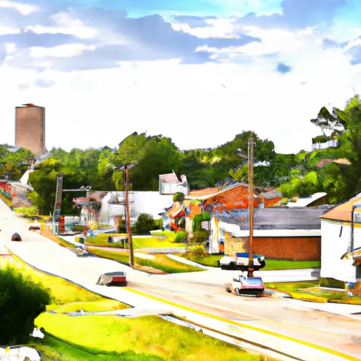
Dunnegan, Missouri has a humid subtropical climate with hot summers and mild winters. The area receives an average of 45 inches of precipitation annually, with most of it falling during the spring and summer months. The hydrology constituents of the area include the Sac River and several smaller creeks and streams that provide abundant fishing opportunities for anglers. In addition to fishing, Dunnegan offers outdoor recreation opportunities such as hiking, camping, and hunting in the nearby conservation areas. The area is known for its beautiful scenery, including rolling hills and Ozark forests. Dunnegan is a great destination for those looking to enjoy the outdoors and experience the natural beauty of Missouri.

What is the Eden Index?

The Snoflo Eden Index serves as a comprehensive rating system for regions, evaluating their desirability through a holistic assessment of climate health, outdoor recreation opportunities, and natural disaster risk, acknowledging the profound impact of these factors on livability and well-being.


Climate Health Indicator (CHI): 8.3


Dunnegan receives approximately 1126mm of rain per year, with humidity levels near 82% and air temperatures averaging around 14°C. Dunnegan has a plant hardyness factor of 6, meaning plants and agriculture in this region thrive during a short period during spring and early summer. Most plants will die off during the colder winter months. By considering the ideal temperature range, reliable water supplies, clean air, and stable seasonal rain or snowpacks, the Climate Health Indicator (CHI) underscores the significance of a healthy climate as the foundation for quality living.

A healthy climate is paramount for ensuring a high quality of life and livability in a region, fostering both physical well-being and environmental harmony. This can be characterized by ideal temperatures, reliable access to water supplies, clean air, and consistent seasonal rain or snowpacks.


Weather Forecast


Streamflow Conditions

Osage

Area Rivers

Osage


Snowpack Depths

Osage


Reservoir Storage Capacity

Osage


Groundwater Levels


Recreational Opportunity Index (ROI): 4.3


The Recreational Opportunity Index (ROI) recognizes the value of outdoor recreational options, such as parks, hiking trails, camping sites, and fishing spots, while acknowledging that climate plays a pivotal role in ensuring the comfort and consistency of these experiences. Access to outdoor recreational opportunities, encompassing activities such as parks, hiking, camping, and fishing, is crucial for overall well-being, and the climate plays a pivotal role in enabling and enhancing these experiences, ensuring that individuals can engage in nature-based activities comfortably and consistently.


Camping Areas

Campground Campsites Reservations Toilets Showers Elevation
Berryville RV Park 18 1,169 ft
Windsor Crossing - Harry S Truman Lake 47 745 ft
Rocky Shoals 5 683 ft
Dragover 7 741 ft
Long Shoal - Harry S. Truman Lake None 783 ft
River Bluff 5 616 ft
Ozone 28 1,825 ft
Beaver Town Park 42 910 ft
Sparrowfoot - Harry S. Truman Lake None 731 ft
Harry S Truman State Park None 864 ft
Tompkins Bend - Lake Ouachita 77 603 ft
Crystal 9 972 ft
Charlton 58 725 ft
Daisy State Park None 592 ft
Big Fir 50 617 ft
Osceola RV Park 48 732 ft
Baxter - Table Rock Lake None 941 ft
Big M - Table Rock Lake None 924 ft
Irons Fork - Lake Ouachita 12 586 ft
Aunts Creek - Table Rock Lake None 998 ft
Big Bay - Table Rock Lake 61 1,022 ft
Cape Fair - Table Rock Lake None 966 ft
Viney Creek None 930 ft
Highway 27 - Lake Ouachita None 593 ft
Avant - Lake Ouachita 25 589 ft
Osage Bluff - Harry S. Truman Lake None 807 ft
Spring Lake 53 522 ft
Eagle Rock - Table Rock Lake None 988 ft
Mount Magazine State Park None 2,429 ft
Withrow Springs State Park None 1,399 ft
Mill Creek - Table Rock Lake None 950 ft
Shoal Bay - Lake Dardanelle None 375 ft
Wheatland - Pomme de Terre Lake None 905 ft
Weaubleau City Park None 988 ft
Joe Bald - Table Rock Lake None 948 ft
Cedar Ridge - Stockton Lake None 905 ft
Campbell Point - Table Rock Lake None 999 ft
Lost Valley - Buffalo National River None 1,096 ft
Cameron Bluff 18 2,553 ft
Waveland - Blue Mountain Lake 51 430 ft
Crystal Springs - Lake Ouachita 74 623 ft
Knob Noster State Park None 833 ft
Little Fir - Lake Ouachita 29 602 ft
Kirby Landing - Lake Greeson None 571 ft
Twin Creek - Lake Ouachita 15 590 ft
Spadra - Lake Dardanelle None 360 ft
Cane Creek - Lake Dardanelle 16 344 ft
Crabtree Cove - Stockton Lake None 902 ft
Berry Bend - Harry S. Truman Lake None 850 ft
Horsehead Lake 80 692 ft
Denby Point - Lake Ouachita 67 655 ft
Lightfoot Landing - Pomme de Terre Lake None 870 ft
Stockton State Park None 910 ft
Joplin - Lake Ouachita 64 592 ft
Carrollton City Park None 709 ft
Fulton Branch 5 644 ft
Outlet Area - Blue Mountain Lake 30 410 ft
Thibaut Point - Harry S. Truman Lake None 731 ft
Indian Point - Table Rock Lake None 1,040 ft
Cove Lake Complex 96 1,034 ft
South Fourche 15 454 ft
Washita - Lake Ouachita None 600 ft
Bogard City Park 26 859 ft
Self Creek - Lake Greeson None 543 ft
Farrington City Park None 859 ft
Shawnee Bend - Harry S Truman Lake None 772 ft
Viola - Table Rock Lake None 1,017 ft
Wolf Pen 21 905 ft
Lake Leatherwood City Park None 1,046 ft
Talley Bend - Harry S. Truman Lake None 822 ft
Bucksaw - Harry S. Truman Lake None 738 ft

Catastrophe Safeguard Index (CSI):


The Catastrophe Safeguard Index (CSI) recognizes that natural disaster risk, encompassing floods, fires, hurricanes, and tornadoes, can drastically affect safety and the overall appeal of an area. The level of natural disaster risk in a region significantly affects safety and the overall livability, with climate change amplifying these risks by potentially increasing the frequency and intensity of events like floods, fires, hurricanes, and tornadoes, thereby posing substantial challenges to community resilience and well-being.


Community Resilience Indicator (CRI):


The Community Resilience Indicator (CRI) recognizes that education, healthcare, and socioeconomics are crucial to the well-being of a region. The CRI acknowledges the profound impact of these elements on residents' overall quality of life. By evaluating educational resources, healthcare accessibility, and economic inclusivity, the index captures the essential aspects that contribute to a thriving community, fostering resident satisfaction, equity, and social cohesion.


Log Your Visit

When was your last visit to ?

Add a Photo

How was it? How were conditions?

Rate the


Submit

Leave A Review


Submit

Upload an Image


Favorite Limit Reached