Farmerville

Climate Recreation Community Catastrophe

Farmerville
Eden Index

Climate 9.1 Recreation 3.1 Community 2.8 Safeguard

5.4/10

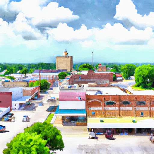
Farmerville, Louisiana is a small town located in Union Parish. The climate in Farmerville is humid subtropical, with hot summers and mild winters. The area is surrounded by several bodies of water, including Lake D'Arbonne and Bayou D'Arbonne, which provide opportunities for fishing, boating, and other water activities. The hydrology constituents of the area also make it a prime location for hunting and wildlife watching. The nearby D'Arbonne National Wildlife Refuge offers visitors the chance to see a variety of birds and other animals in their natural habitat. Other outdoor recreation opportunities in the area include hiking, camping, and golfing. Overall, Farmerville is a great destination for those looking to enjoy the outdoors and experience Louisiana's natural beauty.

What is the Eden Index?

The Snoflo Eden Index serves as a comprehensive rating system for regions, evaluating their desirability through a holistic assessment of climate health, outdoor recreation opportunities, and natural disaster risk, acknowledging the profound impact of these factors on livability and well-being.


Climate Health Indicator (CHI): 9.1


Farmerville receives approximately 1408mm of rain per year, with humidity levels near 78% and air temperatures averaging around 18°C. Farmerville has a plant hardyness factor of 8, meaning plants and agriculture in this region tend to thrive here all year round. By considering the ideal temperature range, reliable water supplies, clean air, and stable seasonal rain or snowpacks, the Climate Health Indicator (CHI) underscores the significance of a healthy climate as the foundation for quality living.

A healthy climate is paramount for ensuring a high quality of life and livability in a region, fostering both physical well-being and environmental harmony. This can be characterized by ideal temperatures, reliable access to water supplies, clean air, and consistent seasonal rain or snowpacks.


Weather Forecast


Streamflow Conditions

Lower Ouachita

Area Rivers

Lower Ouachita


Snowpack Depths

Lower Ouachita


Reservoir Storage Capacity

Lower Ouachita


Groundwater Levels


Recreational Opportunity Index (ROI): 3.1


The Recreational Opportunity Index (ROI) recognizes the value of outdoor recreational options, such as parks, hiking trails, camping sites, and fishing spots, while acknowledging that climate plays a pivotal role in ensuring the comfort and consistency of these experiences. Access to outdoor recreational opportunities, encompassing activities such as parks, hiking, camping, and fishing, is crucial for overall well-being, and the climate plays a pivotal role in enabling and enhancing these experiences, ensuring that individuals can engage in nature-based activities comfortably and consistently.


Camping Areas

Campground Campsites Reservations Toilets Showers Elevation
Twin Lakes Military - Camp Beauregard None 95 ft
Patrick Bridge Access - MDC 12 613 ft
Little Rock AFB Military None 352 ft
Bull Shoals State Park None 516 ft
Bidwell Point - Norfolk Lake None 549 ft
Toad Suck Ferry None 274 ft
Henderson - Norfolk Lake None 590 ft
Buffalo Point - Buffalo National River None 535 ft
Gamaliel - Norfolk Lake None 648 ft
Bankston Camp Complex 15 218 ft
Point Return City Park 22 716 ft
Lakeview - Bull Shoals Lake None 757 ft
Panther Bay - Norfolk Lake None 639 ft
Chicot State Park None 78 ft
Jimmie Davis State Park None 232 ft
Rush Landing - Buffalo National River None 451 ft
Loran Site Complex 30 230 ft
Highway 472 Camp 15 154 ft
Woolly Hollow State Park None 483 ft
Stuart 8 153 ft
Quarry Cove - Norfolk Lake None 628 ft
Roubidoux Springs None 775 ft
Moro Bay State Park None 90 ft
Rippee Conserrvation Area - MDC None 793 ft
Burns Park 38 280 ft
Old Lock and Dam 8 5 91 ft
Gunner Pool 40 492 ft
Cranfield - Norfolk Lake None 566 ft
Robinson Point - Norfolk Lake None 605 ft
Barkshed 6 559 ft
Indian Creek Recreation Area None 105 ft
Abbeville RV Park 55 10 ft
Maumelle None 281 ft
Camp Robinson RV Military None 512 ft
Rayne RV Park Gossen Memorial Park 737 27 ft
Downtown Riverside RV Park 69 250 ft
Blanchard Springs 254 638 ft
Pearson Camp Complex 25 154 ft
Crooked Creek Rec Area None 103 ft
Rapides Coliseum None 78 ft
Woods Point - Norfolk Lake 11 548 ft
Lake DArbonne State Park None 191 ft
Jordan - Norfolk Lake None 683 ft

Catastrophe Safeguard Index (CSI):


The Catastrophe Safeguard Index (CSI) recognizes that natural disaster risk, encompassing floods, fires, hurricanes, and tornadoes, can drastically affect safety and the overall appeal of an area. The level of natural disaster risk in a region significantly affects safety and the overall livability, with climate change amplifying these risks by potentially increasing the frequency and intensity of events like floods, fires, hurricanes, and tornadoes, thereby posing substantial challenges to community resilience and well-being.


Community Resilience Indicator (CRI): 2.8


The Community Resilience Indicator (CRI) recognizes that education, healthcare, and socioeconomics are crucial to the well-being of a region. The CRI acknowledges the profound impact of these elements on residents' overall quality of life. By evaluating educational resources, healthcare accessibility, and economic inclusivity, the index captures the essential aspects that contribute to a thriving community, fostering resident satisfaction, equity, and social cohesion.


Log Your Visit

When was your last visit to ?

Add a Photo

How was it? How were conditions?

Rate the


Submit

Leave A Review


Submit

Upload an Image


Favorite Limit Reached