Forest

Climate Recreation Community Catastrophe

Forest
Eden Index

Climate 7.4 Recreation 4.6 Community 2.0 Safeguard

5.0/10

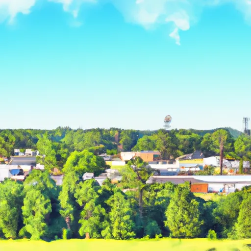
Forest, Mississippi is a small town located in Scott County in central Mississippi. The climate is classified as humid subtropical with hot, humid summers and mild winters. The town is nestled in the Bienville National Forest which provides ample opportunities for outdoor recreation such as hiking, camping, hunting, and fishing. The area is also home to several lakes and rivers, including the Pearl River, which provides opportunities for boating and water sports. The hydrology constituents of the area include wetlands, rivers, streams, and lakes, which support a diverse range of aquatic plants and animals. Overall, Forest, Mississippi offers plenty of opportunities for outdoor enthusiasts to explore and enjoy the natural beauty of the region.

What is the Eden Index?

The Snoflo Eden Index serves as a comprehensive rating system for regions, evaluating their desirability through a holistic assessment of climate health, outdoor recreation opportunities, and natural disaster risk, acknowledging the profound impact of these factors on livability and well-being.


Climate Health Indicator (CHI): 7.4


Forest receives approximately 1506mm of rain per year, with humidity levels near 84% and air temperatures averaging around 18°C. Forest has a plant hardyness factor of 8, meaning plants and agriculture in this region tend to thrive here all year round. By considering the ideal temperature range, reliable water supplies, clean air, and stable seasonal rain or snowpacks, the Climate Health Indicator (CHI) underscores the significance of a healthy climate as the foundation for quality living.

A healthy climate is paramount for ensuring a high quality of life and livability in a region, fostering both physical well-being and environmental harmony. This can be characterized by ideal temperatures, reliable access to water supplies, clean air, and consistent seasonal rain or snowpacks.


Weather Forecast


Streamflow Conditions

Pearl

Area Rivers

Pearl


Snowpack Depths

Pearl


Reservoir Storage Capacity

Pearl


Groundwater Levels


Recreational Opportunity Index (ROI): 4.6


The Recreational Opportunity Index (ROI) recognizes the value of outdoor recreational options, such as parks, hiking trails, camping sites, and fishing spots, while acknowledging that climate plays a pivotal role in ensuring the comfort and consistency of these experiences. Access to outdoor recreational opportunities, encompassing activities such as parks, hiking, camping, and fishing, is crucial for overall well-being, and the climate plays a pivotal role in enabling and enhancing these experiences, ensuring that individuals can engage in nature-based activities comfortably and consistently.


Camping Areas

Campground Campsites Reservations Toilets Showers Elevation
Trail of Tears State Park None 441 ft
General Watkins Conservation Area - MDC 5 466 ft
Langford Lake 11 1,681 ft
Otter Lake 25 1,643 ft
Eldon Hazlet State Park 350 455 ft
Sherwood Forest None 625 ft
Whispering Hills - Kakabeka Falls Provincial Park 94 991 ft
Jamison Town Park 18 823 ft
Pomeroy Lake 17 1,643 ft
Sylvania - Clark Lake 48 1,830 ft
Green River State Wildlife Area 50 677 ft
Woodford State Conservation Area None 472 ft
Ontonagon Township Park 56 613 ft
Marathon Park None 1,268 ft
Lake Mike Conner 20 314 ft
North Graysport - Grenada Lake 51 279 ft
Washington County Lake State Conservation Area 150 503 ft
Lake Ross Barnett 22 402 ft
Turkey Bayou None 371 ft
Johnson Creek 20 644 ft
Lake Gogebic County Park None 1,296 ft
Choctaw - Grenada Lake 5 289 ft
Roosevelt State Park None 562 ft
Riverside/Fern's Edge - Kakabeka Falls Provincial Park 75 859 ft
Collins Park 25 1,212 ft
Big Creek Waterpark None 254 ft
Lake Gogebic State Park 165 1,304 ft
McLeod Water Park None 22 ft
Carl Spindler None 456 ft
Trail of Tears State Forest None 525 ft
Lake Murphysboro State Park 75 403 ft
Marathon Lake 71 481 ft
Dells of the Eau Claire Park - Wausau 27 1,408 ft
Ontonagon County Park 43 1,301 ft
Sangchris Lake State Park 185 586 ft
Veterans Memorial Field - Portage None 784 ft
Coles Creek - Lake Carlyle 150 459 ft
Little Black Creek Waterpark None 296 ft
Dam West - Lake Carlyle 110 453 ft
Okatoma Water Park None 396 ft
Pyramid State Park 80 475 ft
Shockaloe Base Camp I 10 578 ft
Lake Lou Yaeger None 691 ft
Buccaneer State Park 276 5 ft
Devils Backbone Park 20 362 ft
Pine Hills 13 460 ft
Bergland Town Park 15 1,320 ft
Lake De Pue City Park 25 466 ft
Lake Taylorville City Campground None 605 ft

Catastrophe Safeguard Index (CSI):


The Catastrophe Safeguard Index (CSI) recognizes that natural disaster risk, encompassing floods, fires, hurricanes, and tornadoes, can drastically affect safety and the overall appeal of an area. The level of natural disaster risk in a region significantly affects safety and the overall livability, with climate change amplifying these risks by potentially increasing the frequency and intensity of events like floods, fires, hurricanes, and tornadoes, thereby posing substantial challenges to community resilience and well-being.


Community Resilience Indicator (CRI): 2.0


The Community Resilience Indicator (CRI) recognizes that education, healthcare, and socioeconomics are crucial to the well-being of a region. The CRI acknowledges the profound impact of these elements on residents' overall quality of life. By evaluating educational resources, healthcare accessibility, and economic inclusivity, the index captures the essential aspects that contribute to a thriving community, fostering resident satisfaction, equity, and social cohesion.


Log Your Visit

When was your last visit to ?

Add a Photo

How was it? How were conditions?

Rate the


Submit

Leave A Review


Submit

Upload an Image


Favorite Limit Reached