Hemphill

Climate Recreation Community Catastrophe

Hemphill
Eden Index

Climate 7.5 Recreation 4.8 Community Safeguard

4.7/10

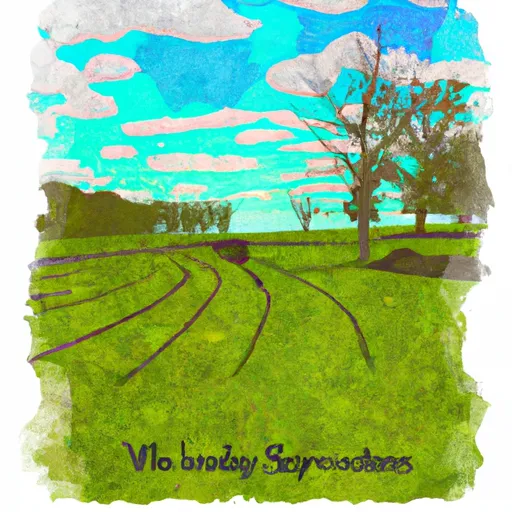
Hemphill, located in Sabine County, Texas, has a humid subtropical climate with hot summers and mild winters. The town is surrounded by the Toledo Bend Reservoir, which provides excellent fishing opportunities for bass, crappie, and catfish. The Sabine National Forest, located nearby, offers hiking, camping, and wildlife watching. Hemphill is also situated on the Sabine River, making it a popular spot for kayaking, canoeing, and tubing. Water quality in the Sabine River is monitored for constituents such as sediment, bacteria, and nutrients. Overall, Hemphill provides a beautiful natural setting for outdoor enthusiasts to enjoy.

What is the Eden Index?

The Snoflo Eden Index serves as a comprehensive rating system for regions, evaluating their desirability through a holistic assessment of climate health, outdoor recreation opportunities, and natural disaster risk, acknowledging the profound impact of these factors on livability and well-being.


Climate Health Indicator (CHI): 7.5


Hemphill receives approximately 1355mm of rain per year, with humidity levels near 90% and air temperatures averaging around 19°C. Hemphill has a plant hardyness factor of 8, meaning plants and agriculture in this region tend to thrive here all year round. By considering the ideal temperature range, reliable water supplies, clean air, and stable seasonal rain or snowpacks, the Climate Health Indicator (CHI) underscores the significance of a healthy climate as the foundation for quality living.

A healthy climate is paramount for ensuring a high quality of life and livability in a region, fostering both physical well-being and environmental harmony. This can be characterized by ideal temperatures, reliable access to water supplies, clean air, and consistent seasonal rain or snowpacks.


Weather Forecast


Streamflow Conditions

Sabine

Area Rivers

Sabine


Snowpack Depths

Sabine


Reservoir Storage Capacity

Sabine


Groundwater Levels


Recreational Opportunity Index (ROI): 4.8


The Recreational Opportunity Index (ROI) recognizes the value of outdoor recreational options, such as parks, hiking trails, camping sites, and fishing spots, while acknowledging that climate plays a pivotal role in ensuring the comfort and consistency of these experiences. Access to outdoor recreational opportunities, encompassing activities such as parks, hiking, camping, and fishing, is crucial for overall well-being, and the climate plays a pivotal role in enabling and enhancing these experiences, ensuring that individuals can engage in nature-based activities comfortably and consistently.


Camping Areas

Campground Campsites Reservations Toilets Showers Elevation
Harmon Lake Dam - Barksdale AFB 6 222 ft
Arrowhead Point 23 582 ft
Fair City RV Park 100 317 ft
Fulton Branch 5 644 ft
Daisy State Park None 592 ft
Cottonshed Landing - Millwood Lake 46 281 ft
Beards Bluff - Millwood Lake 28 366 ft
Dragover 7 741 ft
Cowhide Cove - Lake Greeson None 542 ft
Boles Field 20 308 ft
North Toledo Bend State Park None 258 ft
Albert Pike 54 904 ft
Indian Mounds 37 190 ft
Crystal 9 972 ft
Shirley Creek 6 763 ft
Red Hills Lake 26 374 ft
Alligator Parish Park 15 29 ft
Allens Ferry at Little River None 261 ft
Buckhorn - Lake Greeson 0 583 ft
Self Creek - Lake Greeson None 543 ft
Cypress Black Bayou Rec Area None 207 ft
Willow Oak 15 216 ft
Hervey Access Camping None 247 ft
Crater of Diamonds State Park None 339 ft
Kirby Landing - Lake Greeson None 571 ft
Highway 27 - Lake Ouachita None 593 ft
Pleasure Point State Rec Area - Toledo Bend Lake None 197 ft
Ragtown 25 208 ft
Barksdale AFB Military None 160 ft
Star of the West - Lake Greeson 21 575 ft
Laurel Creek - Lake Greeson None 582 ft
Oak Ridge None 199 ft
Rock Creek - Lake Greeson None 560 ft
Saratoga Landing - Millwood Lake 17 270 ft
Claiborne West Park None 16 ft
Toledo Bend Military None 203 ft
San Miguel Park State Rec Area None 228 ft
Rocky Shoals 5 683 ft
South Toledo Bend State Park None 221 ft
Beards Lake - Millwood Lake 5 263 ft
Converse Bay Rec Area - Toledo Bend Lake None 231 ft
Cypress Bend State Rec Area None 216 ft
River Bluff 5 616 ft
Dam Area - Lake Greeson None 431 ft
Pikeville - Lake Greeson 12 568 ft
River Run West - Millwood Lake 4 269 ft
River Run East - Millwood Lake 8 264 ft
Parker Creek - Lake Greeson None 684 ft
Nashville City Park None 456 ft

Catastrophe Safeguard Index (CSI):


The Catastrophe Safeguard Index (CSI) recognizes that natural disaster risk, encompassing floods, fires, hurricanes, and tornadoes, can drastically affect safety and the overall appeal of an area. The level of natural disaster risk in a region significantly affects safety and the overall livability, with climate change amplifying these risks by potentially increasing the frequency and intensity of events like floods, fires, hurricanes, and tornadoes, thereby posing substantial challenges to community resilience and well-being.


Community Resilience Indicator (CRI):


The Community Resilience Indicator (CRI) recognizes that education, healthcare, and socioeconomics are crucial to the well-being of a region. The CRI acknowledges the profound impact of these elements on residents' overall quality of life. By evaluating educational resources, healthcare accessibility, and economic inclusivity, the index captures the essential aspects that contribute to a thriving community, fostering resident satisfaction, equity, and social cohesion.


Log Your Visit

When was your last visit to ?

Add a Photo

How was it? How were conditions?

Rate the


Submit

Leave A Review


Submit

Upload an Image


Favorite Limit Reached