Homer

Climate Recreation Community Catastrophe

Homer
Eden Index

Climate 7.6 Recreation 2.0 Community 1.2 Safeguard

4.0/10

Homer, Louisiana is a small town located in Claiborne Parish in the northern part of the state. The climate in Homer is characterized as humid subtropical, with hot and humid summers and mild winters. Average temperatures range from the mid-90s°F (mid-30s°C) in summer to the mid-50s°F (10-15°C) in winter. The area experiences moderate rainfall throughout the year, with the wettest months occurring from March to May.

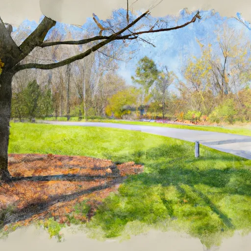
Homer is situated near Lake Claiborne, a popular destination for outdoor enthusiasts. The lake offers various recreational opportunities, including fishing for bass, crappie, and catfish. Boating, water skiing, and swimming are also popular activities in the lake. Additionally, the town is surrounded by scenic forests and wildlife management areas, providing opportunities for hunting, hiking, and birdwatching.

Hydrologically, Homer lies on the Bayou D'Arbonne watershed, which is part of the larger Ouachita River basin. The waterways in the area offer additional recreational options such as canoeing and kayaking. Overall, Homer's climate, hydrology constituents, and outdoor recreation opportunities make it an attractive destination for nature lovers and those seeking outdoor adventures in northern Louisiana.

What is the Eden Index?

The Snoflo Eden Index serves as a comprehensive rating system for regions, evaluating their desirability through a holistic assessment of climate health, outdoor recreation opportunities, and natural disaster risk, acknowledging the profound impact of these factors on livability and well-being.


Climate Health Indicator (CHI): 7.6


Homer receives approximately 1401mm of rain per year, with humidity levels near 87% and air temperatures averaging around 18°C. Homer has a plant hardyness factor of 8, meaning plants and agriculture in this region tend to thrive here all year round. By considering the ideal temperature range, reliable water supplies, clean air, and stable seasonal rain or snowpacks, the Climate Health Indicator (CHI) underscores the significance of a healthy climate as the foundation for quality living.

A healthy climate is paramount for ensuring a high quality of life and livability in a region, fostering both physical well-being and environmental harmony. This can be characterized by ideal temperatures, reliable access to water supplies, clean air, and consistent seasonal rain or snowpacks.


Weather Forecast


Streamflow Conditions

Lower Ouachita

Area Rivers

Lower Ouachita


Snowpack Depths

Lower Ouachita


Reservoir Storage Capacity

Lower Ouachita


Groundwater Levels


Recreational Opportunity Index (ROI): 2.0


The Recreational Opportunity Index (ROI) recognizes the value of outdoor recreational options, such as parks, hiking trails, camping sites, and fishing spots, while acknowledging that climate plays a pivotal role in ensuring the comfort and consistency of these experiences. Access to outdoor recreational opportunities, encompassing activities such as parks, hiking, camping, and fishing, is crucial for overall well-being, and the climate plays a pivotal role in enabling and enhancing these experiences, ensuring that individuals can engage in nature-based activities comfortably and consistently.


Camping Areas

Campground Campsites Reservations Toilets Showers Elevation
White Oak Park 7 12 ft
Lorrain Parish Park 15 5 ft
Iron Mountain - De Gray Lake 69 456 ft
Gulpha Gorge - Hot Springs National Park 44 540 ft
Red Bluff Camp Complex 10 205 ft
County Line None 359 ft
Petit Jean State Park None 900 ft
White Oak Lake State Park None 208 ft
Bayou Bluff 28 634 ft
Turkey Trot Complex 25 261 ft
Quarry Cove None 372 ft
Long Pool 77 615 ft
Richland Creek 13 1,034 ft
Ozan Point - De Gray Lake 50 422 ft
Fullerton Complex 36 307 ft
Carver - Buffalo National River None 710 ft
Oak Camp Complex 23 300 ft
Custis Camp Complex 10 302 ft
Bucktail Camp Complex 40 296 ft
Stephens - Lake Ouachita 9 420 ft
Lake Sylvia 27 704 ft
Ozark - Buffalo National River None 865 ft
Mount Nebo State Park None 1,404 ft
Edgewood - De Gray Lake 51 409 ft
Logoly State Park None 327 ft
John Blank Sportsman Park None 14 ft
Lake Claiborne State Park None 337 ft
Enduro Complex 35 269 ft
Lake Dardanelle State Park None 344 ft
Alpine Ridge - De Gray Lake 49 473 ft
Cloud Crossing Complex 13 130 ft
Cedar Glades Park None 562 ft
Lead Hill - Bull Shoals Lake None 678 ft
Tucker Hollow - Bull Shoals Lake None 697 ft
Lake Catherine State Park None 396 ft
Carter Cove None 358 ft
Lake Ouachita State Park None 759 ft
Branson City Campground None 704 ft
Dogwood Complex 12 174 ft
Caddo Drive - De Gray Lake 72 415 ft
River Road None 355 ft
Kisatchie Bayou Complex 30 167 ft
Arlie Moore - De Gray Lake 87 517 ft
Sam Houston Jones State Park 40 18 ft
Lotus Camp 20 215 ft
Erbie - Buffalo National River None 847 ft
Lena Landing - Lake Ouachita 10 599 ft
DeGray Lake State Park 113 403 ft
Shadow Rock Park None 676 ft
River Run None 701 ft
Riverview - Lake Dardanelle None 363 ft
Coyote Camp Complex 13 367 ft
Drury-Mincy Conservation Area - MDC 4 976 ft

Catastrophe Safeguard Index (CSI):


The Catastrophe Safeguard Index (CSI) recognizes that natural disaster risk, encompassing floods, fires, hurricanes, and tornadoes, can drastically affect safety and the overall appeal of an area. The level of natural disaster risk in a region significantly affects safety and the overall livability, with climate change amplifying these risks by potentially increasing the frequency and intensity of events like floods, fires, hurricanes, and tornadoes, thereby posing substantial challenges to community resilience and well-being.


Community Resilience Indicator (CRI): 1.2


The Community Resilience Indicator (CRI) recognizes that education, healthcare, and socioeconomics are crucial to the well-being of a region. The CRI acknowledges the profound impact of these elements on residents' overall quality of life. By evaluating educational resources, healthcare accessibility, and economic inclusivity, the index captures the essential aspects that contribute to a thriving community, fostering resident satisfaction, equity, and social cohesion.


Log Your Visit

When was your last visit to ?

Add a Photo

How was it? How were conditions?

Rate the


Submit

Leave A Review


Submit

Upload an Image


Favorite Limit Reached