-
Snoflo Premium
Get unlimited access to all our content
With no Ad interruptions! - Start Your Free Trial Login with existing account
Ivanhoe
Eden Index
Climate
8.3
•
Recreation
3.1
•
Community
•
Safeguard
4.4/10
Ivanhoe, Virginia, is a small town located in Wythe County in the southwestern part of the state. The climate in Ivanhoe is classified as humid subtropical, experiencing mild to warm summers and cool winters. Average temperatures range from the mid-80s Fahrenheit in summer to the mid-30s in winter. Precipitation is evenly distributed throughout the year, with an average annual rainfall of around 44 inches.
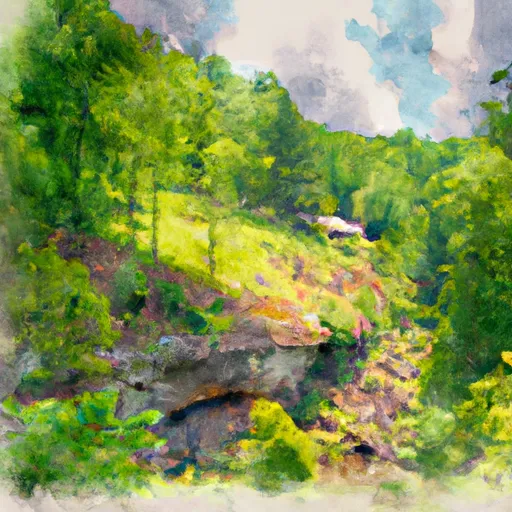
Hydrologically, Ivanhoe is situated near the New River, one of the oldest rivers in North America. This river offers a variety of recreational opportunities, including fishing, kayaking, and canoeing. The New River Trail State Park, which spans over 57 miles, provides scenic views and opportunities for hiking, biking, and horseback riding. Additionally, the nearby Big Walker Mountain and Jefferson National Forests offer picturesque landscapes and ample space for outdoor activities, such as camping, hunting, and wildlife observation.
In conclusion, Ivanhoe, Virginia, offers a pleasant climate with defined seasons, a connection to the beautiful New River, and access to various outdoor recreational opportunities, making it an attractive destination for nature enthusiasts and adventurers alike.
What is the Eden Index?
The Snoflo Eden Index serves as a comprehensive rating system for regions, evaluating their desirability through a holistic assessment of climate health, outdoor recreation opportunities, and natural disaster risk, acknowledging the profound impact of these factors on livability and well-being.
Climate Health Indicator (CHI): 8.3
Ivanhoe receives approximately
1069mm of rain per year,
with humidity levels near 83%
and air temperatures averaging around
12°C.
Ivanhoe has a plant hardyness factor of
6, meaning
plants and agriculture in this region thrive during a short period during spring and early summer. Most
plants will die off during the colder winter months.
By considering the ideal temperature range, reliable water supplies, clean air, and stable seasonal rain or snowpacks, the Climate Health Indicator (CHI) underscores the significance of a healthy climate as the foundation for quality living.
A healthy climate is paramount for ensuring a high quality of life and livability in a region, fostering both physical well-being and environmental harmony. This can be characterized by ideal temperatures, reliable access to water supplies, clean air, and consistent seasonal rain or snowpacks.
Weather Forecast
Streamflow Conditions
Kanawha
Area Rivers
Kanawha
Snowpack Depths
Kanawha
Reservoir Storage Capacity
Kanawha
Groundwater Levels
Recreational Opportunity Index (ROI): 3.1
The Recreational Opportunity Index (ROI) recognizes the value of outdoor recreational options, such as parks, hiking trails, camping sites, and fishing spots, while acknowledging that climate plays a pivotal role in ensuring the comfort and consistency of these experiences.
Access to outdoor recreational opportunities, encompassing activities such as parks, hiking, camping, and fishing, is crucial for overall well-being, and the climate plays a pivotal role in enabling and enhancing these experiences, ensuring that individuals can engage in nature-based activities comfortably and consistently.
Camping Areas
Campground | Campsites | Reservations | Toilets | Showers | Elevation |
---|---|---|---|---|---|
Shanklins Ferry - Bluestone WMA | 80 | 1,514 ft | |||
Bull Falls - Bluestone WMA | 20 | 1,421 ft | |||
Indian Mills - Bluestone WMA | 15 | 1,492 ft | |||
Keatley - Bluestone WMA | 15 | 1,557 ft | |||
Mouth of Indian Creek - Bluestone WMA | 100 | 1,456 ft | |||
Doughton Park - Blue Ridge Parkway | None | 3,692 ft | |||
Mash Fork - Camp Creek State Park | 26 | 2,032 ft | |||
Gentrys Landing | 80 | 1,527 ft | |||
Babcock State Park | None | 2,355 ft | |||
Cedar Branch - Bluestone WMA | 45 | 1,619 ft | |||
Walnut Flats | 10 | 2,446 ft | |||
Pipestem Resort State Park | None | 2,735 ft | |||
Stone Mountain State Park | 88 | 1,767 ft | |||
Bluestone State Park | None | 1,728 ft | |||
Raven Cliff | 20 | 2,209 ft | |||
Bertha - Bluestone WMA | 55 | 1,484 ft | |||
Stony Fork | 74 | 2,387 ft | |||
Gatewood Park | 42 | 2,184 ft | |||
Blue Jay - Camp Creek State Park | 13 | 2,130 ft |
Nearby Fishing
Nearby Ski Areas
Catastrophe Safeguard Index (CSI):
The Catastrophe Safeguard Index (CSI) recognizes that natural disaster risk, encompassing floods, fires, hurricanes, and tornadoes, can drastically affect safety and the overall appeal of an area.
The level of natural disaster risk in a region significantly affects safety and the overall livability, with climate change amplifying these risks by potentially increasing the frequency and intensity of events like floods, fires, hurricanes, and tornadoes, thereby posing substantial challenges to community resilience and well-being.
Community Resilience Indicator (CRI):
The Community Resilience Indicator (CRI) recognizes that education, healthcare, and socioeconomics are crucial to the well-being of a region. The CRI acknowledges the profound impact of these elements on residents' overall quality of life. By evaluating educational resources, healthcare accessibility, and economic inclusivity, the index captures the essential aspects that contribute to a thriving community, fostering resident satisfaction, equity, and social cohesion.