-
Snoflo Premium
Get unlimited access to all our content
With no Ad interruptions! - Start Your Free Trial Login with existing account
Keezletown
Eden Index
Climate
8.3
•
Recreation
5.0
•
Community
•
Safeguard
5.1/10
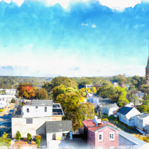
Keezletown is a small unincorporated community located in Rockingham County, Virginia. Situated in the Shenandoah Valley, the town experiences a humid subtropical climate characterized by warm summers and mild winters. Summers are generally comfortable, with temperatures ranging from the low 70s to mid-80s Fahrenheit. Winters are cool, with temperatures averaging in the 30s and occasional snowfall.
The community is encompassed by the Shenandoah River watershed, with several smaller creeks flowing through the area. This hydrological system contributes to the region's vibrant natural beauty and provides opportunities for various recreational activities. Fishing and boating enthusiasts can enjoy the Shenandoah River's abundant smallmouth bass, catfish, and other species. The nearby George Washington National Forest offers numerous hiking trails, scenic overlooks, and camping options.
Keezletown's proximity to Massanutten Mountain provides opportunities for outdoor enthusiasts to engage in activities like hiking, mountain biking, and rock climbing. The area also boasts picturesque farmland, making it a great spot for leisurely drives or cycling tours. Overall, Keezletown offers a charming rural setting with a range of outdoor recreation options for nature lovers.
What is the Eden Index?
The Snoflo Eden Index serves as a comprehensive rating system for regions, evaluating their desirability through a holistic assessment of climate health, outdoor recreation opportunities, and natural disaster risk, acknowledging the profound impact of these factors on livability and well-being.
Climate Health Indicator (CHI): 8.3
Keezletown receives approximately
1076mm of rain per year,
with humidity levels near 86%
and air temperatures averaging around
12°C.
Keezletown has a plant hardyness factor of
6, meaning
plants and agriculture in this region thrive during a short period during spring and early summer. Most
plants will die off during the colder winter months.
By considering the ideal temperature range, reliable water supplies, clean air, and stable seasonal rain or snowpacks, the Climate Health Indicator (CHI) underscores the significance of a healthy climate as the foundation for quality living.
A healthy climate is paramount for ensuring a high quality of life and livability in a region, fostering both physical well-being and environmental harmony. This can be characterized by ideal temperatures, reliable access to water supplies, clean air, and consistent seasonal rain or snowpacks.
Weather Forecast
Streamflow Conditions
Potomac
Area Rivers
Potomac
Snowpack Depths
Potomac
Reservoir Storage Capacity
Potomac
Groundwater Levels
Recreational Opportunity Index (ROI): 5.0
The Recreational Opportunity Index (ROI) recognizes the value of outdoor recreational options, such as parks, hiking trails, camping sites, and fishing spots, while acknowledging that climate plays a pivotal role in ensuring the comfort and consistency of these experiences.
Access to outdoor recreational opportunities, encompassing activities such as parks, hiking, camping, and fishing, is crucial for overall well-being, and the climate plays a pivotal role in enabling and enhancing these experiences, ensuring that individuals can engage in nature-based activities comfortably and consistently.
Camping Areas
Campground | Campsites | Reservations | Toilets | Showers | Elevation |
---|---|---|---|---|---|
James River State Park | None | 592 ft | |||
Short Mountain WMA | 74 | 2,136 ft | |||
Wolf Gap | 10 | 2,245 ft | |||
Loft Mountain - Shenandoah National Park | None | 3,369 ft | |||
Trout Pond | 70 | 1,995 ft | |||
Holliday Lake State Park | None | 509 ft | |||
Spring Gap - C and O Canal National Park | 19 | 563 ft |
Nearby Ski Areas
Catastrophe Safeguard Index (CSI):
The Catastrophe Safeguard Index (CSI) recognizes that natural disaster risk, encompassing floods, fires, hurricanes, and tornadoes, can drastically affect safety and the overall appeal of an area.
The level of natural disaster risk in a region significantly affects safety and the overall livability, with climate change amplifying these risks by potentially increasing the frequency and intensity of events like floods, fires, hurricanes, and tornadoes, thereby posing substantial challenges to community resilience and well-being.
Community Resilience Indicator (CRI):
The Community Resilience Indicator (CRI) recognizes that education, healthcare, and socioeconomics are crucial to the well-being of a region. The CRI acknowledges the profound impact of these elements on residents' overall quality of life. By evaluating educational resources, healthcare accessibility, and economic inclusivity, the index captures the essential aspects that contribute to a thriving community, fostering resident satisfaction, equity, and social cohesion.