Lake-Spring

Climate Recreation Community Catastrophe

Lake-Spring
Eden Index

Climate 8.3 Recreation 2.5 Community Safeguard

4.2/10

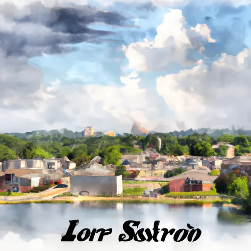
Lake-Spring, Missouri is a picturesque town located in the heart of the Midwest. Known for its beautiful lake and abundant outdoor recreation opportunities, it attracts nature enthusiasts from near and far. The climate in Lake-Spring is typically moderate, with warm summers and cool winters. The area experiences all four seasons, allowing residents and visitors to enjoy a variety of outdoor activities throughout the year.

One of the main highlights of Lake-Spring is its stunning lake, which serves as a hub for water-based activities. The hydrology constituents of the lake include pristine waters, lush vegetation, and a diverse ecosystem. The lake offers excellent fishing opportunities, with species such as bass, crappie, and catfish. Boating, kayaking, and swimming are also popular activities, thanks to the lake's calm and inviting waters.

Aside from the lake, Lake-Spring boasts numerous other outdoor recreation opportunities. The surrounding landscape is ideal for hiking, biking, and camping, with scenic trails winding through lush forests and rolling hills. Birdwatching is another popular activity, as the area is home to a wide variety of species.

Overall, Lake-Spring, Missouri is a nature lover's paradise, offering a moderate climate, a beautiful lake with diverse hydrology constituents, and a plethora of outdoor recreation opportunities for all to enjoy.

What is the Eden Index?

The Snoflo Eden Index serves as a comprehensive rating system for regions, evaluating their desirability through a holistic assessment of climate health, outdoor recreation opportunities, and natural disaster risk, acknowledging the profound impact of these factors on livability and well-being.


Climate Health Indicator (CHI): 8.3


Lake-Spring receives approximately 1138mm of rain per year, with humidity levels near 86% and air temperatures averaging around 13°C. Lake-Spring has a plant hardyness factor of 6, meaning plants and agriculture in this region thrive during a short period during spring and early summer. Most plants will die off during the colder winter months. By considering the ideal temperature range, reliable water supplies, clean air, and stable seasonal rain or snowpacks, the Climate Health Indicator (CHI) underscores the significance of a healthy climate as the foundation for quality living.

A healthy climate is paramount for ensuring a high quality of life and livability in a region, fostering both physical well-being and environmental harmony. This can be characterized by ideal temperatures, reliable access to water supplies, clean air, and consistent seasonal rain or snowpacks.


Weather Forecast


Streamflow Conditions

Upper Mississippi-Meramec

Area Rivers

Upper Mississippi-Meramec


Snowpack Depths

Upper Mississippi-Meramec


Reservoir Storage Capacity

Upper Mississippi-Meramec


Groundwater Levels


Recreational Opportunity Index (ROI): 2.5


The Recreational Opportunity Index (ROI) recognizes the value of outdoor recreational options, such as parks, hiking trails, camping sites, and fishing spots, while acknowledging that climate plays a pivotal role in ensuring the comfort and consistency of these experiences. Access to outdoor recreational opportunities, encompassing activities such as parks, hiking, camping, and fishing, is crucial for overall well-being, and the climate plays a pivotal role in enabling and enhancing these experiences, ensuring that individuals can engage in nature-based activities comfortably and consistently.


Camping Areas

Campground Campsites Reservations Toilets Showers Elevation
Joy Springs County Park None 1,084 ft
Frank Russell None 704 ft
Midwest Old Threshers None 689 ft
Trulock - Arkansas River 15 195 ft
Chamois Access - MDC 4 530 ft
Mondovi Town Park 6 822 ft
Mac Coon Access None 614 ft
Shimek State Forest None 691 ft
Three Elms County Park None 929 ft
Prairie Island City Campground 90 662 ft
Marr Park 26 744 ft
F. W. Kent County Park 85 840 ft
Buffalo Creek County Park 18 914 ft
John Latsch State Park 7 670 ft
Round Prairie Park None 723 ft
Montauk State Park None 910 ft
Duttons Cave Co Park 5 1,218 ft
Backbone State Park 125 1,154 ft
River Junction Access None 615 ft
Scout Park - Lamont None 1,034 ft
Chemin - A - Haut State Park None 125 ft
Brinton Timber None 721 ft
Canton City River Park 23 481 ft
Cane Creek State park None 257 ft
Volga River State Rec Area 41 930 ft
Maynard City Park None 1,092 ft
Palisades Kepler State Park 50 863 ft
Myron County Park 45 1,011 ft
Bentonsport None 561 ft
Paydown Access - MDC 6 596 ft
Wildcat Bluff County Park 50 774 ft
Pietrek County Park 25 754 ft
Hills Access 13 629 ft
Lane Spring 64 1,069 ft
Merrick State Park 65 654 ft
Twin Bridges County Park 45 1,051 ft
Poverty Point Reservoir State Park 50 97 ft
Waterworks Park - Oakland Mills Park None 575 ft
Troy Mills Wapsi Access Dispersed None 869 ft
Pleasant Creek State Rec Area 69 846 ft
Water Works Park 30 573 ft
Buffalo Creek Area None 1,021 ft
Pulltite - Ozark National Scenic River 55 817 ft
Morgan Creek County Park 36 744 ft
Squaw Creek County Park 60 786 ft
Mark Twain State Park None 666 ft
Akers None 818 ft
Graham Cave State Park None 778 ft
Bear Creek - Mississippi River 30 492 ft
Battle of Athens State Park None 664 ft
Goeken Co Park None 1,181 ft
Rollins Ferry Access - MDC 11 568 ft
Ray Behrens None 677 ft
Perrot State Park 95 715 ft
Klocks Island Park 25 1,012 ft
Rising Star None 196 ft
Coffins Grove 25 971 ft
Oakland Mills Park 50 573 ft
Wakpicada Natural Area None 823 ft
Veterans Memorial County Park None 898 ft
Jakway County Park None 1,074 ft
Indian Lake Park None 595 ft
Wakonda State Park None 496 ft
Mississippi Riverfront RV Park None 483 ft

Catastrophe Safeguard Index (CSI):


The Catastrophe Safeguard Index (CSI) recognizes that natural disaster risk, encompassing floods, fires, hurricanes, and tornadoes, can drastically affect safety and the overall appeal of an area. The level of natural disaster risk in a region significantly affects safety and the overall livability, with climate change amplifying these risks by potentially increasing the frequency and intensity of events like floods, fires, hurricanes, and tornadoes, thereby posing substantial challenges to community resilience and well-being.


Community Resilience Indicator (CRI):


The Community Resilience Indicator (CRI) recognizes that education, healthcare, and socioeconomics are crucial to the well-being of a region. The CRI acknowledges the profound impact of these elements on residents' overall quality of life. By evaluating educational resources, healthcare accessibility, and economic inclusivity, the index captures the essential aspects that contribute to a thriving community, fostering resident satisfaction, equity, and social cohesion.


Log Your Visit

When was your last visit to ?

Add a Photo

How was it? How were conditions?

Rate the


Submit

Leave A Review


Submit

Upload an Image


Favorite Limit Reached