Lime-Springs

Climate Recreation Community Catastrophe

Lime-Springs
Eden Index

Climate 6.4 Recreation 3.5 Community Safeguard

3.8/10

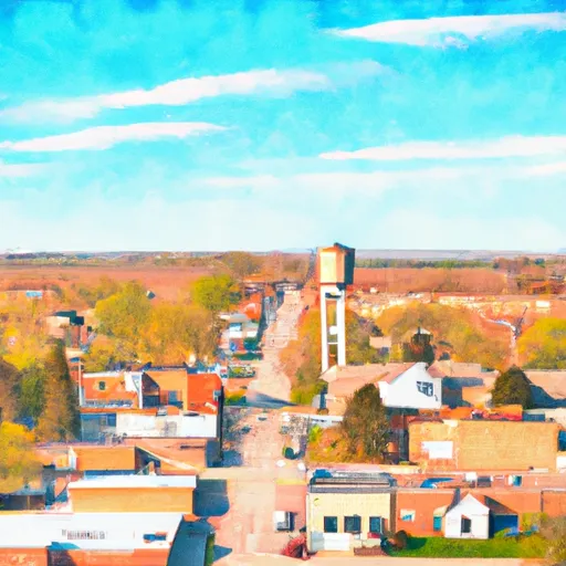
Lime Springs is a small town located in Howard County, Iowa. It has a continental climate with warm summers and cold winters. The average temperature during summer ranges from 70°F to 85°F, while in winter, it can drop to 10°F to 30°F. Precipitation is relatively evenly distributed throughout the year, with an average annual rainfall of 36 inches.

The town is situated along the Upper Iowa River, providing opportunities for various outdoor recreational activities. Fishing enthusiasts can enjoy catching a variety of fish species like trout, walleye, and bass. Canoeing and kayaking are also popular on the river, allowing visitors to explore the scenic waterways and enjoy the tranquil surroundings.

Lime Springs boasts several parks and trails, offering opportunities for hiking, biking, and picnicking. Heritage Park, with its beautiful landscapes and playgrounds, is a favorite spot for families. The Prairie's Edge Nature Center nearby provides educational exhibits and trails to explore the local flora and fauna.

In conclusion, Lime Springs, Iowa offers a pleasant continental climate, access to the Upper Iowa River for fishing and water activities, and a range of outdoor recreational opportunities in its parks and trails.

What is the Eden Index?

The Snoflo Eden Index serves as a comprehensive rating system for regions, evaluating their desirability through a holistic assessment of climate health, outdoor recreation opportunities, and natural disaster risk, acknowledging the profound impact of these factors on livability and well-being.


Climate Health Indicator (CHI): 6.4


Lime-Springs receives approximately 897mm of rain per year, with humidity levels near 81% and air temperatures averaging around 7°C. Lime-Springs has a plant hardyness factor of 4, meaning plants and agriculture in this region thrive during a short period during spring and early summer. Most plants will die off during the colder winter months. By considering the ideal temperature range, reliable water supplies, clean air, and stable seasonal rain or snowpacks, the Climate Health Indicator (CHI) underscores the significance of a healthy climate as the foundation for quality living.

A healthy climate is paramount for ensuring a high quality of life and livability in a region, fostering both physical well-being and environmental harmony. This can be characterized by ideal temperatures, reliable access to water supplies, clean air, and consistent seasonal rain or snowpacks.


Weather Forecast


Streamflow Conditions

Upper Mississippi-Maquoketa-Plum

Area Rivers

Upper Mississippi-Maquoketa-Plum


Snowpack Depths

Upper Mississippi-Maquoketa-Plum


Reservoir Storage Capacity

Upper Mississippi-Maquoketa-Plum


Groundwater Levels


Recreational Opportunity Index (ROI): 3.5


The Recreational Opportunity Index (ROI) recognizes the value of outdoor recreational options, such as parks, hiking trails, camping sites, and fishing spots, while acknowledging that climate plays a pivotal role in ensuring the comfort and consistency of these experiences. Access to outdoor recreational opportunities, encompassing activities such as parks, hiking, camping, and fishing, is crucial for overall well-being, and the climate plays a pivotal role in enabling and enhancing these experiences, ensuring that individuals can engage in nature-based activities comfortably and consistently.


Camping Areas

Campground Campsites Reservations Toilets Showers Elevation
Highland Ridge - Eau Galle Reservoir None 1,130 ft
Twin Ponds Co Park - East None 1,053 ft
Balsam Lake Pine Park - Town 15 1,144 ft
Macon Co Park None 873 ft
Split Rock County Park 54 1,069 ft
Namekagon Trail Bridge - St. Croix National Scenic River None 933 ft
Pfeiffer Lake 16 1,470 ft
Twin Ponds Co Park - West None 1,070 ft
George Wyth State Park 70 849 ft
Chacauqua River Access None 721 ft
Glen Hills County Park 61 1,183 ft
Bear Head Lake State Park 75 1,523 ft
North Woods Park None 1,080 ft
Big Woods Lake None 859 ft
Clear Lake City Park None 1,164 ft
Cedar Bend Park 40 975 ft
Heritage City Park 18 1,439 ft
Lake Jeanette 12 1,375 ft
McFarlane Park None 804 ft
Vermilion Trail 40 1,430 ft
T. F. Clark Co Park 13 891 ft
Finger Lakes State Park None 725 ft
Lake Fisher 6 840 ft
Boulder - St Croix State Forest 21 999 ft
Deerwood City Park None 838 ft
Waubonsie Trail Park 7 784 ft
McKinley City Park 80 1,396 ft
Turtle Lake City Park 18 1,265 ft
Manhattan Bridge Access None 644 ft
Dry Fork 18 763 ft
Bay City 25 676 ft
Pine Ridge 8 770 ft
Sherwood Forest City Campground 57 1,505 ft
Highland Ridge 45 1,105 ft
Nugget Lake County Park 55 1,022 ft
Lake Iowa County Park 122 892 ft
Siggelkov County Park None 945 ft
Binder Park 17 655 ft
Hannen County Park 90 817 ft
Drakesville City Park 6 886 ft
Eau Galle Lake Spring Valley None 957 ft
Whiteface Reservoir 58 1,489 ft
Rothwell Park None 858 ft
Rodgers County Park 50 832 ft
Hoodoo Point City Campground 85 1,362 ft
Yenruogis County Park None 799 ft
McGowen Rec Area 12 857 ft
Echo Lake 24 1,275 ft
Black Hawk County Park None 858 ft
Fishermans Point City Campground 70 1,441 ft
Riverside Landing - St. Croix National Scenic River None 896 ft
Hickory Hills Park - La Porte City 80 911 ft
Garfvert - Nemadji State Forest 18 1,162 ft
Belva - Deer Rec Area 56 828 ft
Big Rice Lake 15 1,452 ft
Alcock Park 40 1,018 ft

Catastrophe Safeguard Index (CSI):


The Catastrophe Safeguard Index (CSI) recognizes that natural disaster risk, encompassing floods, fires, hurricanes, and tornadoes, can drastically affect safety and the overall appeal of an area. The level of natural disaster risk in a region significantly affects safety and the overall livability, with climate change amplifying these risks by potentially increasing the frequency and intensity of events like floods, fires, hurricanes, and tornadoes, thereby posing substantial challenges to community resilience and well-being.


Community Resilience Indicator (CRI):


The Community Resilience Indicator (CRI) recognizes that education, healthcare, and socioeconomics are crucial to the well-being of a region. The CRI acknowledges the profound impact of these elements on residents' overall quality of life. By evaluating educational resources, healthcare accessibility, and economic inclusivity, the index captures the essential aspects that contribute to a thriving community, fostering resident satisfaction, equity, and social cohesion.


Log Your Visit

When was your last visit to ?

Add a Photo

How was it? How were conditions?

Rate the


Submit

Leave A Review


Submit

Upload an Image


Favorite Limit Reached