Loose-Creek

Climate Recreation Community Catastrophe

Loose-Creek
Eden Index

Climate 8.3 Recreation 3.4 Community 2.4 Safeguard

5.1/10

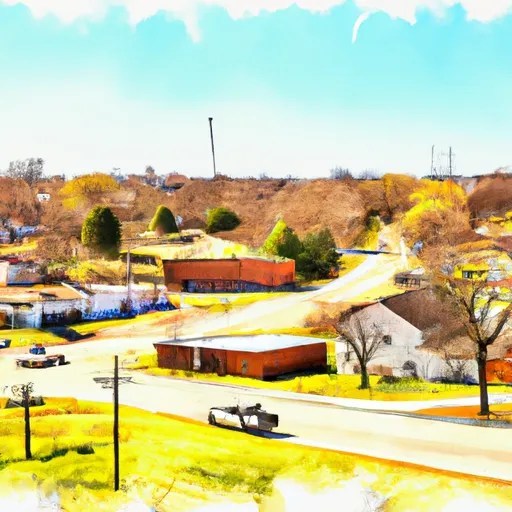
Loose Creek is a small community located in Osage County, Missouri. The town experiences a humid continental climate characterized by hot and humid summers and cold winters. Summers are typically warm with temperatures ranging from 80°F to 90°F, while winters are cold with temperatures averaging around 30°F. Precipitation is fairly evenly distributed throughout the year, with an average annual rainfall of around 43 inches.

The town is surrounded by beautiful natural scenery, with creeks, streams, and rivers running through the area. The primary hydrology constituent in Loose Creek is the Loose Creek itself, which flows through the town and offers opportunities for various outdoor activities. Fishing enthusiasts can enjoy catching a variety of fish species, such as bass, catfish, and crappie, while nature lovers can explore the picturesque landscapes by kayaking or canoeing along the creek.

In addition to water activities, Loose Creek also provides opportunities for hiking and camping. The nearby Loose Creek Conservation Area offers trails for hikers to explore and observe the local flora and fauna. Camping facilities are available for those who wish to spend the night and enjoy the tranquility of the area.

Overall, Loose Creek, Missouri, offers a welcoming environment for outdoor enthusiasts to experience the natural beauty of the region through various recreational activities.

What is the Eden Index?

The Snoflo Eden Index serves as a comprehensive rating system for regions, evaluating their desirability through a holistic assessment of climate health, outdoor recreation opportunities, and natural disaster risk, acknowledging the profound impact of these factors on livability and well-being.


Climate Health Indicator (CHI): 8.3


Loose-Creek receives approximately 1074mm of rain per year, with humidity levels near 86% and air temperatures averaging around 13°C. Loose-Creek has a plant hardyness factor of 6, meaning plants and agriculture in this region thrive during a short period during spring and early summer. Most plants will die off during the colder winter months. By considering the ideal temperature range, reliable water supplies, clean air, and stable seasonal rain or snowpacks, the Climate Health Indicator (CHI) underscores the significance of a healthy climate as the foundation for quality living.

A healthy climate is paramount for ensuring a high quality of life and livability in a region, fostering both physical well-being and environmental harmony. This can be characterized by ideal temperatures, reliable access to water supplies, clean air, and consistent seasonal rain or snowpacks.


Weather Forecast


Streamflow Conditions

Osage

Area Rivers

Osage


Snowpack Depths

Osage


Reservoir Storage Capacity

Osage


Groundwater Levels


Recreational Opportunity Index (ROI): 3.4


The Recreational Opportunity Index (ROI) recognizes the value of outdoor recreational options, such as parks, hiking trails, camping sites, and fishing spots, while acknowledging that climate plays a pivotal role in ensuring the comfort and consistency of these experiences. Access to outdoor recreational opportunities, encompassing activities such as parks, hiking, camping, and fishing, is crucial for overall well-being, and the climate plays a pivotal role in enabling and enhancing these experiences, ensuring that individuals can engage in nature-based activities comfortably and consistently.


Camping Areas

Campground Campsites Reservations Toilets Showers Elevation
Volga River State Rec Area 41 930 ft
Tar Camp None 238 ft
Bentonsport None 561 ft
Lacey - Keosauqua State Park 113 744 ft
Pine Bluff Aresenal Military None 243 ft
Cane Creek State park None 257 ft
Jakway County Park None 1,074 ft
Lane Spring 64 1,069 ft
Little Rock AFB Military None 352 ft
Saracen Trace RV Park 52 217 ft
Austin County Park None 578 ft
Independence City RV Park None 896 ft
Crossett RV Park 119 68 ft
Pleasant Creek State Rec Area 69 846 ft
Gouldsburg County Park 26 993 ft
Chamois Access - MDC 4 530 ft
Rising Star None 196 ft
Pine Ridge 8 770 ft
Rollins Ferry Access - MDC 11 568 ft
Wildcat Bluff County Park 50 774 ft
Round Prairie Park None 723 ft
Willow Beach None 243 ft
Klocks Island Park 25 1,012 ft
Lime Creek Park - Brandon None 858 ft
Rodgers County Park 50 832 ft
Cutshall Area None 921 ft
Mac Coon Access None 614 ft
Oelwein City Park 30 1,013 ft
Morgan Creek County Park 36 744 ft
Paydown Access - MDC 6 596 ft
Waubonsie Trail Park 7 784 ft
Paddy Creek 36 1,008 ft
Lake Darling State Park 118 688 ft
Veterans Memorial County Park None 898 ft
Siggelkov County Park None 945 ft
Manhattan Bridge Access None 644 ft
Shelbina Lake City Park None 722 ft
Sycamore Loop Dispersed - Noblett Lake None 905 ft
Indian Lake Park None 595 ft
Piney River Military - Fort Leonard Wood None 768 ft
McFarlane Park None 804 ft
Brinton Timber None 721 ft
Dry Fork 18 763 ft
Lakeview Park - Mexico None 810 ft
Minne Estema Park 30 870 ft
Skunk River Access None 630 ft
Georges Cove - Norfolk Lake None 633 ft
Trulock - Arkansas River 15 195 ft
Lake Sugema County Park None 741 ft
Downing County Park None 1,028 ft
Hoefle - Dulin Area County Park 16 774 ft
Grand Marais County Park None 79 ft
Middle Amana Park 24 742 ft
Milroy Access 95 783 ft
John Latsch State Park 7 670 ft
Goeken Co Park None 1,181 ft
Mark Twain State Park None 666 ft
Hannen County Park 90 817 ft
Belva - Deer Rec Area 56 828 ft
Merrick State Park 65 654 ft
Reicks Lake Park None 670 ft
Maynard City Park None 1,092 ft
Fontana County Park 55 986 ft
Chemin - A - Haut State Park None 125 ft
Benton City - Fry Area 25 843 ft
North Woods Park None 1,080 ft
Twin Bridges County Park 45 1,051 ft
Duttons Cave Co Park 5 1,218 ft
Sever Lake Conservation Area - MDC 84 736 ft
Three Elms County Park None 929 ft

Catastrophe Safeguard Index (CSI):


The Catastrophe Safeguard Index (CSI) recognizes that natural disaster risk, encompassing floods, fires, hurricanes, and tornadoes, can drastically affect safety and the overall appeal of an area. The level of natural disaster risk in a region significantly affects safety and the overall livability, with climate change amplifying these risks by potentially increasing the frequency and intensity of events like floods, fires, hurricanes, and tornadoes, thereby posing substantial challenges to community resilience and well-being.


Community Resilience Indicator (CRI): 2.4


The Community Resilience Indicator (CRI) recognizes that education, healthcare, and socioeconomics are crucial to the well-being of a region. The CRI acknowledges the profound impact of these elements on residents' overall quality of life. By evaluating educational resources, healthcare accessibility, and economic inclusivity, the index captures the essential aspects that contribute to a thriving community, fostering resident satisfaction, equity, and social cohesion.


Log Your Visit

When was your last visit to ?

Add a Photo

How was it? How were conditions?

Rate the


Submit

Leave A Review


Submit

Upload an Image


Favorite Limit Reached