Mabel

Climate Recreation Community Catastrophe

Mabel
Eden Index

Climate 6.4 Recreation 4.3 Community Safeguard

4.1/10

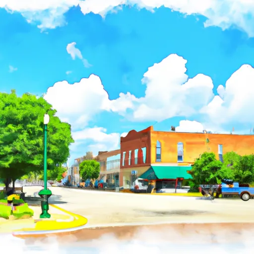
Mabel, Iowa is a small town located in the northeastern part of the state. It experiences a humid continental climate, characterized by hot summers and cold winters. Summer temperatures range from 70°F to 90°F, while winter temperatures can drop as low as 10°F. Precipitation is spread evenly throughout the year, with an average annual rainfall of around 35 inches.

The hydrology constituents in Mabel primarily consist of the Upper Iowa River and various creeks that flow through the area. The Upper Iowa River offers opportunities for fishing, kayaking, and canoeing. It is known for its scenic beauty and is a popular spot for nature enthusiasts.

Outdoor recreation opportunities in Mabel also include hiking and camping in the nearby forests and parks. There are several trails and campsites available for visitors to explore and enjoy the natural surroundings. The area boasts picturesque landscapes, with rolling hills, wooded areas, and abundant wildlife.

Overall, Mabel, Iowa offers a pleasant climate for outdoor activities, with opportunities for water-based pursuits and exploring the surrounding natural beauty.

What is the Eden Index?

The Snoflo Eden Index serves as a comprehensive rating system for regions, evaluating their desirability through a holistic assessment of climate health, outdoor recreation opportunities, and natural disaster risk, acknowledging the profound impact of these factors on livability and well-being.


Climate Health Indicator (CHI): 6.4


Mabel receives approximately 883mm of rain per year, with humidity levels near 82% and air temperatures averaging around 7°C. Mabel has a plant hardyness factor of 4, meaning plants and agriculture in this region thrive during a short period during spring and early summer. Most plants will die off during the colder winter months. By considering the ideal temperature range, reliable water supplies, clean air, and stable seasonal rain or snowpacks, the Climate Health Indicator (CHI) underscores the significance of a healthy climate as the foundation for quality living.

A healthy climate is paramount for ensuring a high quality of life and livability in a region, fostering both physical well-being and environmental harmony. This can be characterized by ideal temperatures, reliable access to water supplies, clean air, and consistent seasonal rain or snowpacks.


Weather Forecast


Streamflow Conditions

Upper Mississippi-Maquoketa-Plum

Area Rivers

Upper Mississippi-Maquoketa-Plum


Snowpack Depths

Upper Mississippi-Maquoketa-Plum


Reservoir Storage Capacity

Upper Mississippi-Maquoketa-Plum


Groundwater Levels


Recreational Opportunity Index (ROI): 4.3


The Recreational Opportunity Index (ROI) recognizes the value of outdoor recreational options, such as parks, hiking trails, camping sites, and fishing spots, while acknowledging that climate plays a pivotal role in ensuring the comfort and consistency of these experiences. Access to outdoor recreational opportunities, encompassing activities such as parks, hiking, camping, and fishing, is crucial for overall well-being, and the climate plays a pivotal role in enabling and enhancing these experiences, ensuring that individuals can engage in nature-based activities comfortably and consistently.


Camping Areas

Campground Campsites Reservations Toilets Showers Elevation
Round Prairie Park None 723 ft
Chamois Access - MDC 4 530 ft
Lake Darling State Park 118 688 ft
Amnicon Falls 35 833 ft
Mac Coon Access None 614 ft
Piney River Military - Fort Leonard Wood None 768 ft
Maynard City Park None 1,092 ft
Earl Landing - St. Croix National Scenic River 12 1,074 ft
Birch Lake 30 1,442 ft
Jakway County Park None 1,074 ft
Paydown Access - MDC 6 596 ft
Paddy Creek 36 1,008 ft
Pioneer Park - Prairie Farm 30 1,028 ft
Rodgers County Park 50 832 ft
Indian Lake Park None 595 ft
Morgan Creek County Park 36 744 ft
Cutshall Area None 921 ft
Bentonsport None 561 ft
Chicog Town Park None 1,010 ft
Lime Creek Park - Brandon None 858 ft
Lakeview Park - Mexico None 810 ft
Goeken Co Park None 1,181 ft
Lucius Woods County Park 24 1,110 ft
Fontana County Park 55 986 ft
Cadotte Lake 27 1,657 ft
Brinton Timber None 721 ft
Milroy Access 95 783 ft
Downing County Park None 1,028 ft
Reicks Lake Park None 670 ft
Gouldsburg County Park 26 993 ft
Shelbina Lake City Park None 722 ft
Bear Head Lake State Park 75 1,523 ft
Buffalo Creek Area None 1,021 ft
South Kawishiwi River 31 1,463 ft
Volga River State Rec Area 41 930 ft
Fall Lake 73 1,333 ft
North Woods Park None 1,080 ft
Fenske Lake 20 1,507 ft
Gordon Dam None 1,023 ft
Austin County Park None 578 ft
Totogatic Park 75 1,025 ft
Minne Estema Park 30 870 ft
Hoefle - Dulin Area County Park 16 774 ft
Myron County Park 45 1,011 ft
Lacey - Keosauqua State Park 113 744 ft
Rollins Ferry Access - MDC 11 568 ft
Troy Mills Wapsi Access Dispersed None 869 ft
Sever Lake Conservation Area - MDC 84 736 ft
Duttons Cave Co Park 5 1,218 ft
Veterans Memorial Park - Cameron 30 1,102 ft
F. W. Kent County Park 85 840 ft
John Latsch State Park 7 670 ft
Mark Twain State Park None 666 ft
Temperance State Park 52 1,679 ft
Veterans Memorial County Park None 898 ft
Pleasant Creek State Rec Area 69 846 ft
Trego Town Park 50 1,060 ft
Wildcat Bluff County Park 50 774 ft
Klocks Island Park 25 1,012 ft
Skunk River Access None 630 ft
Independence City RV Park None 896 ft
Manhattan Bridge Access None 644 ft
Merrick State Park 65 654 ft
Twin Bridges County Park 45 1,051 ft
Howell Landing - St. Croix National Scenic River None 950 ft
Lane Spring 64 1,069 ft
Waubonsie Trail Park 7 784 ft
Oelwein City Park 30 1,013 ft
Lake Sugema County Park None 741 ft
Shell Lake Municipal Park 42 1,224 ft
Benton City - Fry Area 25 843 ft
Battle of Athens State Park None 664 ft
Middle Amana Park 24 742 ft
Three Elms County Park None 929 ft
Indian Lake - Cloquet Valley State Forest 26 1,526 ft

Catastrophe Safeguard Index (CSI):


The Catastrophe Safeguard Index (CSI) recognizes that natural disaster risk, encompassing floods, fires, hurricanes, and tornadoes, can drastically affect safety and the overall appeal of an area. The level of natural disaster risk in a region significantly affects safety and the overall livability, with climate change amplifying these risks by potentially increasing the frequency and intensity of events like floods, fires, hurricanes, and tornadoes, thereby posing substantial challenges to community resilience and well-being.


Community Resilience Indicator (CRI):


The Community Resilience Indicator (CRI) recognizes that education, healthcare, and socioeconomics are crucial to the well-being of a region. The CRI acknowledges the profound impact of these elements on residents' overall quality of life. By evaluating educational resources, healthcare accessibility, and economic inclusivity, the index captures the essential aspects that contribute to a thriving community, fostering resident satisfaction, equity, and social cohesion.


Log Your Visit

When was your last visit to ?

Add a Photo

How was it? How were conditions?

Rate the


Submit

Leave A Review


Submit

Upload an Image


Favorite Limit Reached