-
Snoflo Premium
Get unlimited access to all our content
With no Ad interruptions! - Start Your Free Trial Login with existing account
Medina
Eden Index
Climate
7.7
•
Recreation
2.8
•
Community
3.4
•
Safeguard
4.9/10
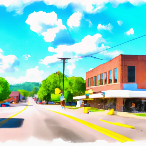
Medina, Tennessee is a charming town located in Gibson County, nestled in the western part of the state. It experiences a humid subtropical climate, characterized by hot summers and mild winters. The average high temperature in summer hovers around 90°F (32°C), while winters see average highs around 50°F (10°C). Precipitation is evenly distributed throughout the year, with an average of 50 inches annually.
Hydrologically, Medina benefits from the nearby South Fork of the Forked Deer River, which adds to its natural beauty. The river serves as a habitat for diverse wildlife, including various fish species and waterfowl. Fishing enthusiasts can enjoy casting their lines and trying to catch bass, catfish, and crappie.
For outdoor recreation, Medina offers a range of opportunities. The city's parks provide spaces for picnicking, hiking, and playing sports. Medina City Park features walking trails, playgrounds, and a basketball court. The nearby Medina Community Center provides indoor activities such as basketball and racquetball. For those seeking a more tranquil experience, Medina is surrounded by scenic countryside, which is perfect for leisurely walks or bike rides.
Overall, Medina, Tennessee boasts a pleasant climate, a beautiful hydrological setting, and ample opportunities for outdoor recreation, making it a desirable destination for nature lovers and outdoor enthusiasts.
What is the Eden Index?
The Snoflo Eden Index serves as a comprehensive rating system for regions, evaluating their desirability through a holistic assessment of climate health, outdoor recreation opportunities, and natural disaster risk, acknowledging the profound impact of these factors on livability and well-being.
Climate Health Indicator (CHI): 7.7
Medina receives approximately
1371mm of rain per year,
with humidity levels near 84%
and air temperatures averaging around
15°C.
Medina has a plant hardyness factor of
7, meaning
plants and agriculture in this region tend to thrive during the non-winter months.
By considering the ideal temperature range, reliable water supplies, clean air, and stable seasonal rain or snowpacks, the Climate Health Indicator (CHI) underscores the significance of a healthy climate as the foundation for quality living.
A healthy climate is paramount for ensuring a high quality of life and livability in a region, fostering both physical well-being and environmental harmony. This can be characterized by ideal temperatures, reliable access to water supplies, clean air, and consistent seasonal rain or snowpacks.
Weather Forecast
Streamflow Conditions
Hatchie-Obion
Area Rivers
Hatchie-Obion
Snowpack Depths
Hatchie-Obion
Reservoir Storage Capacity
Hatchie-Obion
Groundwater Levels
Recreational Opportunity Index (ROI): 2.8
The Recreational Opportunity Index (ROI) recognizes the value of outdoor recreational options, such as parks, hiking trails, camping sites, and fishing spots, while acknowledging that climate plays a pivotal role in ensuring the comfort and consistency of these experiences.
Access to outdoor recreational opportunities, encompassing activities such as parks, hiking, camping, and fishing, is crucial for overall well-being, and the climate plays a pivotal role in enabling and enhancing these experiences, ensuring that individuals can engage in nature-based activities comfortably and consistently.
Camping Areas
Campground | Campsites | Reservations | Toilets | Showers | Elevation |
---|---|---|---|---|---|
Richardson Lake | 26 | 1,599 ft | |||
Shepard State Park | None | 16 ft | |||
Illini State Park | None | 563 ft | |||
Sam Dale Lake Conservation Area | None | 493 ft | |||
Coon Creek - Shelbyville Lake | 230 | 666 ft | |||
Shawano County Fairgrounds | None | 814 ft | |||
Stephen A. Forbes State Park | 135 | 604 ft | |||
Friends Creek Regional Park | 35 | 693 ft | |||
Faries Park | 37 | 618 ft | |||
Clinton Lake State Rec Area | 310 | 725 ft | |||
Dunns Falls Water Park | None | 269 ft | |||
Boot Lake | 34 | 1,332 ft | |||
Keesler AFB Military | 52 | 22 ft | |||
Turkey Fork Rec. Area | 76 | 278 ft | |||
Moraine View State Park | 200 | 853 ft | |||
Maynor Creek Waterpark | None | 362 ft | |||
Clarkco State Park | None | 273 ft | |||
Fairley Bridge Landing | 6 | 88 ft | |||
Weldon Springs State Park | 75 | 717 ft | |||
Twiltley Branch - Okatibbee Lake | None | 421 ft | |||
Lake Perry | 20 | 157 ft | |||
Livingston County 4-H Park | None | 636 ft | |||
Opossum Creek - Shelbyville Lake | 80 | 654 ft | |||
Ada Lake | 27 | 1,672 ft | |||
Gulf Marine State Park | None | 6 ft | |||
Davis Bayou - Gulf Islands National Seashore | 52 | 19 ft | |||
Archusa Creek Waterpark | 69 | 315 ft |
Catastrophe Safeguard Index (CSI):
The Catastrophe Safeguard Index (CSI) recognizes that natural disaster risk, encompassing floods, fires, hurricanes, and tornadoes, can drastically affect safety and the overall appeal of an area.
The level of natural disaster risk in a region significantly affects safety and the overall livability, with climate change amplifying these risks by potentially increasing the frequency and intensity of events like floods, fires, hurricanes, and tornadoes, thereby posing substantial challenges to community resilience and well-being.
Community Resilience Indicator (CRI): 3.4
The Community Resilience Indicator (CRI) recognizes that education, healthcare, and socioeconomics are crucial to the well-being of a region. The CRI acknowledges the profound impact of these elements on residents' overall quality of life. By evaluating educational resources, healthcare accessibility, and economic inclusivity, the index captures the essential aspects that contribute to a thriving community, fostering resident satisfaction, equity, and social cohesion.