Monett

Climate Recreation Community Catastrophe

Monett
Eden Index

Climate 8.3 Recreation 2.2 Community 2.1 Safeguard

4.6/10

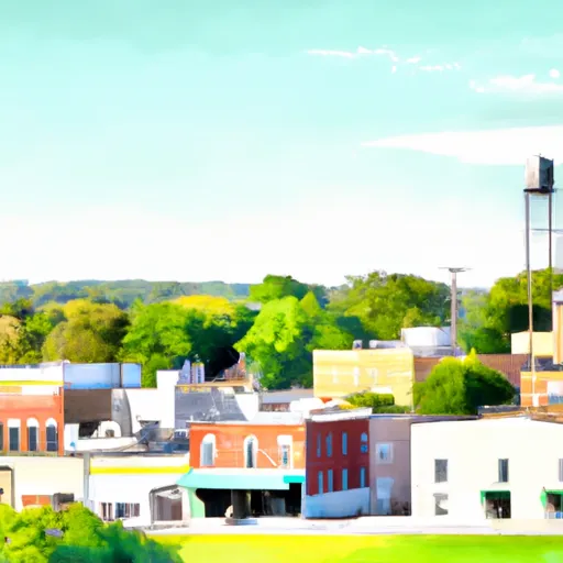
Monett, Missouri, is a charming city located in Barry and Lawrence counties. It experiences a humid subtropical climate, characterized by mild winters and hot, humid summers. Average temperatures range from around 30°F (-1°C) in winter to approximately 90°F (32°C) in summer. Monett receives an average annual precipitation of 45 inches, with rainfall fairly evenly distributed throughout the year.

The hydrology constituents in Monett include several rivers and creeks, with the Spring River being the closest major waterway. The hydrological system provides various recreational activities like fishing, canoeing, and swimming. Additionally, Monett has a few parks and green spaces that offer opportunities for outdoor recreation, such as Monett City Park and North Park. These parks provide amenities like picnic areas, playgrounds, walking trails, and sports fields.

Nature enthusiasts can explore the nearby Roaring River State Park, located around 30 miles south of Monett. This park offers opportunities for hiking, bird-watching, camping, and trout fishing. With its pleasant climate and diverse outdoor offerings, Monett provides a welcoming environment for residents and visitors to enjoy nature and engage in outdoor recreational activities.

What is the Eden Index?

The Snoflo Eden Index serves as a comprehensive rating system for regions, evaluating their desirability through a holistic assessment of climate health, outdoor recreation opportunities, and natural disaster risk, acknowledging the profound impact of these factors on livability and well-being.


Climate Health Indicator (CHI): 8.3


Monett receives approximately 1144mm of rain per year, with humidity levels near 81% and air temperatures averaging around 14°C. Monett has a plant hardyness factor of 6, meaning plants and agriculture in this region thrive during a short period during spring and early summer. Most plants will die off during the colder winter months. By considering the ideal temperature range, reliable water supplies, clean air, and stable seasonal rain or snowpacks, the Climate Health Indicator (CHI) underscores the significance of a healthy climate as the foundation for quality living.

A healthy climate is paramount for ensuring a high quality of life and livability in a region, fostering both physical well-being and environmental harmony. This can be characterized by ideal temperatures, reliable access to water supplies, clean air, and consistent seasonal rain or snowpacks.


Weather Forecast


Streamflow Conditions

Neosho

Area Rivers

Neosho


Snowpack Depths

Neosho


Reservoir Storage Capacity

Neosho


Groundwater Levels


Recreational Opportunity Index (ROI): 2.2


The Recreational Opportunity Index (ROI) recognizes the value of outdoor recreational options, such as parks, hiking trails, camping sites, and fishing spots, while acknowledging that climate plays a pivotal role in ensuring the comfort and consistency of these experiences. Access to outdoor recreational opportunities, encompassing activities such as parks, hiking, camping, and fishing, is crucial for overall well-being, and the climate plays a pivotal role in enabling and enhancing these experiences, ensuring that individuals can engage in nature-based activities comfortably and consistently.


Camping Areas

Campground Campsites Reservations Toilets Showers Elevation
Laurel Creek - Lake Greeson None 582 ft
Buckhorn - Lake Greeson 0 583 ft
Charleston Lake 4 487 ft
Big Brushy 9 938 ft
Stockton State Park None 910 ft
Aux Arc None 395 ft
Ruark Bluff - Stockton Lake None 1,001 ft
Redding 25 739 ft
Knoppers Ford 6 780 ft
Pikeville - Lake Greeson 12 568 ft
Dam Area - Lake Greeson None 431 ft
Lost Bridge North - Beaver Lake 48 1,197 ft
Shady Lake 66 1,229 ft
Parker Creek - Lake Greeson None 684 ft
Prairie Creek - Beaver Lake 112 1,135 ft
Orleans Trail North Park -Stockton Lake None 931 ft
Roaring River State Park None 1,036 ft
Starkey - Beaver Lake 23 1,309 ft
Magazine Municipal RV Park 8 476 ft
Albert Pike 54 904 ft
Daisy State Park None 592 ft
Lost Bridge South - Beaver Lake 36 1,149 ft
Lake Leatherwood City Park None 1,046 ft
Star of the West - Lake Greeson 21 575 ft
River Ridge - Ozark Lake 18 391 ft
Rocky Branch - Beaver Lake None 1,129 ft
Paraloma Landing - Millwood Lake 34 270 ft
White Cliffs - Millwood Lake 18 270 ft
Eagle Rock - Table Rock Lake None 988 ft
Crabtree Cove - Stockton Lake None 902 ft
Mill Creek Family Camp None 873 ft
Bard Springs 17 1,380 ft
Dam Site Lake - Beaver Lake 48 1,123 ft
Hawker Point - Stockton Lake None 977 ft
Sparrowfoot - Harry S. Truman Lake None 731 ft
Dam Site River - Beaver Lake 59 1,177 ft
Shirley Creek 6 763 ft
Orleans Trail South Park - Stockton Lake None 936 ft
Nashville City Park None 456 ft
Rock Creek - Lake Greeson None 560 ft
Citadel Bluff 25 416 ft
Horseshoe Bend - Dierks Lake 11 472 ft
Self Creek - Lake Greeson None 543 ft
Indian Creek - Beaver Lake 33 1,287 ft
Mutton Creek Park - Stockton Lake 100 937 ft
Booneville Municipal Park None 469 ft
Beaver Town Park 42 910 ft
Cottonshed Landing - Millwood Lake 46 281 ft
Saratoga Landing - Millwood Lake 17 270 ft
Dogwood Drive - Lake Eufaula State Park None 499 ft
Jefferson Ridge - Dierks Lake None 589 ft
Vine Prairie None 402 ft
Shores Lake 106 631 ft
Arrowhead Point 23 582 ft
Osceola RV Park 48 732 ft
Withrow Springs State Park None 1,399 ft
Blue Ridge - Dierks Lake 22 625 ft

Catastrophe Safeguard Index (CSI):


The Catastrophe Safeguard Index (CSI) recognizes that natural disaster risk, encompassing floods, fires, hurricanes, and tornadoes, can drastically affect safety and the overall appeal of an area. The level of natural disaster risk in a region significantly affects safety and the overall livability, with climate change amplifying these risks by potentially increasing the frequency and intensity of events like floods, fires, hurricanes, and tornadoes, thereby posing substantial challenges to community resilience and well-being.


Community Resilience Indicator (CRI): 2.1


The Community Resilience Indicator (CRI) recognizes that education, healthcare, and socioeconomics are crucial to the well-being of a region. The CRI acknowledges the profound impact of these elements on residents' overall quality of life. By evaluating educational resources, healthcare accessibility, and economic inclusivity, the index captures the essential aspects that contribute to a thriving community, fostering resident satisfaction, equity, and social cohesion.


Log Your Visit

When was your last visit to ?

Add a Photo

How was it? How were conditions?

Rate the


Submit

Leave A Review


Submit

Upload an Image


Favorite Limit Reached