Monroe

Climate Recreation Community Catastrophe

Monroe
Eden Index

Climate 7.0 Recreation 2.8 Community 3.1 Safeguard

4.6/10

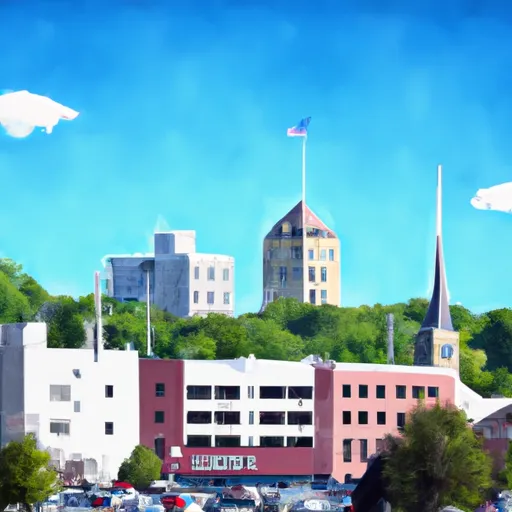
Monroe, Wisconsin is a charming city located in Green County, with a population of approximately 10,800 residents. The climate in Monroe is categorized as humid continental, experiencing warm summers and cold, snowy winters. Average temperatures range from 20°F (-6°C) in winter to 80°F (27°C) in summer, with precipitation spread evenly throughout the year.

Hydrologically, Monroe lies in the Sugar River watershed, featuring the Sugar River that flows through the city. The river is known for its diverse aquatic life and offers opportunities for fishing, kayaking, and canoeing. Additionally, Monroe boasts several beautiful parks, such as Twining Park and Honey Creek Park, where residents and visitors can enjoy outdoor activities like picnic gatherings, hiking, and nature walks.

For outdoor recreation enthusiasts, Monroe is surrounded by picturesque countryside ideal for biking and hiking. The nearby Badger State Trail, a converted railroad trail, provides a scenic route for biking, walking, and snowmobiling. Additionally, the Monroe Country Club offers a golfing experience, perfect for golf enthusiasts to enjoy the rolling hills and lush landscapes. Whether exploring the river, parks, trails, or golf course, Monroe offers a variety of outdoor opportunities to connect with nature and enjoy the beautiful surroundings.

What is the Eden Index?

The Snoflo Eden Index serves as a comprehensive rating system for regions, evaluating their desirability through a holistic assessment of climate health, outdoor recreation opportunities, and natural disaster risk, acknowledging the profound impact of these factors on livability and well-being.


Climate Health Indicator (CHI): 7.0


Monroe receives approximately 943mm of rain per year, with humidity levels near 83% and air temperatures averaging around 8°C. Monroe has a plant hardyness factor of 5, meaning plants and agriculture in this region thrive during a short period during spring and early summer. Most plants will die off during the colder winter months. By considering the ideal temperature range, reliable water supplies, clean air, and stable seasonal rain or snowpacks, the Climate Health Indicator (CHI) underscores the significance of a healthy climate as the foundation for quality living.

A healthy climate is paramount for ensuring a high quality of life and livability in a region, fostering both physical well-being and environmental harmony. This can be characterized by ideal temperatures, reliable access to water supplies, clean air, and consistent seasonal rain or snowpacks.


Weather Forecast


Streamflow Conditions

Rock

Area Rivers

Rock


Snowpack Depths

Rock


Reservoir Storage Capacity

Rock


Groundwater Levels


Recreational Opportunity Index (ROI): 2.8


The Recreational Opportunity Index (ROI) recognizes the value of outdoor recreational options, such as parks, hiking trails, camping sites, and fishing spots, while acknowledging that climate plays a pivotal role in ensuring the comfort and consistency of these experiences. Access to outdoor recreational opportunities, encompassing activities such as parks, hiking, camping, and fishing, is crucial for overall well-being, and the climate plays a pivotal role in enabling and enhancing these experiences, ensuring that individuals can engage in nature-based activities comfortably and consistently.


Camping Areas

Campground Campsites Reservations Toilets Showers Elevation
Scott AFB Military None 439 ft
Ontonagon County Park 43 1,301 ft
Old Fort - Grenada Lake 21 279 ft
Lake Gogebic State Park 165 1,304 ft
Low Head Dam None 310 ft
Sangchris Lake State Park 185 586 ft
Roosevelt State Park None 562 ft
Council Grounds State Park 55 1,300 ft
Lake Mike Conner 20 314 ft
Rib Mountain State Park 30 1,850 ft
Bryant - Grenada Lake 6 210 ft
Dry Creek Water Park None 514 ft
General Watkins Conservation Area - MDC 5 466 ft
Blue Mound State Park None 1,522 ft
Marathon Park None 1,268 ft
Johnson Creek 20 644 ft
Mirror Lake State Park 165 868 ft
Devils Backbone Park 20 362 ft
Lake Columbia 12 212 ft
Spring Lake State Conservation Area 70 507 ft
Otter Lake 25 1,643 ft
Lake Gogebic County Park None 1,296 ft
Lake Girardeau Conservation Area - MDC None 404 ft
Lake Ross Barnett 22 402 ft
Lake Lou Yaeger None 691 ft
North Graysport - Grenada Lake 51 279 ft
Green River State Wildlife Area 50 677 ft
Pomeroy Lake 17 1,643 ft
North Abutment - Grenada Lake 88 251 ft
Carl Spindler None 456 ft
Langford Lake 11 1,681 ft
Sara Park None 1,443 ft
Leake County Water Park None 324 ft
Skuna/Turkey Creek - Grenada Lake None 246 ft
Brigham Park 25 1,364 ft
Hugh White State Park None 310 ft
Woodford State Conservation Area None 472 ft
Lincolns New Salem Historic Site 200 606 ft
Randolph County State Conservation Area 95 513 ft
Trail of Tears State Park None 441 ft
Choctaw - Grenada Lake 5 289 ft
Little Black Creek Waterpark None 296 ft
Riverside/Fern's Edge - Kakabeka Falls Provincial Park 75 859 ft
Sherwood Forest None 625 ft
Coal Bluff Park 60 335 ft
Camp New Wood County Park None 1,322 ft
Whispering Hills - Kakabeka Falls Provincial Park 94 991 ft
Simpson County Lake 11 427 ft
Okatoma Water Park None 396 ft
Pyramid State Park 80 475 ft
Hennepin Canal Parkway State Park None 667 ft
Rocky Arbor State Park 90 852 ft
Jamison Town Park 18 823 ft
Shockaloe Base Camp I 10 578 ft
Bergland Town Park 15 1,320 ft
McLeod Water Park None 22 ft
Veterans Memorial Field - Portage None 784 ft
Jubilee College State Park 165 674 ft
Walkiah Bluff Water Park None 38 ft

Catastrophe Safeguard Index (CSI):


The Catastrophe Safeguard Index (CSI) recognizes that natural disaster risk, encompassing floods, fires, hurricanes, and tornadoes, can drastically affect safety and the overall appeal of an area. The level of natural disaster risk in a region significantly affects safety and the overall livability, with climate change amplifying these risks by potentially increasing the frequency and intensity of events like floods, fires, hurricanes, and tornadoes, thereby posing substantial challenges to community resilience and well-being.


Community Resilience Indicator (CRI): 3.1


The Community Resilience Indicator (CRI) recognizes that education, healthcare, and socioeconomics are crucial to the well-being of a region. The CRI acknowledges the profound impact of these elements on residents' overall quality of life. By evaluating educational resources, healthcare accessibility, and economic inclusivity, the index captures the essential aspects that contribute to a thriving community, fostering resident satisfaction, equity, and social cohesion.


Log Your Visit

When was your last visit to ?

Add a Photo

How was it? How were conditions?

Rate the


Submit

Leave A Review


Submit

Upload an Image


Favorite Limit Reached