Murrayville

Climate Recreation Community Catastrophe

Murrayville
Eden Index

Climate 7.4 Recreation 4.3 Community 4.7 Safeguard

5.6/10

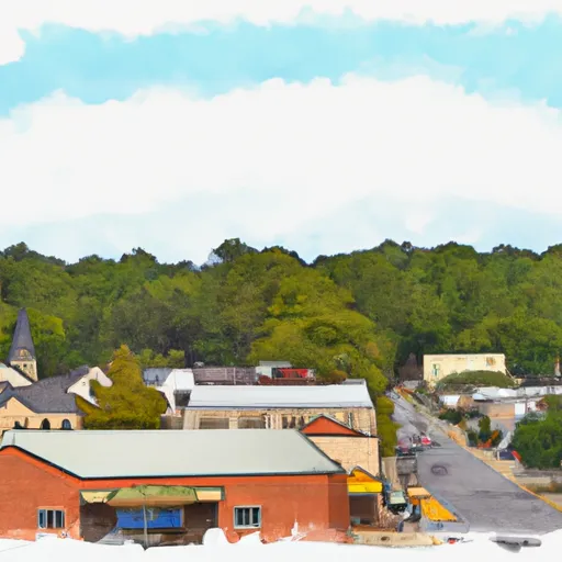
Murrayville, located in the northeastern part of Georgia, offers a pleasant climate characterized by mild winters and warm summers. With an average annual temperature of around 61°F (16°C), residents and visitors can enjoy outdoor activities year-round. The region experiences approximately 53 inches of rainfall per year, ensuring lush greenery and abundant water resources.

Hydrologically, Murrayville benefits from proximity to Lake Lanier, a massive reservoir created by the Buford Dam on the Chattahoochee River. This pristine lake not only provides a serene environment for boating, fishing, and swimming but also serves as a primary water supply for the Atlanta metropolitan area.

Outdoor enthusiasts will find plenty of recreational opportunities in Murrayville. The vast expanse of Lake Lanier offers endless possibilities for water-based activities, including kayaking, jet skiing, and paddleboarding. Nature lovers can explore numerous hiking trails in the nearby Chattahoochee National Forest, which boasts scenic beauty, waterfalls, and diverse wildlife. Additionally, visitors can enjoy camping, picnicking, and bird-watching in the local parks, ensuring a well-rounded experience for nature enthusiasts of all ages.

What is the Eden Index?

The Snoflo Eden Index serves as a comprehensive rating system for regions, evaluating their desirability through a holistic assessment of climate health, outdoor recreation opportunities, and natural disaster risk, acknowledging the profound impact of these factors on livability and well-being.


Climate Health Indicator (CHI): 7.4


Murrayville receives approximately 1497mm of rain per year, with humidity levels near 82% and air temperatures averaging around 15°C. Murrayville has a plant hardyness factor of 7, meaning plants and agriculture in this region tend to thrive during the non-winter months. By considering the ideal temperature range, reliable water supplies, clean air, and stable seasonal rain or snowpacks, the Climate Health Indicator (CHI) underscores the significance of a healthy climate as the foundation for quality living.

A healthy climate is paramount for ensuring a high quality of life and livability in a region, fostering both physical well-being and environmental harmony. This can be characterized by ideal temperatures, reliable access to water supplies, clean air, and consistent seasonal rain or snowpacks.


Weather Forecast


Streamflow Conditions

Apalachicola

Area Rivers

Apalachicola


Snowpack Depths

Apalachicola


Reservoir Storage Capacity

Apalachicola


Groundwater Levels


Recreational Opportunity Index (ROI): 4.3


The Recreational Opportunity Index (ROI) recognizes the value of outdoor recreational options, such as parks, hiking trails, camping sites, and fishing spots, while acknowledging that climate plays a pivotal role in ensuring the comfort and consistency of these experiences. Access to outdoor recreational opportunities, encompassing activities such as parks, hiking, camping, and fishing, is crucial for overall well-being, and the climate plays a pivotal role in enabling and enhancing these experiences, ensuring that individuals can engage in nature-based activities comfortably and consistently.


Camping Areas

Campground Campsites Reservations Toilets Showers Elevation
Poland Creek 35 861 ft
Fort Yargo State Park None 914 ft
Double Camp/Citgo Creek 50 1,486 ft
Loyston Point 64 1,051 ft
James Shackleford County Park None 904 ft
Low Gap Creek 13 1,792 ft
Lake Winfield Scott 44 2,979 ft
Duckett Mill - Lake Lanier None 1,163 ft
Upper Chattahoochee River 34 2,209 ft
Andrews Cove 10 2,056 ft
Unicoi State Park None 1,678 ft
Cable Cove 26 1,796 ft
Laurel Park - Lake Lanier None 1,118 ft
Poteete Creek None 1,832 ft
Clay Co Park None 1,974 ft
Cades Cove - Great Smoky Mountains National Park 159 1,884 ft
Fires Creek Hunt Camp 20 1,845 ft
Bolding Mill - Lake Lanier None 1,102 ft
Desoto Falls 44 2,195 ft
Newton Factory Shoals Rec Area None 608 ft
Chestnut Ridge - Lake Lanier None 1,108 ft
Old Federal - Lake Lanier None 1,108 ft
River Forks - Lake Lanier 73 1,123 ft
Dames Ferry County Park None 424 ft
Vogel State Park None 2,323 ft
Cheoah Point 26 1,990 ft
Jackrabbit Mountain 100 1,959 ft
Shady Grove - Lake Lanier None 1,113 ft
War Hill - Lake Lanier 14 1,132 ft
Gibson Cove - Chatuge Reservoir None 1,939 ft
Horse Cove 17 2,052 ft
Bald Ridge Creek None 1,097 ft
High Falls State Park None 600 ft
Hanging Dog 49 1,668 ft
Cooper Creek 17 2,164 ft
Look Rock - Great Smoky Mountains National Park 68 2,476 ft
Big Oak Cove 12 2,585 ft
Anderson County Park 72 1,078 ft
Mulky 11 2,172 ft
Big Ridge State Park 50 1,034 ft
Boggs Creek 31 1,798 ft
Shoal Creek - Lake Lanier None 1,117 ft
Sawnee None 1,070 ft
Abrams Creek - Great Smoky Mountains National Park 16 1,111 ft
State Line 10 2,602 ft
Georgia Mountain Fair Campground 200 1,970 ft
Lake Chatuga 10 1,973 ft
Dockery Lake 18 2,416 ft
Charleston - Lake Lanier None 1,185 ft
Bear Creek Hunt Camp 5 2,131 ft
Snowbird Camping 28 2,223 ft
Claystone County Park None 410 ft
Indian Springs State Park None 503 ft
Davis Branch 5 2,281 ft
Arrowhead County Park None 390 ft

Catastrophe Safeguard Index (CSI):


The Catastrophe Safeguard Index (CSI) recognizes that natural disaster risk, encompassing floods, fires, hurricanes, and tornadoes, can drastically affect safety and the overall appeal of an area. The level of natural disaster risk in a region significantly affects safety and the overall livability, with climate change amplifying these risks by potentially increasing the frequency and intensity of events like floods, fires, hurricanes, and tornadoes, thereby posing substantial challenges to community resilience and well-being.


Community Resilience Indicator (CRI): 4.7


The Community Resilience Indicator (CRI) recognizes that education, healthcare, and socioeconomics are crucial to the well-being of a region. The CRI acknowledges the profound impact of these elements on residents' overall quality of life. By evaluating educational resources, healthcare accessibility, and economic inclusivity, the index captures the essential aspects that contribute to a thriving community, fostering resident satisfaction, equity, and social cohesion.


Log Your Visit

When was your last visit to ?

Add a Photo

How was it? How were conditions?

Rate the


Submit

Leave A Review


Submit

Upload an Image


Favorite Limit Reached