

-
 Snoflo Premium
Get unlimited access to all our content
With no Ad interruptions! - Start Your Free Trial Login with existing account
Pray
Eden Index
Climate
7.2
•
Recreation
4.7
•
Community
•
Safeguard
4.5/10
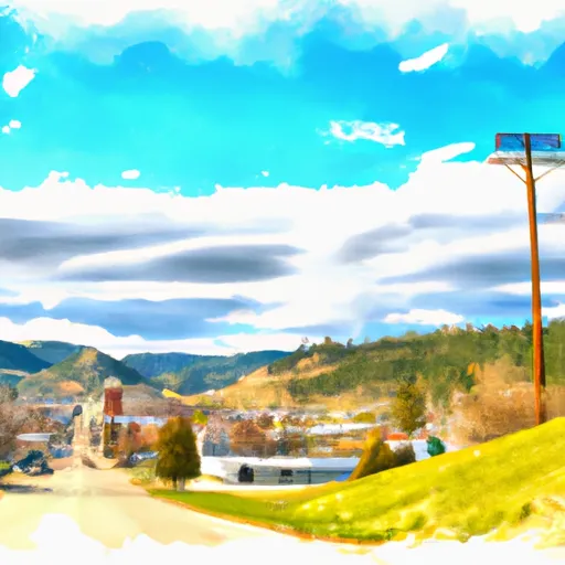
Pray, Montana is a small town located in Park County, in the western part of the state. The climate in Pray is characterized by cold winters and mild summers. Average temperatures range from the 20s to 30s Fahrenheit during winter months, while summer temperatures typically reach the high 70s to low 80s. The region experiences a good amount of precipitation throughout the year, with snowfall being common in the winter.
Pray is also blessed with abundant hydrology constituents. The town is situated near the Yellowstone River, providing access to various water activities such as fishing, kayaking, and rafting. The area is also surrounded by several creeks and streams, adding to the recreational opportunities.
Outdoor enthusiasts will find plenty of activities to enjoy in Pray. The nearby Absaroka-Beartooth Wilderness offers opportunities for hiking, camping, and wildlife viewing. The region is home to diverse wildlife, including elk, deer, bears, and mountain goats. Additionally, the nearby Yellowstone National Park is a short drive away, offering incredible natural beauty, geothermal features, and wildlife.
Overall, Pray, Montana provides a picturesque setting with its climate, diverse hydrology constituents, and abundant outdoor recreation opportunities for visitors and residents to enjoy.
What is the Eden Index?
The Snoflo Eden Index serves as a comprehensive rating system for regions, evaluating their desirability through a holistic assessment of climate health, outdoor recreation opportunities, and natural disaster risk, acknowledging the profound impact of these factors on livability and well-being.
Climate Health Indicator (CHI): 7.2
Pray receives approximately
340mm of rain per year,
with humidity levels near 63%
and air temperatures averaging around
7°C.
Pray has a plant hardyness factor of
4, meaning
plants and agriculture in this region thrive during a short period during spring and early summer. Most
plants will die off during the colder winter months.
By considering the ideal temperature range, reliable water supplies, clean air, and stable seasonal rain or snowpacks, the Climate Health Indicator (CHI) underscores the significance of a healthy climate as the foundation for quality living.
A healthy climate is paramount for ensuring a high quality of life and livability in a region, fostering both physical well-being and environmental harmony. This can be characterized by ideal temperatures, reliable access to water supplies, clean air, and consistent seasonal rain or snowpacks.
Weather Forecast
Streamflow Conditions
Upper Yellowstone
Area Rivers
Upper Yellowstone
Snowpack Depths
Upper Yellowstone
Reservoir Storage Capacity
Upper Yellowstone
Groundwater Levels
Recreational Opportunity Index (ROI): 4.7
The Recreational Opportunity Index (ROI) recognizes the value of outdoor recreational options, such as parks, hiking trails, camping sites, and fishing spots, while acknowledging that climate plays a pivotal role in ensuring the comfort and consistency of these experiences.
Access to outdoor recreational opportunities, encompassing activities such as parks, hiking, camping, and fishing, is crucial for overall well-being, and the climate plays a pivotal role in enabling and enhancing these experiences, ensuring that individuals can engage in nature-based activities comfortably and consistently.
Camping Areas
| Campground | Campsites | Reservations | Toilets | Showers | Elevation |
|---|---|---|---|---|---|
| Mammoth - Yellowstone National Park | 85 | 5,988 ft | |||
| Loch Leven FAS | None | 4,752 ft | |||
| Indian Creek - Yellowstone National Park | 75 | 7,307 ft | |||
| Battle Ridge | 13 | 6,402 ft | |||
| Mallards Rest FAS | 8 | 4,720 ft | |||
| Chisholm | 10 | 6,721 ft | |||
| Fairy Lake | 9 | 7,706 ft | |||
| Hood Creek | 18 | 6,729 ft | |||
| Paradise FAS | None | 4,812 ft | |||
| Norris - Yellowstone National Park | 100 | 7,508 ft |
Nearby Ski Areas
Catastrophe Safeguard Index (CSI):
The Catastrophe Safeguard Index (CSI) recognizes that natural disaster risk, encompassing floods, fires, hurricanes, and tornadoes, can drastically affect safety and the overall appeal of an area.
The level of natural disaster risk in a region significantly affects safety and the overall livability, with climate change amplifying these risks by potentially increasing the frequency and intensity of events like floods, fires, hurricanes, and tornadoes, thereby posing substantial challenges to community resilience and well-being.
Community Resilience Indicator (CRI):
The Community Resilience Indicator (CRI) recognizes that education, healthcare, and socioeconomics are crucial to the well-being of a region. The CRI acknowledges the profound impact of these elements on residents' overall quality of life. By evaluating educational resources, healthcare accessibility, and economic inclusivity, the index captures the essential aspects that contribute to a thriving community, fostering resident satisfaction, equity, and social cohesion.