

-
 Snoflo Premium
Get unlimited access to all our content
With no Ad interruptions! - Start Your Free Trial Login with existing account
Radcliff
Eden Index
Climate
8.0
•
Recreation
3.4
•
Community
2.3
•
Safeguard
5.0/10
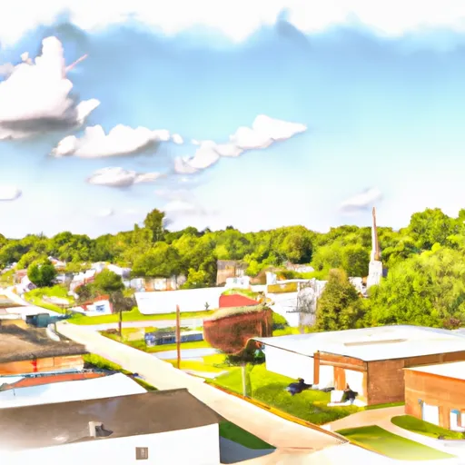
Radcliff, Kentucky is a small city located in Hardin County, in the central part of the state. It experiences a humid subtropical climate characterized by hot, humid summers and mild to cool winters. Average temperatures range from around 30°F (-1°C) in January to approximately 90°F (32°C) in July. Precipitation is fairly evenly distributed throughout the year, with the wettest months being May and July.
The city of Radcliff is situated near the shores of Rough River Lake and Nolin River Lake, which provide excellent hydrology constituents for recreational activities. These lakes offer opportunities for boating, fishing, swimming, and other water sports. Additionally, the area is surrounded by beautiful natural landscapes, including rolling hills, forests, and valleys, offering a myriad of outdoor recreation opportunities such as hiking, camping, and wildlife observation.
Radcliff is also home to several parks and green spaces, including Saunders Springs Nature Preserve, which features nature trails and picnic areas. Overall, the city of Radcliff provides a welcoming environment for outdoor enthusiasts to enjoy nature and engage in various recreational activities amidst its pleasant climate and abundant water resources.
What is the Eden Index?
The Snoflo Eden Index serves as a comprehensive rating system for regions, evaluating their desirability through a holistic assessment of climate health, outdoor recreation opportunities, and natural disaster risk, acknowledging the profound impact of these factors on livability and well-being.
Climate Health Indicator (CHI): 8.0
Radcliff receives approximately
1234mm of rain per year,
with humidity levels near 82%
and air temperatures averaging around
14°C.
Radcliff has a plant hardyness factor of
6, meaning
plants and agriculture in this region thrive during a short period during spring and early summer. Most
plants will die off during the colder winter months.
By considering the ideal temperature range, reliable water supplies, clean air, and stable seasonal rain or snowpacks, the Climate Health Indicator (CHI) underscores the significance of a healthy climate as the foundation for quality living.
A healthy climate is paramount for ensuring a high quality of life and livability in a region, fostering both physical well-being and environmental harmony. This can be characterized by ideal temperatures, reliable access to water supplies, clean air, and consistent seasonal rain or snowpacks.
Weather Forecast
Streamflow Conditions
Lower Ohio-Salt
Area Rivers
Lower Ohio-Salt
Snowpack Depths
Lower Ohio-Salt
Reservoir Storage Capacity
Lower Ohio-Salt
Groundwater Levels
Recreational Opportunity Index (ROI): 3.4
The Recreational Opportunity Index (ROI) recognizes the value of outdoor recreational options, such as parks, hiking trails, camping sites, and fishing spots, while acknowledging that climate plays a pivotal role in ensuring the comfort and consistency of these experiences.
Access to outdoor recreational opportunities, encompassing activities such as parks, hiking, camping, and fishing, is crucial for overall well-being, and the climate plays a pivotal role in enabling and enhancing these experiences, ensuring that individuals can engage in nature-based activities comfortably and consistently.
Camping Areas
| Campground | Campsites | Reservations | Toilets | Showers | Elevation |
|---|---|---|---|---|---|
| Floating Mill - Center Hill Lake | None | 977 ft | |||
| Arnold AFB Military | None | 1,001 ft | |||
| Old Stone Fort State Park | 51 | 1,005 ft | |||
| Cove Hollow - Center Hill Lake | None | 702 ft | |||
| Long Branch - Center Hill Lake | 60 | 818 ft | |||
| Salt Lick Creek - Cordell Hull Lake | 145 | 574 ft | |||
| Defeated Creek - Cordell Hull Lake | 155 | 527 ft | |||
| Stevenson Municipal Park - Guntersville Reservoir | None | 599 ft | |||
| Edgar Evins State Park | 60 | 929 ft | |||
| Holmes Creek - Center Hill Lake | None | 749 ft |
Nearby Ski Areas
Catastrophe Safeguard Index (CSI):
The Catastrophe Safeguard Index (CSI) recognizes that natural disaster risk, encompassing floods, fires, hurricanes, and tornadoes, can drastically affect safety and the overall appeal of an area.
The level of natural disaster risk in a region significantly affects safety and the overall livability, with climate change amplifying these risks by potentially increasing the frequency and intensity of events like floods, fires, hurricanes, and tornadoes, thereby posing substantial challenges to community resilience and well-being.
Community Resilience Indicator (CRI): 2.3
The Community Resilience Indicator (CRI) recognizes that education, healthcare, and socioeconomics are crucial to the well-being of a region. The CRI acknowledges the profound impact of these elements on residents' overall quality of life. By evaluating educational resources, healthcare accessibility, and economic inclusivity, the index captures the essential aspects that contribute to a thriving community, fostering resident satisfaction, equity, and social cohesion.