Rogersville

Climate Recreation Community Catastrophe

Rogersville
Eden Index

Climate 8.3 Recreation 2.8 Community 3.1 Safeguard

5.0/10

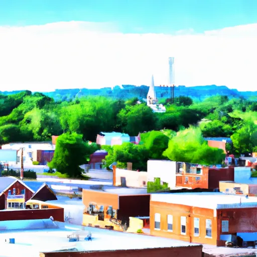
Rogersville, Missouri is a charming town located in Webster County. With a population of approximately 4,500, it offers a welcoming small-town atmosphere to its residents and visitors.

The climate in Rogersville is classified as humid subtropical, characterized by hot summers and mild winters. Summers are typically hot and humid, with average temperatures ranging from the upper 80s to low 90s Fahrenheit. Winters are generally mild, with temperatures averaging in the 30s to 40s Fahrenheit. Precipitation is spread throughout the year, with the highest rainfall occurring during the spring and early summer months.

Hydrology constituents in Rogersville consist of several creeks and streams, with Finley Creek being the largest. These water bodies provide opportunities for fishing and boating, as well as scenic views for outdoor enthusiasts.

Outdoor recreation options in Rogersville are plentiful. The town is surrounded by beautiful natural landscapes and offers various parks and trails for hiking, biking, and picnicking. Nearby lakes and rivers provide opportunities for water sports such as kayaking, canoeing, and paddleboarding. Additionally, Rogersville is home to a golf course, providing options for golf enthusiasts.

Overall, Rogersville, Missouri offers a pleasant climate, diverse hydrology constituents, and numerous outdoor recreation opportunities, making it an appealing destination for nature lovers and adventure seekers.

What is the Eden Index?

The Snoflo Eden Index serves as a comprehensive rating system for regions, evaluating their desirability through a holistic assessment of climate health, outdoor recreation opportunities, and natural disaster risk, acknowledging the profound impact of these factors on livability and well-being.


Climate Health Indicator (CHI): 8.3


Rogersville receives approximately 1134mm of rain per year, with humidity levels near 80% and air temperatures averaging around 13°C. Rogersville has a plant hardyness factor of 6, meaning plants and agriculture in this region thrive during a short period during spring and early summer. Most plants will die off during the colder winter months. By considering the ideal temperature range, reliable water supplies, clean air, and stable seasonal rain or snowpacks, the Climate Health Indicator (CHI) underscores the significance of a healthy climate as the foundation for quality living.

A healthy climate is paramount for ensuring a high quality of life and livability in a region, fostering both physical well-being and environmental harmony. This can be characterized by ideal temperatures, reliable access to water supplies, clean air, and consistent seasonal rain or snowpacks.


Weather Forecast


Streamflow Conditions


Area Rivers


Snowpack Depths


Reservoir Storage Capacity


Groundwater Levels


Recreational Opportunity Index (ROI): 2.8


The Recreational Opportunity Index (ROI) recognizes the value of outdoor recreational options, such as parks, hiking trails, camping sites, and fishing spots, while acknowledging that climate plays a pivotal role in ensuring the comfort and consistency of these experiences. Access to outdoor recreational opportunities, encompassing activities such as parks, hiking, camping, and fishing, is crucial for overall well-being, and the climate plays a pivotal role in enabling and enhancing these experiences, ensuring that individuals can engage in nature-based activities comfortably and consistently.


Camping Areas

Campground Campsites Reservations Toilets Showers Elevation
Cedar Fourche - Lake Ouachita None 587 ft
Mount Nebo State Park None 1,404 ft
White Oak Lake State Park None 208 ft
Riverview - Lake Dardanelle None 363 ft
Maxwell Taylor Park None 702 ft
Cedar Glades Park None 562 ft
Cricket Creek None 1,156 ft
Pershing State Park None 691 ft
Unionville City RV Park 45 1,065 ft
Iron Mountain - De Gray Lake 69 456 ft
Nemo Landing - Pomme de Terre Lake None 912 ft
Pilot Grove City Park None 845 ft
Shouse Ford - De Gray Lake 99 401 ft
Erbie - Buffalo National River None 847 ft
Lake Catherine State Park None 396 ft
River Run None 701 ft
Pittsburg Park - Pomme de Terre Lake None 871 ft
Lena Landing - Lake Ouachita 10 599 ft
Richland Creek 13 1,034 ft
Lake Ouachita State Park None 759 ft
Lead Hill - Bull Shoals Lake None 678 ft
Shadow Rock Park None 676 ft
Branson City Campground None 704 ft
Camp Ridge 91 1,347 ft
Edgewood - De Gray Lake 51 409 ft
Alpine Ridge - De Gray Lake 49 473 ft
Carter Cove None 358 ft
Arrow Rock State Park 46 728 ft
Logoly State Park None 327 ft
Bayou Bluff 28 634 ft
Stephens - Lake Ouachita 9 420 ft
Tucker Hollow - Bull Shoals Lake None 697 ft
Petit Jean State Park None 900 ft
Gulpha Gorge - Hot Springs National Park 44 540 ft
River Road None 355 ft
Carver - Buffalo National River None 710 ft
Long Pool 77 615 ft
County Line None 359 ft
Cobb Ridge 19 1,360 ft
Arlie Moore - De Gray Lake 87 517 ft
Brady Mountain - Lake Ouachita 74 616 ft
Caddo Drive - De Gray Lake 72 415 ft
Lake Dardanelle State Park None 344 ft
Haw Creek Falls 9 791 ft
DeGray Lake State Park 113 403 ft
Quarry Cove None 372 ft
Point Cedar - De Gray Lake 62 417 ft
Ozark - Buffalo National River None 865 ft
Brookfield City Park 15 788 ft
Herring Memorial Park - Brunswick None 761 ft
Van Meter State Park None 662 ft
Drury-Mincy Conservation Area - MDC 4 976 ft
Ozan Point - De Gray Lake 50 422 ft

Catastrophe Safeguard Index (CSI):


The Catastrophe Safeguard Index (CSI) recognizes that natural disaster risk, encompassing floods, fires, hurricanes, and tornadoes, can drastically affect safety and the overall appeal of an area. The level of natural disaster risk in a region significantly affects safety and the overall livability, with climate change amplifying these risks by potentially increasing the frequency and intensity of events like floods, fires, hurricanes, and tornadoes, thereby posing substantial challenges to community resilience and well-being.


Community Resilience Indicator (CRI): 3.1


The Community Resilience Indicator (CRI) recognizes that education, healthcare, and socioeconomics are crucial to the well-being of a region. The CRI acknowledges the profound impact of these elements on residents' overall quality of life. By evaluating educational resources, healthcare accessibility, and economic inclusivity, the index captures the essential aspects that contribute to a thriving community, fostering resident satisfaction, equity, and social cohesion.


Log Your Visit

When was your last visit to ?

Add a Photo

How was it? How were conditions?

Rate the


Submit

Leave A Review


Submit

Upload an Image


Favorite Limit Reached