Rose-Hill

Climate Recreation Community Catastrophe

Rose-Hill
Eden Index

Climate 7.8 Recreation 4.3 Community Safeguard

4.6/10

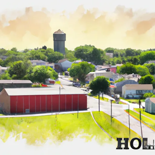
Rose-Hill, Iowa is a small, rural community located in the southern part of the state. The climate in Rose-Hill is classified as humid continental, characterized by hot summers and cold winters. Average temperatures range from the mid-80s Fahrenheit in July to the mid-20s Fahrenheit in January. Precipitation is relatively evenly distributed throughout the year, with an annual average of around 35 inches.

Hydrologically, Rose-Hill lies in the Upper Mississippi River Basin. The area is drained by various streams and small rivers, including the Skunk River, which flows near the town. These water sources provide ample opportunities for fishing, boating, and other water-based activities.

Outdoor recreation enthusiasts will find plenty to do in Rose-Hill and its surrounding areas. The nearby Keokuk County Park offers various amenities, including hiking trails, picnic areas, and a campground. The region also boasts several wildlife management areas, providing opportunities for hunting, birdwatching, and nature observation.

In conclusion, Rose-Hill, Iowa offers a typical Midwest climate, with moderate rainfall and distinct seasonal variations. Its hydrology is defined by the Upper Mississippi River Basin, providing ample outdoor recreation opportunities for nature lovers.

What is the Eden Index?

The Snoflo Eden Index serves as a comprehensive rating system for regions, evaluating their desirability through a holistic assessment of climate health, outdoor recreation opportunities, and natural disaster risk, acknowledging the profound impact of these factors on livability and well-being.


Climate Health Indicator (CHI): 7.8


Rose-Hill receives approximately 928mm of rain per year, with humidity levels near 83% and air temperatures averaging around 10°C. Rose-Hill has a plant hardyness factor of 5, meaning plants and agriculture in this region thrive during a short period during spring and early summer. Most plants will die off during the colder winter months. By considering the ideal temperature range, reliable water supplies, clean air, and stable seasonal rain or snowpacks, the Climate Health Indicator (CHI) underscores the significance of a healthy climate as the foundation for quality living.

A healthy climate is paramount for ensuring a high quality of life and livability in a region, fostering both physical well-being and environmental harmony. This can be characterized by ideal temperatures, reliable access to water supplies, clean air, and consistent seasonal rain or snowpacks.


Weather Forecast


Streamflow Conditions

Upper Mississippi-Skunk-Wapsipinicon

Area Rivers

Upper Mississippi-Skunk-Wapsipinicon


Snowpack Depths

Upper Mississippi-Skunk-Wapsipinicon


Reservoir Storage Capacity

Upper Mississippi-Skunk-Wapsipinicon


Groundwater Levels


Recreational Opportunity Index (ROI): 4.3


The Recreational Opportunity Index (ROI) recognizes the value of outdoor recreational options, such as parks, hiking trails, camping sites, and fishing spots, while acknowledging that climate plays a pivotal role in ensuring the comfort and consistency of these experiences. Access to outdoor recreational opportunities, encompassing activities such as parks, hiking, camping, and fishing, is crucial for overall well-being, and the climate plays a pivotal role in enabling and enhancing these experiences, ensuring that individuals can engage in nature-based activities comfortably and consistently.


Camping Areas

Campground Campsites Reservations Toilets Showers Elevation
Hatfield City Park 10 995 ft
McGowen Rec Area 12 857 ft
Point Return City Park 22 716 ft
Shell Rock Rec Area 40 899 ft
Hoffman City Park None 920 ft
Glendale Access None 696 ft
Theodosia None 691 ft
Bull Shoals State Park None 516 ft
Norway Point Landing - St. Croix National Scenic River None 861 ft
Interstate State Park 85 977 ft
Lake of the Ozarks State Park 183 773 ft
North Cedar Park 40 935 ft
Ozark Isle - Bull Shoals Lake None 689 ft
Rippee Conserrvation Area - MDC None 793 ft
Anderson - Berger Park None 1,143 ft
Union Mills Access None 762 ft
Twin Ponds Co Park - East None 1,053 ft
Thunder Woman Park 190 878 ft
Oakland - Bull Shoals Lake None 722 ft
Lake Fisher 6 840 ft
Roadman Roadside Park None 956 ft
Black Hawk County Park None 858 ft
Clear Lake City Park None 1,164 ft
Bay City 25 676 ft
Rothwell Park None 858 ft
Drakesville City Park 6 886 ft
Finger Lakes State Park None 725 ft
Robertson Access None 758 ft
Paint Rock Springs - St. Croix State Park 210 915 ft
Long Branch State Park None 841 ft
Otter Creek Lake and Park 83 933 ft
Lakeview - Bull Shoals Lake None 757 ft
Cedar Bend Park 40 975 ft
Panther Bay - Norfolk Lake None 639 ft
Hickory Hills Park - La Porte City 80 911 ft
Pontiac None 796 ft
Boulder - St Croix State Forest 21 999 ft
Deerwood City Park None 838 ft
Lake Wapello State Park 80 803 ft
Binder Park 17 655 ft
Thomas Hill Reservoir - Hwy T Campground - MDC 10 753 ft
Lake Keomah State Park 65 810 ft
T. F. Clark Co Park 13 891 ft
Nelsons Landing - St. Croix National Scenic River None 868 ft
Cranfield - Norfolk Lake None 566 ft
Balsam Lake Pine Park - Town 15 1,144 ft
Big Woods Lake None 859 ft
Dam Site - Bull Shoals Lake None 681 ft
Macon Co Park None 873 ft
Quercus Wilderness Area 5 670 ft
Lake of the Ozarks Military None 768 ft
Diamond Lake County Park 100 910 ft
Thousand Hills State Park None 862 ft
Twin Ponds Co Park - West None 1,070 ft
Riverview - St. Croix State Park 211 905 ft
Alcock Park 40 1,018 ft
George Wyth State Park 70 849 ft

Catastrophe Safeguard Index (CSI):


The Catastrophe Safeguard Index (CSI) recognizes that natural disaster risk, encompassing floods, fires, hurricanes, and tornadoes, can drastically affect safety and the overall appeal of an area. The level of natural disaster risk in a region significantly affects safety and the overall livability, with climate change amplifying these risks by potentially increasing the frequency and intensity of events like floods, fires, hurricanes, and tornadoes, thereby posing substantial challenges to community resilience and well-being.


Community Resilience Indicator (CRI):


The Community Resilience Indicator (CRI) recognizes that education, healthcare, and socioeconomics are crucial to the well-being of a region. The CRI acknowledges the profound impact of these elements on residents' overall quality of life. By evaluating educational resources, healthcare accessibility, and economic inclusivity, the index captures the essential aspects that contribute to a thriving community, fostering resident satisfaction, equity, and social cohesion.


Log Your Visit

When was your last visit to ?

Add a Photo

How was it? How were conditions?

Rate the


Submit

Leave A Review


Submit

Upload an Image


Favorite Limit Reached