Saint-Olaf

Climate Recreation Community Catastrophe

Saint-Olaf
Eden Index

Climate 6.8 Recreation 4.9 Community Safeguard

4.4/10

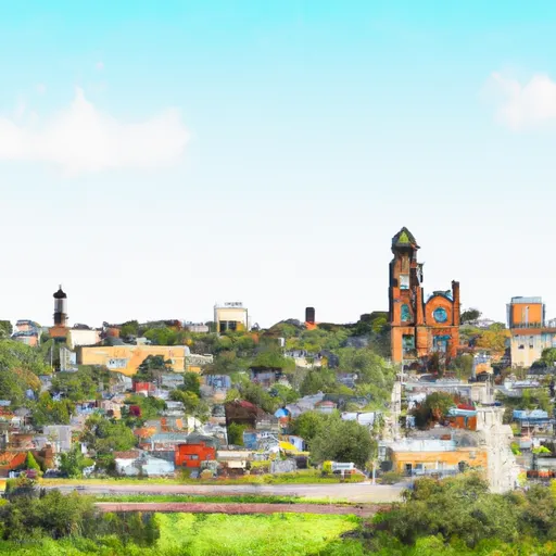
Saint Olaf is a small town located in Clayton County, Iowa. The town experiences a humid continental climate, characterized by hot summers and cold winters. Summer temperatures average around 80°F (27°C), while winter temperatures can drop to around 20°F (-6°C). Precipitation is evenly distributed throughout the year, with an average annual rainfall of 35 inches.

The town's hydrology is influenced by the nearby Mississippi River. Saint Olaf is situated near several creeks and streams that contribute to the hydrological system. These water bodies provide opportunities for fishing, kayaking, and canoeing. The Mississippi River is also easily accessible, allowing residents and visitors to engage in activities such as boating and water skiing.

In terms of outdoor recreation, Saint Olaf is surrounded by picturesque landscapes and offers various opportunities for hiking, biking, and camping. Nearby parks and natural areas, such as the Effigy Mounds National Monument and Yellow River State Forest, provide a diverse range of outdoor activities, including bird-watching, hunting, and horseback riding. Nature enthusiasts can explore the region's stunning scenery, lush forests, and diverse wildlife. Saint Olaf provides a peaceful and scenic environment for outdoor enthusiasts to enjoy various recreational activities.

What is the Eden Index?

The Snoflo Eden Index serves as a comprehensive rating system for regions, evaluating their desirability through a holistic assessment of climate health, outdoor recreation opportunities, and natural disaster risk, acknowledging the profound impact of these factors on livability and well-being.


Climate Health Indicator (CHI): 6.8


Saint-Olaf receives approximately 891mm of rain per year, with humidity levels near 80% and air temperatures averaging around 8°C. Saint-Olaf has a plant hardyness factor of 4, meaning plants and agriculture in this region thrive during a short period during spring and early summer. Most plants will die off during the colder winter months. By considering the ideal temperature range, reliable water supplies, clean air, and stable seasonal rain or snowpacks, the Climate Health Indicator (CHI) underscores the significance of a healthy climate as the foundation for quality living.

A healthy climate is paramount for ensuring a high quality of life and livability in a region, fostering both physical well-being and environmental harmony. This can be characterized by ideal temperatures, reliable access to water supplies, clean air, and consistent seasonal rain or snowpacks.


Weather Forecast


Streamflow Conditions

Upper Mississippi-Maquoketa-Plum

Area Rivers

Upper Mississippi-Maquoketa-Plum


Snowpack Depths

Upper Mississippi-Maquoketa-Plum


Reservoir Storage Capacity

Upper Mississippi-Maquoketa-Plum


Groundwater Levels


Recreational Opportunity Index (ROI): 4.9


The Recreational Opportunity Index (ROI) recognizes the value of outdoor recreational options, such as parks, hiking trails, camping sites, and fishing spots, while acknowledging that climate plays a pivotal role in ensuring the comfort and consistency of these experiences. Access to outdoor recreational opportunities, encompassing activities such as parks, hiking, camping, and fishing, is crucial for overall well-being, and the climate plays a pivotal role in enabling and enhancing these experiences, ensuring that individuals can engage in nature-based activities comfortably and consistently.


Camping Areas

Campground Campsites Reservations Toilets Showers Elevation
Audie Lake County Park 30 1,469 ft
Wakpicada Natural Area None 823 ft
Sandbar Lake Provincial Park 74 1,376 ft
Roberts Field None 561 ft
Marr Park 26 744 ft
Moon Lake City Park 29 1,110 ft
Stephenson Park None 559 ft
Grays Landing None 559 ft
Little Isabella River 11 1,828 ft
Doolittle Park 40 1,236 ft
Pin Oak Co Park None 928 ft
Pietrek County Park 25 754 ft
Hermann City RV Park 20 509 ft
Mooney Dam County Park 11 1,138 ft
Lower Augusta Skunk River Access None 555 ft
Coffins Grove 25 971 ft
Bruce Village Park None 1,104 ft
Great River Bluffs State Park 31 1,271 ft
Wilbur D Mills None 188 ft
Pendleton Bend None 172 ft
Little Scotia Dispersed None 1,362 ft
Midwest Old Threshers None 689 ft
Riverfront RV Park None 178 ft
Turtle Creek County Park 30 982 ft
Waldo Carlson Park 35 1,207 ft
Greer Crossing 72 564 ft
Alley Spring - Ozark National Scenic River 162 672 ft
Gooseberry Falls State Park 70 768 ft
Phipps Landing - St. Croix National Scenic River None 1,259 ft
Sawmill Lake County Park 25 1,465 ft
Fair Hill County Campground 30 917 ft
Round Spring - Ozark National Scenic River None 673 ft
Loggers Lake 29 1,160 ft
River Junction Access None 615 ft
Backbone State Park 125 1,154 ft
Wanoka 20 1,131 ft
Warsaw City Campground None 495 ft
Squaw Creek County Park 60 786 ft
Split Rock Lighthouse State Park 25 714 ft
Jerktail Landing None 657 ft
Col Larson County Park None 805 ft
Wakonda State Park None 496 ft
Perrot State Park 95 715 ft
Lake Wissota State Park None 947 ft
Victory Park 5 510 ft
Joy Springs County Park None 1,084 ft
Town of Clover None 607 ft
Owls Bend - Powder Mill None 556 ft
Silver Lake County Park None 1,029 ft
Murphy Flowage Park 15 1,250 ft
Mcdougal Lake 21 1,796 ft
Hubinger Landing Park 18 503 ft
Mississippi Riverfront RV Park None 483 ft
Two Lakes 90 1,412 ft
Baileys Ford 50 925 ft
Tettegouche State Park 30 872 ft
Palisades Kepler State Park 50 863 ft
Crystal Lake Park - Strum 40 887 ft
Upper Augusta Skunk River Access None 557 ft
Finland - Finland State Forest 39 1,314 ft
Copper Range - Brule River State Forest 15 941 ft
Bear Creek - Mississippi River 30 492 ft
Welter Recreation Park None 555 ft
Merrisach Lake Park - Merrisach Lake None 169 ft
Riverside Memorial Park None 844 ft
Pulltite - Ozark National Scenic River 55 817 ft
Notrebes Bend None 160 ft
Matsell Bridge Natural Area 70 819 ft
Graham Cave State Park None 778 ft
Lions Club - Four Seasons Park - Independence None 770 ft
Eckbeck ? Finland State Forest 31 1,065 ft
Hills Access 13 629 ft
Canton City River Park 23 481 ft
Boise Brule - Brule River State Forest 20 1,017 ft
Blackhawk Park - DeSoto 150 630 ft
Onondaga Cave State Park None 791 ft
Twin Bear County Park None 1,042 ft
Two Rivers - Ozark National Scenic River None 608 ft
Wapello Fairgrounds Park None 587 ft
Yellow River State Forest 150 645 ft
Louisa County Fairgrounds 10 579 ft
Edgewood Campground None 1,165 ft
Big Hollow Creek Park 48 734 ft
Akers None 818 ft
Virginia Grove Rec Area None 769 ft
Powder Mill - Ozark National Scenic River 8 561 ft
Delta Lake County Park 34 1,071 ft
Buffalo Creek County Park 18 914 ft
Fountain Springs County Park None 1,006 ft
Geode State Park 170 699 ft
Wapsipinicon State Park 25 825 ft

Catastrophe Safeguard Index (CSI):


The Catastrophe Safeguard Index (CSI) recognizes that natural disaster risk, encompassing floods, fires, hurricanes, and tornadoes, can drastically affect safety and the overall appeal of an area. The level of natural disaster risk in a region significantly affects safety and the overall livability, with climate change amplifying these risks by potentially increasing the frequency and intensity of events like floods, fires, hurricanes, and tornadoes, thereby posing substantial challenges to community resilience and well-being.


Community Resilience Indicator (CRI):


The Community Resilience Indicator (CRI) recognizes that education, healthcare, and socioeconomics are crucial to the well-being of a region. The CRI acknowledges the profound impact of these elements on residents' overall quality of life. By evaluating educational resources, healthcare accessibility, and economic inclusivity, the index captures the essential aspects that contribute to a thriving community, fostering resident satisfaction, equity, and social cohesion.


Log Your Visit

When was your last visit to ?

Add a Photo

How was it? How were conditions?

Rate the


Submit

Leave A Review


Submit

Upload an Image


Favorite Limit Reached