Selma

Climate Recreation Community Catastrophe

Selma
Eden Index

Climate 8.3 Recreation 4.2 Community 2.4 Safeguard

5.4/10

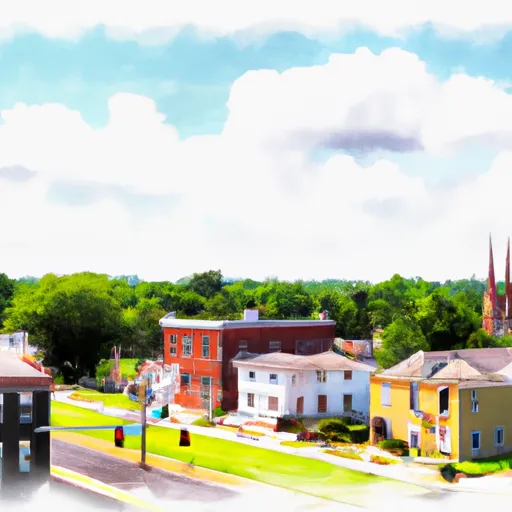
Selma, Virginia is a small town located in Rockbridge County in the central part of the state. The climate in Selma is characterized as humid subtropical, with hot and humid summers and mild winters. Average temperatures range from the low 30s°F (-1°C) in winter to the upper 80s°F (around 30°C) in summer. Precipitation is evenly distributed throughout the year, with the highest amounts occurring during the summer months.

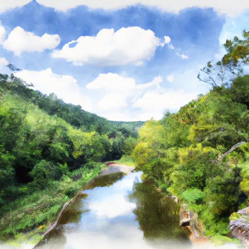
Selma is fortunate to be surrounded by the Maury River, which provides various hydrology constituents to the area. The river serves as a habitat for diverse aquatic species and supports recreational activities such as fishing, kayaking, and canoeing. The Maury River also offers picturesque scenery and is a popular spot for picnicking and hiking along its banks.

In addition to the Maury River, Selma is located near several outdoor recreation opportunities. The nearby George Washington and Jefferson National Forests provide ample opportunities for hiking, camping, and wildlife viewing. The Blue Ridge Mountains are also within reach, offering breathtaking vistas and opportunities for mountain biking and rock climbing. Overall, Selma, Virginia provides a pleasant climate, access to water resources, and a range of outdoor activities for nature enthusiasts to enjoy.

What is the Eden Index?

The Snoflo Eden Index serves as a comprehensive rating system for regions, evaluating their desirability through a holistic assessment of climate health, outdoor recreation opportunities, and natural disaster risk, acknowledging the profound impact of these factors on livability and well-being.


Climate Health Indicator (CHI): 8.3


Selma receives approximately 1043mm of rain per year, with humidity levels near 82% and air temperatures averaging around 13°C. Selma has a plant hardyness factor of 7, meaning plants and agriculture in this region tend to thrive during the non-winter months. By considering the ideal temperature range, reliable water supplies, clean air, and stable seasonal rain or snowpacks, the Climate Health Indicator (CHI) underscores the significance of a healthy climate as the foundation for quality living.

A healthy climate is paramount for ensuring a high quality of life and livability in a region, fostering both physical well-being and environmental harmony. This can be characterized by ideal temperatures, reliable access to water supplies, clean air, and consistent seasonal rain or snowpacks.


Weather Forecast


Streamflow Conditions

James

Area Rivers

James


Snowpack Depths

James


Reservoir Storage Capacity

James


Groundwater Levels


Recreational Opportunity Index (ROI): 4.2


The Recreational Opportunity Index (ROI) recognizes the value of outdoor recreational options, such as parks, hiking trails, camping sites, and fishing spots, while acknowledging that climate plays a pivotal role in ensuring the comfort and consistency of these experiences. Access to outdoor recreational opportunities, encompassing activities such as parks, hiking, camping, and fishing, is crucial for overall well-being, and the climate plays a pivotal role in enabling and enhancing these experiences, ensuring that individuals can engage in nature-based activities comfortably and consistently.


Camping Areas

Campground Campsites Reservations Toilets Showers Elevation
Goose Dam None 1,309 ft
Roanoke Mountain - Blue Ridge Parkway None 1,458 ft
Bolar Mountain 90 1,592 ft
Salthouse Branch - Philpott Lake None 1,042 ft
Bird Run 10 2,707 ft
West Shore - Lake Sherwood 155 2,687 ft
Seneca State Forest None 2,683 ft
Pocahontas 9 2,488 ft
Blowing Springs 40 1,710 ft
Goose Point - Philpott Lake None 1,155 ft
Mcclintic Point 57 1,593 ft
Pine Run - Lake Sherwood 36 2,687 ft
Meadow Creek - Lake Sherwood 38 2,692 ft
Laurel Fork 14 3,108 ft

Catastrophe Safeguard Index (CSI):


The Catastrophe Safeguard Index (CSI) recognizes that natural disaster risk, encompassing floods, fires, hurricanes, and tornadoes, can drastically affect safety and the overall appeal of an area. The level of natural disaster risk in a region significantly affects safety and the overall livability, with climate change amplifying these risks by potentially increasing the frequency and intensity of events like floods, fires, hurricanes, and tornadoes, thereby posing substantial challenges to community resilience and well-being.


Community Resilience Indicator (CRI): 2.4


The Community Resilience Indicator (CRI) recognizes that education, healthcare, and socioeconomics are crucial to the well-being of a region. The CRI acknowledges the profound impact of these elements on residents' overall quality of life. By evaluating educational resources, healthcare accessibility, and economic inclusivity, the index captures the essential aspects that contribute to a thriving community, fostering resident satisfaction, equity, and social cohesion.


Log Your Visit

When was your last visit to ?

Add a Photo

How was it? How were conditions?

Rate the


Submit

Leave A Review


Submit

Upload an Image


Favorite Limit Reached