Sondheimer

Climate Recreation Community Catastrophe

Sondheimer
Eden Index

Climate 7.5 Recreation Community Safeguard

3.0/10

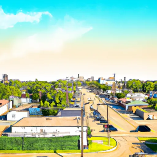
Sondheimer, Louisiana is a small rural community located in the northeastern part of the state, situated in East Carroll Parish. The region experiences a humid subtropical climate characterized by hot and humid summers, with average temperatures reaching the upper 90s Fahrenheit (around 37 degrees Celsius), and mild winters, where temperatures range from the mid-30s to mid-50s Fahrenheit (around 1 to 13 degrees Celsius). The area receives an average annual rainfall of around 55 inches (1397 mm).

Hydrologically, Sondheimer is situated near the Mississippi River, providing easy access to water-based activities. The river supports a diverse ecosystem and is popular for fishing, boating, and wildlife observation. In addition, there are several small lakes and bayous in the area, offering opportunities for outdoor enthusiasts to enjoy activities such as kayaking, canoeing, and birdwatching.

Sondheimer is surrounded by beautiful countryside and offers plenty of outdoor recreational opportunities. The region is known for its hunting, with deer, waterfowl, and turkey being popular game species. The expansive forests and fields provide ample space for hiking, camping, and nature photography. Overall, Sondheimer provides a peaceful and picturesque setting for individuals seeking outdoor adventures and a connection to nature.

What is the Eden Index?

The Snoflo Eden Index serves as a comprehensive rating system for regions, evaluating their desirability through a holistic assessment of climate health, outdoor recreation opportunities, and natural disaster risk, acknowledging the profound impact of these factors on livability and well-being.


Climate Health Indicator (CHI): 7.5


Sondheimer receives approximately 1436mm of rain per year, with humidity levels near 84% and air temperatures averaging around 18°C. Sondheimer has a plant hardyness factor of 8, meaning plants and agriculture in this region tend to thrive here all year round. By considering the ideal temperature range, reliable water supplies, clean air, and stable seasonal rain or snowpacks, the Climate Health Indicator (CHI) underscores the significance of a healthy climate as the foundation for quality living.

A healthy climate is paramount for ensuring a high quality of life and livability in a region, fostering both physical well-being and environmental harmony. This can be characterized by ideal temperatures, reliable access to water supplies, clean air, and consistent seasonal rain or snowpacks.


Weather Forecast


Streamflow Conditions

Lower Mississippi-Greenville

Area Rivers

Lower Mississippi-Greenville


Snowpack Depths

Lower Mississippi-Greenville


Reservoir Storage Capacity

Lower Mississippi-Greenville


Groundwater Levels


Recreational Opportunity Index (ROI):


The Recreational Opportunity Index (ROI) recognizes the value of outdoor recreational options, such as parks, hiking trails, camping sites, and fishing spots, while acknowledging that climate plays a pivotal role in ensuring the comfort and consistency of these experiences. Access to outdoor recreational opportunities, encompassing activities such as parks, hiking, camping, and fishing, is crucial for overall well-being, and the climate plays a pivotal role in enabling and enhancing these experiences, ensuring that individuals can engage in nature-based activities comfortably and consistently.


Camping Areas

Campground Campsites Reservations Toilets Showers Elevation
Ferry Landing 50 604 ft
Saulsbury Bridge 35 614 ft
Sugar Creek City Campground None 618 ft
Lake Charlie Capps None 146 ft
Fountain Springs County Park None 1,006 ft
Cuivre River State Park 94 658 ft
Meramec State Park None 613 ft
Natchez State Park None 236 ft
Flaming Prairie Park 24 541 ft
Jerktail Landing None 657 ft
Farr Park 108 26 ft
Grand Gulf Military Park 42 238 ft
Blackhawk Park - DeSoto 150 630 ft
Lake Chicot State Park None 128 ft
Snively Access 30 656 ft
Owls Bend - Powder Mill None 556 ft
Powder Mill - Ozark National Scenic River 8 561 ft
Onondaga Cave State Park None 791 ft
Blanchard Island - Mississippi River 35 556 ft
Big Hollow Creek Park 48 734 ft
Ridge - Sidie Hollow Park 20 1,209 ft
Wilbur D Mills None 188 ft
Council Bluff - Wild Boar Ridge 100 1,268 ft
Keithsburg Riverside Campground 60 541 ft
Hazel Creek None 846 ft
Pictured Rocks Co Park None 885 ft
Wapsipinicon State Park 25 825 ft
Boat Landing - Sidie Hollow Park 22 939 ft
Little Scotia Dispersed None 1,362 ft
Lower Augusta Skunk River Access None 555 ft
Fillmore County Rec Area None 835 ft
Chicot County RV Park 98 111 ft
Warfield Point Park None 132 ft
Riverfront RV Park None 178 ft
Kemper Williams Parish Park None 5 ft
Central Park 100 978 ft
Two Rivers - Ozark National Scenic River None 608 ft
Merrisach Lake Park - Merrisach Lake None 169 ft
Red Bluff 109 821 ft
Loggers Lake 29 1,160 ft
Roberts Field None 561 ft
Leroy Percy State Park None 108 ft
Welter Recreation Park None 555 ft
Clear Spgs Rec Area 45 317 ft
Delabar State Park 60 575 ft
Cappy Russell Access Dispersed None 554 ft
Main - Sidie Hollow Park 31 930 ft
Big Spring - Ozark National Scenic River 123 727 ft
Bankston Park 50 950 ft
Wapello Fairgrounds Park None 587 ft
New Wine County Park 55 1,002 ft
Esofea - Rentz Memorial Park 27 958 ft
Siloam Springs State Park 180 690 ft
Watercress 114 523 ft
Henderson County State Conservation 35 554 ft
Lake Bruin State Park None 75 ft
Lake End City Park 74 4 ft
Virginia Grove Rec Area None 769 ft
Greer Crossing 72 564 ft
Fourth Pumping Plant Rec Area 22 531 ft
Bennett Park 13 795 ft
Lake End Park 167 4 ft
Lamar Dixon Expo RV Center 300 11 ft
Yellow River State Forest 150 645 ft
Notrebes Bend None 160 ft
Dupont Reservation Conservation Area - MDC 20 460 ft
Carthage City Park None 666 ft
Sutton Bluff 45 820 ft
Silver Lake County Park None 1,029 ft
Berryman 19 1,009 ft
Upper Augusta Skunk River Access None 557 ft
Great River Road State Park None 150 ft
Big River State Forest 100 541 ft
Fairport State Rec Area 40 566 ft

Catastrophe Safeguard Index (CSI):


The Catastrophe Safeguard Index (CSI) recognizes that natural disaster risk, encompassing floods, fires, hurricanes, and tornadoes, can drastically affect safety and the overall appeal of an area. The level of natural disaster risk in a region significantly affects safety and the overall livability, with climate change amplifying these risks by potentially increasing the frequency and intensity of events like floods, fires, hurricanes, and tornadoes, thereby posing substantial challenges to community resilience and well-being.


Community Resilience Indicator (CRI):


The Community Resilience Indicator (CRI) recognizes that education, healthcare, and socioeconomics are crucial to the well-being of a region. The CRI acknowledges the profound impact of these elements on residents' overall quality of life. By evaluating educational resources, healthcare accessibility, and economic inclusivity, the index captures the essential aspects that contribute to a thriving community, fostering resident satisfaction, equity, and social cohesion.


Log Your Visit

When was your last visit to ?

Add a Photo

How was it? How were conditions?

Rate the


Submit

Leave A Review


Submit

Upload an Image


Favorite Limit Reached