Spirit-Lake

Climate Recreation Community Catastrophe

Spirit-Lake
Eden Index

Climate 6.7 Recreation 2.8 Community 3.7 Safeguard

4.6/10

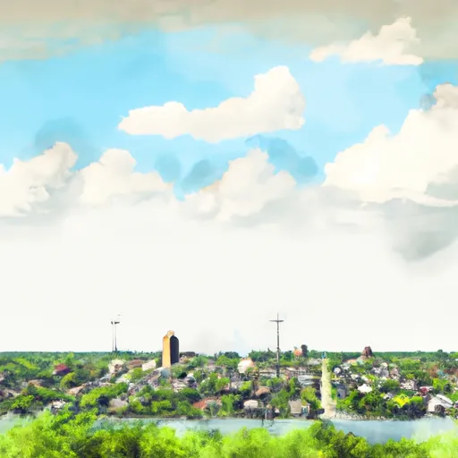
Spirit Lake is a charming city located in Dickinson County, Iowa. The region experiences a humid continental climate, characterized by warm summers and cold winters. Average temperatures range from the mid-20s°F in winter to the mid-80s°F in summer. Precipitation is evenly distributed throughout the year, with snowfall occurring in the winter months.

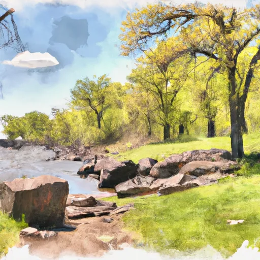
Situated by the beautiful Spirit Lake, the city offers various outdoor recreation opportunities. The lake is the largest natural lake in Iowa, providing opportunities for boating, fishing, and water sports. Anglers can enjoy catching a variety of fish, including walleye, bass, and northern pike. The lake also supports an impressive range of bird species, making it a popular spot for birdwatching.

In addition to Spirit Lake, the region boasts numerous parks and trails, perfect for hiking, biking, and nature exploration. The Gull Point State Park and the Dickinson County Nature Center offer educational experiences and guided tours. The area's stunning landscapes and diverse wildlife provide ample opportunities for outdoor enthusiasts to enjoy the natural beauty of Spirit Lake, Iowa.

What is the Eden Index?

The Snoflo Eden Index serves as a comprehensive rating system for regions, evaluating their desirability through a holistic assessment of climate health, outdoor recreation opportunities, and natural disaster risk, acknowledging the profound impact of these factors on livability and well-being.


Climate Health Indicator (CHI): 6.7


Spirit-Lake receives approximately 754mm of rain per year, with humidity levels near 81% and air temperatures averaging around 8°C. Spirit-Lake has a plant hardyness factor of 5, meaning plants and agriculture in this region thrive during a short period during spring and early summer. Most plants will die off during the colder winter months. By considering the ideal temperature range, reliable water supplies, clean air, and stable seasonal rain or snowpacks, the Climate Health Indicator (CHI) underscores the significance of a healthy climate as the foundation for quality living.

A healthy climate is paramount for ensuring a high quality of life and livability in a region, fostering both physical well-being and environmental harmony. This can be characterized by ideal temperatures, reliable access to water supplies, clean air, and consistent seasonal rain or snowpacks.


Weather Forecast


Streamflow Conditions

Missouri-Little Sioux

Area Rivers

Missouri-Little Sioux


Snowpack Depths

Missouri-Little Sioux


Reservoir Storage Capacity

Missouri-Little Sioux


Groundwater Levels


Recreational Opportunity Index (ROI): 2.8


The Recreational Opportunity Index (ROI) recognizes the value of outdoor recreational options, such as parks, hiking trails, camping sites, and fishing spots, while acknowledging that climate plays a pivotal role in ensuring the comfort and consistency of these experiences. Access to outdoor recreational opportunities, encompassing activities such as parks, hiking, camping, and fishing, is crucial for overall well-being, and the climate plays a pivotal role in enabling and enhancing these experiences, ensuring that individuals can engage in nature-based activities comfortably and consistently.


Camping Areas

Campground Campsites Reservations Toilets Showers Elevation
Prairie Rose State Park 95 1,250 ft
Cocklin Fish Farm 56 1,110 ft
Sunnyside Park Campground None 1,204 ft
Legion City Park 10 1,033 ft
Cold Spring Park 80 1,122 ft
Sailors and Soldiers Memorial Park 24 1,035 ft
Pilot Grove Co Park 16 1,184 ft
Gilfillan Estate 44 1,040 ft
Memorial Park - Olivia 6 1,071 ft
Birch Coulee Co Park None 1,024 ft
Beaver Falls Co Park None 869 ft
Rothenburg City Park None 1,015 ft
Nishna Bend Rec Area 14 1,188 ft
Alexander Ramsey Park 31 1,019 ft

Catastrophe Safeguard Index (CSI):


The Catastrophe Safeguard Index (CSI) recognizes that natural disaster risk, encompassing floods, fires, hurricanes, and tornadoes, can drastically affect safety and the overall appeal of an area. The level of natural disaster risk in a region significantly affects safety and the overall livability, with climate change amplifying these risks by potentially increasing the frequency and intensity of events like floods, fires, hurricanes, and tornadoes, thereby posing substantial challenges to community resilience and well-being.


Community Resilience Indicator (CRI): 3.7


The Community Resilience Indicator (CRI) recognizes that education, healthcare, and socioeconomics are crucial to the well-being of a region. The CRI acknowledges the profound impact of these elements on residents' overall quality of life. By evaluating educational resources, healthcare accessibility, and economic inclusivity, the index captures the essential aspects that contribute to a thriving community, fostering resident satisfaction, equity, and social cohesion.


Log Your Visit

When was your last visit to ?

Add a Photo

How was it? How were conditions?

Rate the


Submit

Leave A Review


Submit

Upload an Image


Favorite Limit Reached