Stanley

Climate Recreation Community Catastrophe

Stanley
Eden Index

Climate 6.9 Recreation 6.8 Community Safeguard

5.2/10

Stanley, Iowa is a small town located in the northeastern part of the state. The climate in Stanley is characterized by four distinct seasons. Summers are warm and humid, with average temperatures ranging from 70°F to 85°F. Winters are cold, with temperatures dropping below freezing and occasional snowfall. Spring and fall offer mild and pleasant weather.

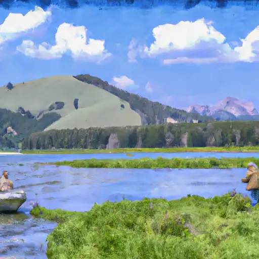
Hydrologically, Stanley is situated near the Cedar River, which runs through the town. The river provides a source of water for the community and supports various aquatic life. Additionally, Stanley is surrounded by several small lakes and ponds, contributing to the local hydrology.

Outdoor recreation opportunities abound in Stanley. The Cedar River offers activities such as fishing, kayaking, and boating. Anglers can catch a variety of fish species including bass, catfish, and walleye. The town also has several parks and trails, perfect for hiking, biking, and picnicking. Stanley State Park is a popular destination with its scenic views and camping facilities. Furthermore, during the winter months, residents and visitors can engage in activities like ice fishing and snowmobiling in the surrounding areas.

In conclusion, Stanley, Iowa offers a diverse climate with warm summers and cold winters. Its hydrology is influenced by the Cedar River and various lakes. The town provides ample opportunities for outdoor recreation, making it an attractive destination for nature enthusiasts and adventure seekers.

What is the Eden Index?

The Snoflo Eden Index serves as a comprehensive rating system for regions, evaluating their desirability through a holistic assessment of climate health, outdoor recreation opportunities, and natural disaster risk, acknowledging the profound impact of these factors on livability and well-being.


Climate Health Indicator (CHI): 6.9


Stanley receives approximately 917mm of rain per year, with humidity levels near 83% and air temperatures averaging around 8°C. Stanley has a plant hardyness factor of 5, meaning plants and agriculture in this region thrive during a short period during spring and early summer. Most plants will die off during the colder winter months. By considering the ideal temperature range, reliable water supplies, clean air, and stable seasonal rain or snowpacks, the Climate Health Indicator (CHI) underscores the significance of a healthy climate as the foundation for quality living.

A healthy climate is paramount for ensuring a high quality of life and livability in a region, fostering both physical well-being and environmental harmony. This can be characterized by ideal temperatures, reliable access to water supplies, clean air, and consistent seasonal rain or snowpacks.


Weather Forecast


Streamflow Conditions

Upper Mississippi-Skunk-Wapsipinicon

Area Rivers

Upper Mississippi-Skunk-Wapsipinicon


Snowpack Depths

Upper Mississippi-Skunk-Wapsipinicon


Reservoir Storage Capacity

Upper Mississippi-Skunk-Wapsipinicon


Groundwater Levels


Recreational Opportunity Index (ROI): 6.8


The Recreational Opportunity Index (ROI) recognizes the value of outdoor recreational options, such as parks, hiking trails, camping sites, and fishing spots, while acknowledging that climate plays a pivotal role in ensuring the comfort and consistency of these experiences. Access to outdoor recreational opportunities, encompassing activities such as parks, hiking, camping, and fishing, is crucial for overall well-being, and the climate plays a pivotal role in enabling and enhancing these experiences, ensuring that individuals can engage in nature-based activities comfortably and consistently.


Camping Areas

Campground Campsites Reservations Toilets Showers Elevation
Lake Sugema County Park None 741 ft
Pioneer Park - Prairie Farm 30 1,028 ft
Sullivan Lake ? Finland State Forest 12 1,703 ft
Duttons Cave Co Park 5 1,218 ft
Cadotte Lake 27 1,657 ft
Mondovi Town Park 6 822 ft
Bentonsport None 561 ft
Shell Lake Municipal Park 42 1,224 ft
Waldo Carlson Park 35 1,207 ft
Middle Amana Park 24 742 ft
Troy Mills Wapsi Access Dispersed None 869 ft
Trego Town Park 50 1,060 ft
Independence City RV Park None 896 ft
Lane Spring 64 1,069 ft
Gouldsburg County Park 26 993 ft
Benton City - Fry Area 25 843 ft
Water Works Park 30 573 ft
Maynard City Park None 1,092 ft
Veterans Memorial Park - Cameron 30 1,102 ft
Volga River State Rec Area 41 930 ft
Round Prairie Park None 723 ft
Indian Lake - Cloquet Valley State Forest 26 1,526 ft
Temperance State Park 52 1,679 ft
Sever Lake Conservation Area - MDC 84 736 ft
Chicog Town Park None 1,010 ft
Indian Lake Park None 595 ft
Goeken Co Park None 1,181 ft
Morgan Creek County Park 36 744 ft
Mac Coon Access None 614 ft
Amnicon Falls 35 833 ft
Frank Russell None 704 ft
Shimek State Forest None 691 ft
Veterans Memorial County Park None 898 ft
Montauk State Park None 910 ft
Klocks Island Park 25 1,012 ft
Austin County Park None 578 ft
F. W. Kent County Park 85 840 ft
Howell Landing - St. Croix National Scenic River None 950 ft
John Latsch State Park 7 670 ft
Lime Creek Park - Brandon None 858 ft
Totogatic Park 75 1,025 ft
Battle of Athens State Park None 664 ft
Prairie Island City Campground 90 662 ft
Merrick State Park 65 654 ft
Minne Estema Park 30 870 ft
Wildcat Bluff County Park 50 774 ft
Joy Springs County Park None 1,084 ft
Oelwein City Park 30 1,013 ft
Birch Lake 30 1,442 ft
Scout Park - Lamont None 1,034 ft
Ray Behrens None 677 ft
Fall Lake 73 1,333 ft
Three Elms County Park None 929 ft
Fenske Lake 20 1,507 ft
Reicks Lake Park None 670 ft
Paydown Access - MDC 6 596 ft
Myron County Park 45 1,011 ft
Fontana County Park 55 986 ft
Brinton Timber None 721 ft
South Kawishiwi River 31 1,463 ft
Rollins Ferry Access - MDC 11 568 ft
Hoefle - Dulin Area County Park 16 774 ft
Milroy Access 95 783 ft
Earl Landing - St. Croix National Scenic River 12 1,074 ft
Pleasant Creek State Rec Area 69 846 ft
Burlington Bay City Campsite 112 610 ft
Waterworks Park - Oakland Mills Park None 575 ft
Southworth County Park None 1,072 ft
Lucius Woods County Park 24 1,110 ft
Jakway County Park None 1,074 ft
Lake Darling State Park 118 688 ft
Buffalo Creek Area None 1,021 ft
Skunk River Access None 630 ft
Oakland Mills Park 50 573 ft
Chamois Access - MDC 4 530 ft
Lakeview Park - Mexico None 810 ft
Gordon Dam None 1,023 ft
Twin Bridges County Park 45 1,051 ft
Mark Twain State Park None 666 ft
Lacey - Keosauqua State Park 113 744 ft

Catastrophe Safeguard Index (CSI):


The Catastrophe Safeguard Index (CSI) recognizes that natural disaster risk, encompassing floods, fires, hurricanes, and tornadoes, can drastically affect safety and the overall appeal of an area. The level of natural disaster risk in a region significantly affects safety and the overall livability, with climate change amplifying these risks by potentially increasing the frequency and intensity of events like floods, fires, hurricanes, and tornadoes, thereby posing substantial challenges to community resilience and well-being.


Community Resilience Indicator (CRI):


The Community Resilience Indicator (CRI) recognizes that education, healthcare, and socioeconomics are crucial to the well-being of a region. The CRI acknowledges the profound impact of these elements on residents' overall quality of life. By evaluating educational resources, healthcare accessibility, and economic inclusivity, the index captures the essential aspects that contribute to a thriving community, fostering resident satisfaction, equity, and social cohesion.


Log Your Visit

When was your last visit to ?

Add a Photo

How was it? How were conditions?

Rate the


Submit

Leave A Review


Submit

Upload an Image


Favorite Limit Reached