-
Snoflo Premium
Get unlimited access to all our content
With no Ad interruptions! - Start Your Free Trial Login with existing account
Stuart
Eden Index
Climate
7.9
•
Recreation
4.6
•
Community
2.4
•
Safeguard
5.4/10
Stuart, Virginia is a charming town located in Patrick County, in the southwestern part of the state. The climate in Stuart is generally mild and temperate, characterized by four distinct seasons. Summers are warm with average temperatures ranging from the mid-70s to mid-80s Fahrenheit, while winters are cool with temperatures typically ranging from the mid-30s to mid-40s Fahrenheit. The area experiences moderate rainfall throughout the year.
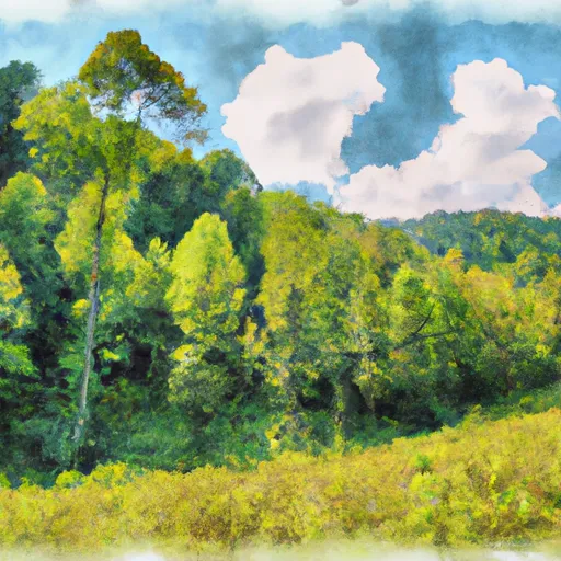
Situated in the heart of the Blue Ridge Mountains, Stuart offers a plethora of outdoor recreation opportunities. The town is surrounded by breathtaking natural beauty, making it an ideal destination for hiking, camping, and fishing. The Smith River, which flows through Stuart, is renowned for its excellent trout fishing. Outdoor enthusiasts can also explore the nearby Primland Resort, which offers activities such as golfing, horseback riding, and ATV tours.
In terms of hydrology constituents, Stuart benefits from the numerous streams and rivers in the region. These waterways not only provide opportunities for recreational activities but also contribute to the overall beauty and ecological health of the area.
What is the Eden Index?
The Snoflo Eden Index serves as a comprehensive rating system for regions, evaluating their desirability through a holistic assessment of climate health, outdoor recreation opportunities, and natural disaster risk, acknowledging the profound impact of these factors on livability and well-being.
Climate Health Indicator (CHI): 7.9
Stuart receives approximately
1289mm of rain per year,
with humidity levels near 83%
and air temperatures averaging around
14°C.
Stuart has a plant hardyness factor of
7, meaning
plants and agriculture in this region tend to thrive during the non-winter months.
By considering the ideal temperature range, reliable water supplies, clean air, and stable seasonal rain or snowpacks, the Climate Health Indicator (CHI) underscores the significance of a healthy climate as the foundation for quality living.
A healthy climate is paramount for ensuring a high quality of life and livability in a region, fostering both physical well-being and environmental harmony. This can be characterized by ideal temperatures, reliable access to water supplies, clean air, and consistent seasonal rain or snowpacks.
Weather Forecast
Streamflow Conditions
Roanoke
Area Rivers
Roanoke
Snowpack Depths
Roanoke
Reservoir Storage Capacity
Roanoke
Groundwater Levels
Recreational Opportunity Index (ROI): 4.6
The Recreational Opportunity Index (ROI) recognizes the value of outdoor recreational options, such as parks, hiking trails, camping sites, and fishing spots, while acknowledging that climate plays a pivotal role in ensuring the comfort and consistency of these experiences.
Access to outdoor recreational opportunities, encompassing activities such as parks, hiking, camping, and fishing, is crucial for overall well-being, and the climate plays a pivotal role in enabling and enhancing these experiences, ensuring that individuals can engage in nature-based activities comfortably and consistently.
Camping Areas
Campground | Campsites | Reservations | Toilets | Showers | Elevation |
---|---|---|---|---|---|
Fairy Stone State Park | None | 1,032 ft | |||
Moncove Lake State Park | None | 2,527 ft | |||
Horseshoe Point - Philpott Lake | None | 1,107 ft | |||
Tanglewood Park | None | 720 ft | |||
Badin Lake | 33 | 557 ft | |||
Goose Point - Philpott Lake | None | 1,155 ft | |||
Salthouse Branch - Philpott Lake | None | 1,042 ft | |||
Rocky Knob - Blue Ridge Parkway | None | 3,072 ft | |||
Arrowhead | 54 | 587 ft | |||
Jamison Mill Park - Philpott Lake | None | 1,042 ft | |||
Hanging Rock State Park | None | 1,700 ft | |||
Blue Bend | 21 | 1,915 ft | |||
Ryans Branch - Philpott Lake | None | 1,154 ft | |||
Deep Water Trailt Horse Camp | 6 | 474 ft |
Nearby Ski Areas
Catastrophe Safeguard Index (CSI):
The Catastrophe Safeguard Index (CSI) recognizes that natural disaster risk, encompassing floods, fires, hurricanes, and tornadoes, can drastically affect safety and the overall appeal of an area.
The level of natural disaster risk in a region significantly affects safety and the overall livability, with climate change amplifying these risks by potentially increasing the frequency and intensity of events like floods, fires, hurricanes, and tornadoes, thereby posing substantial challenges to community resilience and well-being.
Community Resilience Indicator (CRI): 2.4
The Community Resilience Indicator (CRI) recognizes that education, healthcare, and socioeconomics are crucial to the well-being of a region. The CRI acknowledges the profound impact of these elements on residents' overall quality of life. By evaluating educational resources, healthcare accessibility, and economic inclusivity, the index captures the essential aspects that contribute to a thriving community, fostering resident satisfaction, equity, and social cohesion.