Sumner

Climate Recreation Community Catastrophe

Sumner
Eden Index

Climate 7.0 Recreation 5.0 Community 2.2 Safeguard

5.1/10

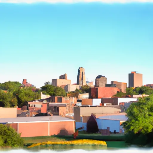
Sumner, Iowa is a small city located in Bremer County, in the northeastern part of the state. The climate in Sumner is classified as humid continental, characterized by hot summers and cold winters. Average temperatures range from the high 70s °F (mid-20s °C) in summer to the low 20s °F (-5 °C) in winter. Precipitation is fairly evenly distributed throughout the year, with an average annual rainfall of around 35 inches (890 mm).

The hydrology constituents in Sumner include several rivers and creeks, with the nearby Wapsipinicon River being the most prominent. The river offers opportunities for fishing, kayaking, and canoeing. Sumner is also home to various parks and green spaces, providing residents and visitors with opportunities for outdoor recreation. The Riverside Park, located along the Wapsipinicon River, offers picnic areas, walking trails, and a boat ramp. The nearby Lake Delhi and Volga River State Recreation Area provide additional options for boating, fishing, camping, and hiking. With its pleasant climate and abundant outdoor recreation opportunities, Sumner is an attractive destination for nature lovers and outdoor enthusiasts.

What is the Eden Index?

The Snoflo Eden Index serves as a comprehensive rating system for regions, evaluating their desirability through a holistic assessment of climate health, outdoor recreation opportunities, and natural disaster risk, acknowledging the profound impact of these factors on livability and well-being.


Climate Health Indicator (CHI): 7.0


Sumner receives approximately 921mm of rain per year, with humidity levels near 83% and air temperatures averaging around 8°C. Sumner has a plant hardyness factor of 5, meaning plants and agriculture in this region thrive during a short period during spring and early summer. Most plants will die off during the colder winter months. By considering the ideal temperature range, reliable water supplies, clean air, and stable seasonal rain or snowpacks, the Climate Health Indicator (CHI) underscores the significance of a healthy climate as the foundation for quality living.

A healthy climate is paramount for ensuring a high quality of life and livability in a region, fostering both physical well-being and environmental harmony. This can be characterized by ideal temperatures, reliable access to water supplies, clean air, and consistent seasonal rain or snowpacks.


Weather Forecast


Streamflow Conditions

Upper Mississippi-Skunk-Wapsipinicon

Area Rivers

Upper Mississippi-Skunk-Wapsipinicon


Snowpack Depths

Upper Mississippi-Skunk-Wapsipinicon


Reservoir Storage Capacity

Upper Mississippi-Skunk-Wapsipinicon


Groundwater Levels


Recreational Opportunity Index (ROI): 5.0


The Recreational Opportunity Index (ROI) recognizes the value of outdoor recreational options, such as parks, hiking trails, camping sites, and fishing spots, while acknowledging that climate plays a pivotal role in ensuring the comfort and consistency of these experiences. Access to outdoor recreational opportunities, encompassing activities such as parks, hiking, camping, and fishing, is crucial for overall well-being, and the climate plays a pivotal role in enabling and enhancing these experiences, ensuring that individuals can engage in nature-based activities comfortably and consistently.


Camping Areas

Campground Campsites Reservations Toilets Showers Elevation
Reicks Lake Park None 670 ft
Hoodoo Point City Campground 85 1,362 ft
Chicog Town Park None 1,010 ft
Yenruogis County Park None 799 ft
Hickory Hills Park - La Porte City 80 911 ft
Minne Estema Park 30 870 ft
Sever Lake Conservation Area - MDC 84 736 ft
Pine Ridge 8 770 ft
Gouldsburg County Park 26 993 ft
Bear Head Lake State Park 75 1,523 ft
Heritage City Park 18 1,439 ft
Skunk River Access None 630 ft
Shelbina Lake City Park None 722 ft
Rodgers County Park 50 832 ft
Benton City - Fry Area 25 843 ft
Middle Amana Park 24 742 ft
Highland Ridge 45 1,105 ft
Pioneer Park - Prairie Farm 30 1,028 ft
Riverside Landing - St. Croix National Scenic River None 896 ft
Fontana County Park 55 986 ft
Gordon Dam None 1,023 ft
Lake Sugema County Park None 741 ft
Clear Lake City Park None 1,164 ft
Nugget Lake County Park 55 1,022 ft
Waubonsie Trail Park 7 784 ft
Shell Lake Municipal Park 42 1,224 ft
Whiteface Reservoir 58 1,489 ft
Turtle Lake City Park 18 1,265 ft
North Woods Park None 1,080 ft
Lake Iowa County Park 122 892 ft
Chacauqua River Access None 721 ft
Dry Fork 18 763 ft
Hannen County Park 90 817 ft
Lake Jeanette 12 1,375 ft
McFarlane Park None 804 ft
Cutshall Area None 921 ft
Siggelkov County Park None 945 ft
Cadotte Lake 27 1,657 ft
Namekagon Trail Bridge - St. Croix National Scenic River None 933 ft
Fishermans Point City Campground 70 1,441 ft
Belva - Deer Rec Area 56 828 ft
Paddy Creek 36 1,008 ft
Piney River Military - Fort Leonard Wood None 768 ft
McKinley City Park 80 1,396 ft
Binder Park 17 655 ft
Lime Creek Park - Brandon None 858 ft
Lake Darling State Park 118 688 ft
Alcock Park 40 1,018 ft
Milroy Access 95 783 ft
Deerwood City Park None 838 ft
Roubidoux Springs None 775 ft
Oelwein City Park 30 1,013 ft
Fenske Lake 20 1,507 ft
Lakeview Park - Mexico None 810 ft
Split Rock County Park 54 1,069 ft
Lacey - Keosauqua State Park 113 744 ft
Manhattan Bridge Access None 644 ft
Austin County Park None 578 ft
Totogatic Park 75 1,025 ft
Howell Landing - St. Croix National Scenic River None 950 ft
Hoefle - Dulin Area County Park 16 774 ft
Downing County Park None 1,028 ft
Highland Ridge - Eau Galle Reservoir None 1,130 ft
Glen Hills County Park 61 1,183 ft
Vermilion Trail 40 1,430 ft
Eau Galle Lake Spring Valley None 957 ft

Catastrophe Safeguard Index (CSI):


The Catastrophe Safeguard Index (CSI) recognizes that natural disaster risk, encompassing floods, fires, hurricanes, and tornadoes, can drastically affect safety and the overall appeal of an area. The level of natural disaster risk in a region significantly affects safety and the overall livability, with climate change amplifying these risks by potentially increasing the frequency and intensity of events like floods, fires, hurricanes, and tornadoes, thereby posing substantial challenges to community resilience and well-being.


Community Resilience Indicator (CRI): 2.2


The Community Resilience Indicator (CRI) recognizes that education, healthcare, and socioeconomics are crucial to the well-being of a region. The CRI acknowledges the profound impact of these elements on residents' overall quality of life. By evaluating educational resources, healthcare accessibility, and economic inclusivity, the index captures the essential aspects that contribute to a thriving community, fostering resident satisfaction, equity, and social cohesion.


Log Your Visit

When was your last visit to ?

Add a Photo

How was it? How were conditions?

Rate the


Submit

Leave A Review


Submit

Upload an Image


Favorite Limit Reached