Vulcan

Climate Recreation Community Catastrophe

Vulcan
Eden Index

Climate 8.1 Recreation 5.5 Community 1.5 Safeguard

5.6/10

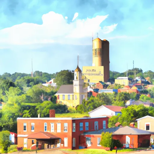
Vulcan, Missouri is a small town located in the southeastern part of the state. It experiences a humid subtropical climate, characterized by hot, humid summers and mild, occasionally cold winters. Summers in Vulcan are typically hot with average temperatures in the 80s Fahrenheit, while winters are mild with temperatures averaging in the 30s to 40s. Precipitation is evenly distributed throughout the year, and the area may experience thunderstorms during spring and summer.

Hydrologically, Vulcan is situated near the Big River, providing an important water source for the region. Additionally, several smaller creeks and streams flow through the area. The water in these water bodies may contain various hydrology constituents, such as minerals and nutrients, that support the local ecosystem.

Vulcan offers diverse outdoor recreation opportunities for nature enthusiasts. The surrounding area features beautiful landscapes, including forests, hills, and valleys. Residents and visitors can enjoy activities such as hiking, camping, fishing, and boating. The Big River State Forest, located nearby, provides opportunities for hunting and birdwatching. Overall, Vulcan, Missouri is a picturesque location with a pleasant climate and abundant outdoor recreation possibilities.

What is the Eden Index?

The Snoflo Eden Index serves as a comprehensive rating system for regions, evaluating their desirability through a holistic assessment of climate health, outdoor recreation opportunities, and natural disaster risk, acknowledging the profound impact of these factors on livability and well-being.


Climate Health Indicator (CHI): 8.1


Vulcan receives approximately 1203mm of rain per year, with humidity levels near 81% and air temperatures averaging around 13°C. Vulcan has a plant hardyness factor of 6, meaning plants and agriculture in this region thrive during a short period during spring and early summer. Most plants will die off during the colder winter months. By considering the ideal temperature range, reliable water supplies, clean air, and stable seasonal rain or snowpacks, the Climate Health Indicator (CHI) underscores the significance of a healthy climate as the foundation for quality living.

A healthy climate is paramount for ensuring a high quality of life and livability in a region, fostering both physical well-being and environmental harmony. This can be characterized by ideal temperatures, reliable access to water supplies, clean air, and consistent seasonal rain or snowpacks.


Weather Forecast


Streamflow Conditions

St. Francis

Area Rivers

St. Francis


Snowpack Depths

St. Francis


Reservoir Storage Capacity

St. Francis


Groundwater Levels


Recreational Opportunity Index (ROI): 5.5


The Recreational Opportunity Index (ROI) recognizes the value of outdoor recreational options, such as parks, hiking trails, camping sites, and fishing spots, while acknowledging that climate plays a pivotal role in ensuring the comfort and consistency of these experiences. Access to outdoor recreational opportunities, encompassing activities such as parks, hiking, camping, and fishing, is crucial for overall well-being, and the climate plays a pivotal role in enabling and enhancing these experiences, ensuring that individuals can engage in nature-based activities comfortably and consistently.


Camping Areas

Campground Campsites Reservations Toilets Showers Elevation
Mineral Lake 12 1,442 ft
Piedmont - Clearwater Lake None 570 ft
Smith Lake County Park 30 1,456 ft
Argyle Lake State Park 160 695 ft
Wild Rock County Park 30 1,067 ft
Baker Lake 5 1,827 ft
Sawbill Lake 50 1,863 ft
Deer Leap 46 338 ft
East Fork - Black River State Forest 24 919 ft
Mead Lake Park 71 1,109 ft
Wildcat Mound County Park None 1,112 ft
Sam A Baker State Park None 420 ft
Shady Creek - Mississippi River 50 554 ft
West Arbutus County Park 44 938 ft
Temperance River 11 1,524 ft
Gile Memorial Village 20 932 ft
Beauford T. Anderson Park None 723 ft
Tickfaw State Park None 15 ft
Robertsville State Park 27 502 ft
Johnsons Shut-Ins State Park None 849 ft
Massey Marina 40 631 ft
North Rec Composite 15 97 ft
Memorial Park - Washburn 51 636 ft
Russell Memorial Park 230 955 ft
Stock Farm Bridge 8 1,463 ft
River Road - Clearwater Lake None 471 ft
Kampsville River Park None 430 ft
Klondike County Park None 530 ft
Schuy - Rush Park 77 580 ft
Maquoketa Caves State Park None 888 ft
Mud Lake County Park 75 638 ft
Lake Three 8 1,384 ft
Robb City Park None 700 ft
Highway K - Clearwater Lake None 600 ft
Kreher City Park 33 604 ft
Rocky Springs - Natchez Trace Pkwy 22 235 ft
Webb Creek - Clearwater Lake None 727 ft
Babler Memorial State Park None 733 ft
East Arbutus Camp 187 891 ft
Weinberg - King State Park 19 590 ft
La Farge City Park 15 846 ft
Snyder Park 32 1,010 ft
South Recreation Composite 100 140 ft
Washington State Park None 637 ft
Percy Quin State Park None 416 ft
Castle Mound - Black River State Forest 35 855 ft
Greenwood Park 14 1,126 ft
Pere Marquette State Park 80 644 ft
Marble Creek Rec Area 33 661 ft
East Twin 10 1,502 ft
McMullen County Park 52 1,016 ft
Wildcat Mountain State Park 30 1,247 ft
St. Francois State Park None 777 ft
Clarks Ferry - Mississippi River 45 556 ft
Pittsfield City Lake None 639 ft
Crescent Lake 34 1,819 ft
Great River Road Campground None 451 ft
St. Joe State Park None 780 ft
Potato River Falls County Forest None 1,060 ft
Marian City Park None 1,534 ft
Finleys Landing City Park 30 633 ft
Bluff View - Clearwater Lake None 572 ft
Anderson Campground - Soldiers Grove 30 725 ft
Copper Falls State Park 50 1,122 ft
Spring Lake Park - Macomb None 680 ft
Potato River Falls None 1,068 ft
Rock Dam Park 150 1,014 ft
Pigeon Creek - Black River State Forest 38 945 ft
Little Sunflower River None 107 ft
Merlin Lambert Park 20 1,027 ft
Horseshoe Pond 20 675 ft
Float Camp 16 472 ft
Cascade River State Park 4 1,641 ft
Pine View Military - Fort McCoy None 870 ft
Sherman Co Park None 701 ft
Swiss Valley County Park 100 726 ft
Eden Valley Park None 710 ft
Walnut Grove Co Park None 691 ft
St. Peters 370 Lakeside Park 50 426 ft
Hawkins Community Park None 1,374 ft
Dubuque Yacht Basin and RV Park 56 608 ft
Lake of the Pines - Flambeau River State Forest 30 1,493 ft
Miller Riverview City Park None 635 ft
Connors Lake - Flambeau River State Forest 30 1,457 ft
Joinerville County Park None 684 ft

Catastrophe Safeguard Index (CSI):


The Catastrophe Safeguard Index (CSI) recognizes that natural disaster risk, encompassing floods, fires, hurricanes, and tornadoes, can drastically affect safety and the overall appeal of an area. The level of natural disaster risk in a region significantly affects safety and the overall livability, with climate change amplifying these risks by potentially increasing the frequency and intensity of events like floods, fires, hurricanes, and tornadoes, thereby posing substantial challenges to community resilience and well-being.


Community Resilience Indicator (CRI): 1.5


The Community Resilience Indicator (CRI) recognizes that education, healthcare, and socioeconomics are crucial to the well-being of a region. The CRI acknowledges the profound impact of these elements on residents' overall quality of life. By evaluating educational resources, healthcare accessibility, and economic inclusivity, the index captures the essential aspects that contribute to a thriving community, fostering resident satisfaction, equity, and social cohesion.


Log Your Visit

When was your last visit to ?

Add a Photo

How was it? How were conditions?

Rate the


Submit

Leave A Review


Submit

Upload an Image


Favorite Limit Reached