Wentworth

Climate Recreation Community Catastrophe

Wentworth
Eden Index

Climate 5.5 Recreation 3.1 Community Safeguard

3.3/10

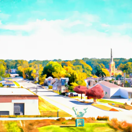
Wentworth, Wisconsin is a charming town located in the northern part of the state. The climate in Wentworth is characterized by cold, snowy winters and pleasant summers. Average temperatures range from around 20°F (-6°C) in winter to 75°F (24°C) in summer, providing a distinct four-season experience.

The town is abundant in hydrology constituents, with numerous lakes, rivers, and streams. The prominent Lake Wentworth offers various recreational activities like fishing, boating, and swimming. The lake's crystal-clear waters make it ideal for water sports enthusiasts and nature lovers alike.

Aside from Lake Wentworth, the area boasts several other outdoor recreation opportunities. The surrounding forests and trails provide ample space for hiking, biking, and camping. Nature enthusiasts can explore the diverse wildlife and enjoy the picturesque landscapes.

Additionally, Wentworth is known for its winter activities, with opportunities for snowboarding, skiing, and snowmobiling. The snowy terrain offers a playground for winter sports enthusiasts.

In conclusion, Wentworth, Wisconsin offers a delightful climate, an abundance of hydrology constituents, and a plethora of outdoor recreation opportunities. Whether visiting in the warm or cold seasons, the town provides a picturesque setting for nature lovers and adventure seekers.

What is the Eden Index?

The Snoflo Eden Index serves as a comprehensive rating system for regions, evaluating their desirability through a holistic assessment of climate health, outdoor recreation opportunities, and natural disaster risk, acknowledging the profound impact of these factors on livability and well-being.


Climate Health Indicator (CHI): 5.5


Wentworth receives approximately 786mm of rain per year, with humidity levels near 82% and air temperatures averaging around 5°C. Wentworth has a plant hardyness factor of 4, meaning plants and agriculture in this region thrive during a short period during spring and early summer. Most plants will die off during the colder winter months. By considering the ideal temperature range, reliable water supplies, clean air, and stable seasonal rain or snowpacks, the Climate Health Indicator (CHI) underscores the significance of a healthy climate as the foundation for quality living.

A healthy climate is paramount for ensuring a high quality of life and livability in a region, fostering both physical well-being and environmental harmony. This can be characterized by ideal temperatures, reliable access to water supplies, clean air, and consistent seasonal rain or snowpacks.


Weather Forecast


Streamflow Conditions

Southwestern Lake Superior

Area Rivers

Southwestern Lake Superior


Snowpack Depths

Southwestern Lake Superior


Reservoir Storage Capacity

Southwestern Lake Superior


Groundwater Levels


Recreational Opportunity Index (ROI): 3.1


The Recreational Opportunity Index (ROI) recognizes the value of outdoor recreational options, such as parks, hiking trails, camping sites, and fishing spots, while acknowledging that climate plays a pivotal role in ensuring the comfort and consistency of these experiences. Access to outdoor recreational opportunities, encompassing activities such as parks, hiking, camping, and fishing, is crucial for overall well-being, and the climate plays a pivotal role in enabling and enhancing these experiences, ensuring that individuals can engage in nature-based activities comfortably and consistently.


Camping Areas

Campground Campsites Reservations Toilets Showers Elevation
Three Elms County Park None 929 ft
Austin County Park None 578 ft
Amnicon Falls 35 833 ft
Birch Lake 30 1,442 ft
Veterans Memorial County Park None 898 ft
Ojibway Provincial Park 45 1,228 ft
Lake Sugema County Park None 741 ft
Twin Bridges County Park 45 1,051 ft
Volga River State Rec Area 41 930 ft
Reicks Lake Park None 670 ft
John Latsch State Park 7 670 ft
Lime Creek Park - Brandon None 858 ft
Belva - Deer Rec Area 56 828 ft
McFarlane Park None 804 ft
Oelwein City Park 30 1,013 ft
Independence City RV Park None 896 ft
Middle Amana Park 24 742 ft
Minne Estema Park 30 870 ft
Totogatic Park 75 1,025 ft
Jakway County Park None 1,074 ft
Temperance State Park 52 1,679 ft
Gordon Dam None 1,023 ft
Earl Landing - St. Croix National Scenic River 12 1,074 ft
Glen Hills County Park 61 1,183 ft
Round Prairie Park None 723 ft
Mac Coon Access None 614 ft
Goeken Co Park None 1,181 ft
Trego Town Park 50 1,060 ft
Waubonsie Trail Park 7 784 ft
Merrick State Park 65 654 ft
Lake Darling State Park 118 688 ft
Howell Landing - St. Croix National Scenic River None 950 ft
Benton City - Fry Area 25 843 ft
Klocks Island Park 25 1,012 ft
Indian Lake Park None 595 ft
Cadotte Lake 27 1,657 ft
Chicog Town Park None 1,010 ft
Rodgers County Park 50 832 ft
Milroy Access 95 783 ft
Gouldsburg County Park 26 993 ft
Wildcat Bluff County Park 50 774 ft
Pioneer Park - Prairie Farm 30 1,028 ft
Brinton Timber None 721 ft
Maynard City Park None 1,092 ft
Turtle Lake City Park 18 1,265 ft
Indian Lake - Cloquet Valley State Forest 26 1,526 ft
Lucius Woods County Park 24 1,110 ft
Pleasant Creek State Rec Area 69 846 ft
Bear Head Lake State Park 75 1,523 ft
North Woods Park None 1,080 ft
Whiteface Reservoir 58 1,489 ft
Morgan Creek County Park 36 744 ft
Skunk River Access None 630 ft
Fenske Lake 20 1,507 ft
Namekagon Trail Bridge - St. Croix National Scenic River None 933 ft
Hannen County Park 90 817 ft
Hoefle - Dulin Area County Park 16 774 ft
Lacey - Keosauqua State Park 113 744 ft
Duttons Cave Co Park 5 1,218 ft
Cutshall Area None 921 ft
Shell Lake Municipal Park 42 1,224 ft
Downing County Park None 1,028 ft
Siggelkov County Park None 945 ft
Bentonsport None 561 ft
Fontana County Park 55 986 ft
Manhattan Bridge Access None 644 ft

Catastrophe Safeguard Index (CSI):


The Catastrophe Safeguard Index (CSI) recognizes that natural disaster risk, encompassing floods, fires, hurricanes, and tornadoes, can drastically affect safety and the overall appeal of an area. The level of natural disaster risk in a region significantly affects safety and the overall livability, with climate change amplifying these risks by potentially increasing the frequency and intensity of events like floods, fires, hurricanes, and tornadoes, thereby posing substantial challenges to community resilience and well-being.


Community Resilience Indicator (CRI):


The Community Resilience Indicator (CRI) recognizes that education, healthcare, and socioeconomics are crucial to the well-being of a region. The CRI acknowledges the profound impact of these elements on residents' overall quality of life. By evaluating educational resources, healthcare accessibility, and economic inclusivity, the index captures the essential aspects that contribute to a thriving community, fostering resident satisfaction, equity, and social cohesion.


Log Your Visit

When was your last visit to ?

Add a Photo

How was it? How were conditions?

Rate the


Submit

Leave A Review


Submit

Upload an Image


Favorite Limit Reached