

-
 Snoflo Premium
Get unlimited access to all our content
With no Ad interruptions! - Start Your Free Trial Login with existing account
Wikieup
Eden Index
Climate
8.7
•
Recreation
1.0
•
Community
0.9
•
Safeguard
4.0/10
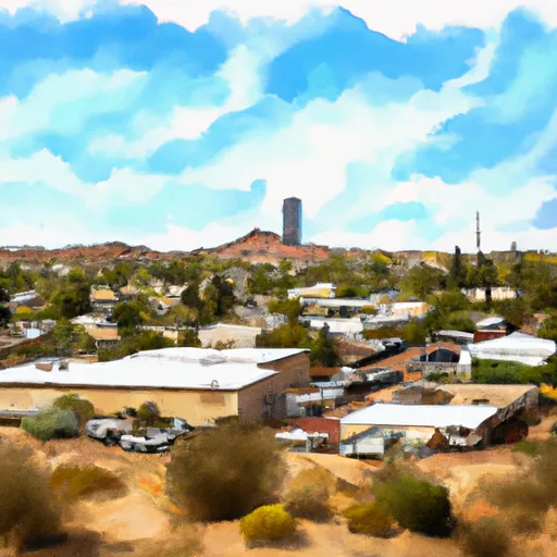
Wikieup, Arizona is a small unincorporated community located in the western part of the state. Situated in Mohave County, Wikieup experiences a desert climate, characterized by hot and dry summers, and mild winters. Summers are sweltering, with temperatures often exceeding 100°F (38°C), while winters are relatively mild, with average temperatures ranging from 50°F to 70°F (10°C to 21°C). Precipitation in Wikieup is minimal, averaging around 7 inches (18 cm) per year, and primarily occurs during the winter months.
Hydrologically, Wikieup is part of the Colorado River Basin, with the Big Sandy River flowing nearby. The area also contains several small creeks and washes that contribute to the hydrology of the region. These water sources attract diverse wildlife and provide opportunities for fishing, boating, and birdwatching.
Outdoor recreation opportunities in Wikieup include hiking, camping, and off-roading. The area is surrounded by vast desert landscapes, offering opportunities for exploring scenic trails, observing unique wildlife, and enjoying the tranquility of nature. Additionally, Wikieup is close to the Hualapai Mountains, providing further hiking and camping options. Off-roading enthusiasts can explore the nearby desert terrain with designated off-road vehicle areas available.
In summary, Wikieup, Arizona offers a hot desert climate, limited precipitation, and a hydrology system that includes the Big Sandy River. Outdoor recreation opportunities encompass hiking, camping, birdwatching, fishing, and off-roading, making it an appealing destination for nature enthusiasts.
What is the Eden Index?
The Snoflo Eden Index serves as a comprehensive rating system for regions, evaluating their desirability through a holistic assessment of climate health, outdoor recreation opportunities, and natural disaster risk, acknowledging the profound impact of these factors on livability and well-being.
Climate Health Indicator (CHI): 8.7
Wikieup receives approximately
258mm of rain per year,
with humidity levels near 47%
and air temperatures averaging around
20°C.
Wikieup has a plant hardyness factor of
9, meaning
plants and agriculture in this region tend to thrive here all year round.
By considering the ideal temperature range, reliable water supplies, clean air, and stable seasonal rain or snowpacks, the Climate Health Indicator (CHI) underscores the significance of a healthy climate as the foundation for quality living.
A healthy climate is paramount for ensuring a high quality of life and livability in a region, fostering both physical well-being and environmental harmony. This can be characterized by ideal temperatures, reliable access to water supplies, clean air, and consistent seasonal rain or snowpacks.
Weather Forecast
Streamflow Conditions
Bill Williams
Area Rivers
Bill Williams
Snowpack Depths
Bill Williams
Reservoir Storage Capacity
Bill Williams
Groundwater Levels
Recreational Opportunity Index (ROI): 1.0
The Recreational Opportunity Index (ROI) recognizes the value of outdoor recreational options, such as parks, hiking trails, camping sites, and fishing spots, while acknowledging that climate plays a pivotal role in ensuring the comfort and consistency of these experiences.
Access to outdoor recreational opportunities, encompassing activities such as parks, hiking, camping, and fishing, is crucial for overall well-being, and the climate plays a pivotal role in enabling and enhancing these experiences, ensuring that individuals can engage in nature-based activities comfortably and consistently.
Camping Areas
| Campground | Campsites | Reservations | Toilets | Showers | Elevation |
|---|---|---|---|---|---|
| Burro Creek | 22 | 1,935 ft | |||
| Alamo Lake State Park | 80 | 1,230 ft |
Nearby Ski Areas
Catastrophe Safeguard Index (CSI):
The Catastrophe Safeguard Index (CSI) recognizes that natural disaster risk, encompassing floods, fires, hurricanes, and tornadoes, can drastically affect safety and the overall appeal of an area.
The level of natural disaster risk in a region significantly affects safety and the overall livability, with climate change amplifying these risks by potentially increasing the frequency and intensity of events like floods, fires, hurricanes, and tornadoes, thereby posing substantial challenges to community resilience and well-being.
Community Resilience Indicator (CRI): 0.9
The Community Resilience Indicator (CRI) recognizes that education, healthcare, and socioeconomics are crucial to the well-being of a region. The CRI acknowledges the profound impact of these elements on residents' overall quality of life. By evaluating educational resources, healthcare accessibility, and economic inclusivity, the index captures the essential aspects that contribute to a thriving community, fostering resident satisfaction, equity, and social cohesion.