Private Land In Sec 1, T21n, R9w To Confluence Of Cold Creek And Black Butte River river run
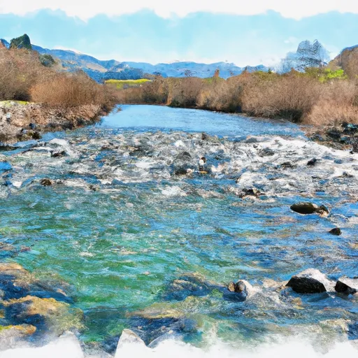
Private Land In Sec 1, T21n, R9w To Confluence Of Cold Creek And Black Butte River
One of the most challenging rapids in this section is called "Staircase," which has a series of steep drops and large waves. Other notable rapids include "The Notch," "Pinball," and "Tombstone." There are also several obstacles such as fallen trees and rocks that require paddlers to be skilled and experienced.
This section of the river is located on private land in Sec 1, T21N, R9W, and access is only permitted by the landowner. Paddlers must obtain permission beforehand and adhere to all rules and regulations set by the landowner. Additionally, the use of alcohol and drugs is strictly prohibited on this section of the river.
In conclusion, the Whitewater River Run in California is a challenging and thrilling whitewater experience. Paddlers must be experienced and skilled to navigate the rapids and obstacles. Access to this section is limited to those who obtain permission from the landowner, and all rules and regulations must be followed.
Plan your run down to the hour
Same weather feed Snoflo's iOS app uses -- updated continuously from NOAA / yr.no. Watch the precipitation column on the meteogram; rain ahead of a run typically lifts flows 12-48 hours later depending on the basin.
Next 5 days, hour by hour
Temperature line with weather symbols on top, snow + rain accumulation as columns, humidity as a dotted line.
5-day forecast table
Every 3 hours, broken out across temperature, snow, rain, humidity, and wind. Each cell is colour-coded relative to the column min/max.
| Time | Condition | Temp (°F) | Snow (in) | Rain (in) | Humidity (%) | Wind (mps) | Wind dir |
|---|---|---|---|---|---|---|---|
| Loading detailed forecast… | |||||||
15-day temperature & precipitation
Daily temperatures, snow, and rain projected over the next two weeks -- the upstream story that drives next week's flows.
Regional streamflow levels
USGS streamgauges around Private Land In Sec 1, T21n, R9w To Confluence Of Cold Creek And Black Butte River -- useful for spotting upstream pulses and gauging which tributary is contributing what.
| Streamgauge | Discharge | View |
|---|---|---|
| Mf Eel R Nr Dos Rios Ca | 343 cfs | → |
| Outlet C Nr Willits Ca | 4 cfs | → |
| Elder C Nr Paskenta Ca | 39 cfs | → |
| Willits C Ab Lk Emily Nr Willits Ca | 0 cfs | → |
| Ef Russian R Nr Calpella Ca | 39 cfs | → |
| Ef Russian R Nr Ukiah Ca | 156 cfs | → |
Plan a longer trip
The closest boat launches, other paddle runs, and campgrounds so a day on the water can grow into a full weekend.
Other river runs
Campgrounds
- Plaskett Meadows Campground
- Plaskett Meadows
- Masterson Group Campground
- Board Tree Campground
- Atchison Campground
- Bear Flats
Whitewater safety
- Check the flow before you run
- Use the linked-gauge card and Regional Flow panel above. Class ratings change with flow -- a Class III at low water can become Class IV+ at high water.
- Know your skill ceiling
- Pick runs comfortably below your ceiling. Cold-water and big-water runs raise the consequences of any mistake.
- Wear the right gear
- Helmet, PFD, drysuit / wetsuit when water is below 60°F. Throw bag, knife, and whistle on your person, not in the boat.
- Scout, set safety, and run with a team
- Scout new rapids on foot, set safety with throw bags above the consequence pool, and run with at least one other competent paddler.
- Respect the river
- Strainers, undercuts, low-head dams, and wood can kill at any class rating. When in doubt, portage.
Set push alerts in the Snoflo app
Save Private Land In Sec 1, T21n, R9w To Confluence Of Cold Creek And Black Butte River as a favorite, set a discharge threshold (e.g. "alert me when flow hits 600 cfs"), and the iOS app pushes the moment the linked gauge crosses.
About Private Land In Sec 1, T21n, R9w To Confluence Of Cold Creek And Black Butte River
What's the optimal flow for Private Land In Sec 1, T21n, R9w To Confluence Of Cold Creek And Black Butte River?
The optimal flow depends on the section and the craft. Check the Run Details panel for the linked gauge and current status.
How fresh is the cfs reading on this page?
The linked USGS streamgauge reports continuously (every 15 minutes); Snoflo refreshes throughout the day. Hover the streamflow sparkline to read individual datapoints.
What's the whitewater class?
See the Run Details panel for the class rating Snoflo tracks for this run. Class ratings change with flow -- a Class III at low water can become Class IV in high water.
Where do I put in / take out?
Tap Directions in the hero above to open driving directions to the put-in. For shuttle planning, check the Nearby Boat Launches panel and the river run operator's site.
Can I get alerts when flows hit the optimal range?
Yes -- alerts are managed in the Snoflo iOS app. Favorite this run, set a discharge threshold, and you'll get a push the moment the gauge crosses.
Other runs near here
Snoflo-tracked paddle runs within driving distance of Private Land In Sec 1, T21n, R9w To Confluence Of Cold Creek And Black Butte River.