North Fork--Insmont To Estabrook river run
Community Reviews
Been here? Share the conditions.
Reviews, ratings & photos are added in the free Snoflo iOS app — rate a spot, tag the conditions, and your visit is verified by location. Add or manage your reviews from the app.
North Fork--Insmont To Estabrook
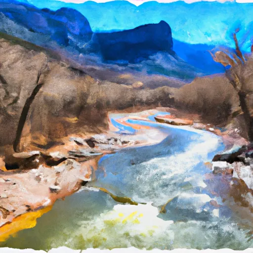
This section of river offers an exciting and challenging run for experienced kayakers and rafters. The rapids on this stretch include Zig Zag, Devil's Slide, Hole in the Wall, and Staircase. These rapids can be technical and require good boat control and the ability to make precise moves.
The North Fork of the South Platte River is regulated by the Colorado Parks and Wildlife. Rafters and kayakers are required to wear personal flotation devices and follow all safety guidelines outlined by the agency. Additionally, this section of river is closed to boating from November 1st through May 31st to protect wintering wildlife.
In summary, the North Fork of the South Platte River offers a challenging and exciting run for experienced boaters with a range of Class III-IV rapids. The ideal streamflow range is between 250-800 cfs and boaters must follow all Colorado Parks and Wildlife regulations for safety and conservation purposes.
Plan your run down to the hour
Same weather feed Snoflo's iOS app uses -- updated continuously from NOAA / yr.no. Watch the precipitation column on the meteogram; rain ahead of a run typically lifts flows 12-48 hours later depending on the basin.
Next 5 days, hour by hour
Temperature line with weather symbols on top, snow + rain accumulation as columns, humidity as a dotted line.
5-day forecast table
Every 3 hours, broken out across temperature, snow, rain, humidity, and wind. Each cell is colour-coded relative to the column min/max.
| Time | Condition | Temp (°F) | Snow (in) | Rain (in) | Humidity (%) | Wind (mps) | Wind dir |
|---|---|---|---|---|---|---|---|
| Loading detailed forecast… | |||||||
15-day temperature & precipitation
Daily temperatures, snow, and rain projected over the next two weeks -- the upstream story that drives next week's flows.
Regional streamflow levels
USGS streamgauges around North Fork--Insmont To Estabrook -- useful for spotting upstream pulses and gauging which tributary is contributing what.
| Streamgauge | Discharge | View |
|---|---|---|
| South Platte River At South Platte | 538 cfs | → |
| So. Platte R. Blw Brush Cr. Nr Trumbull Co | 252 cfs | → |
| South Platte River Below Cheesman Lake | 260 cfs | → |
| South Platte River Above Cheesman Lake | 97 cfs | → |
| Bear Creek Above Evergreen | 5 cfs | → |
| South Platte River At Waterton | 37 cfs | → |
Plan a longer trip
The closest boat launches, other paddle runs, and campgrounds so a day on the water can grow into a full weekend.
Boat launches
Other river runs
- Bailey Canyon
- Estabrook To Cliffdale
- Foxton
- Cheeseman Dam To Wigman Club
- Wigman Club To Strontia Reservoir
Campgrounds
Fishing spots
- Pine Valley Ranch Pond
- Wellington Lake
- South Platte River
- Tarryall Reservoir
- Roosevelt Lakes
- Cheesman Reservoir
Whitewater safety
- Check the flow before you run
- Use the linked-gauge card and Regional Flow panel above. Class ratings change with flow -- a Class III at low water can become Class IV+ at high water.
- Know your skill ceiling
- Pick runs comfortably below your ceiling. Cold-water and big-water runs raise the consequences of any mistake.
- Wear the right gear
- Helmet, PFD, drysuit / wetsuit when water is below 60°F. Throw bag, knife, and whistle on your person, not in the boat.
- Scout, set safety, and run with a team
- Scout new rapids on foot, set safety with throw bags above the consequence pool, and run with at least one other competent paddler.
- Respect the river
- Strainers, undercuts, low-head dams, and wood can kill at any class rating. When in doubt, portage.
Set push alerts in the Snoflo app
Save North Fork--Insmont To Estabrook as a favorite, set a discharge threshold (e.g. "alert me when flow hits 600 cfs"), and the iOS app pushes the moment the linked gauge crosses.
About North Fork--Insmont To Estabrook
What's the optimal flow for North Fork--Insmont To Estabrook?
The optimal flow depends on the section and the craft. Check the Run Details panel for the linked gauge and current status.
How fresh is the cfs reading on this page?
The linked USGS streamgauge reports continuously (every 15 minutes); Snoflo refreshes throughout the day. Hover the streamflow sparkline to read individual datapoints.
What's the whitewater class?
See the Run Details panel for the class rating Snoflo tracks for this run. Class ratings change with flow -- a Class III at low water can become Class IV in high water.
Where do I put in / take out?
Tap Directions in the hero above to open driving directions to the put-in. For shuttle planning, check the Nearby Boat Launches panel and the river run operator's site.
Can I get alerts when flows hit the optimal range?
Yes -- alerts are managed in the Snoflo iOS app. Favorite this run, set a discharge threshold, and you'll get a push the moment the gauge crosses.
Other runs near here
Snoflo-tracked paddle runs within driving distance of North Fork--Insmont To Estabrook.