West Section Line Sec 2, T38n, R16w (Below Mcphee Reservoir) To Bradfield Ranch Bridge River Run
Community Reviews
Been here? Share the conditions.
Reviews, ratings & photos are added in the free Snoflo iOS app — rate a spot, tag the conditions, and your visit is verified by location. Add or manage your reviews from the app.
West Section Line Sec 2, T38n, R16w (Below Mcphee Reservoir) To Bradfield Ranch Bridge
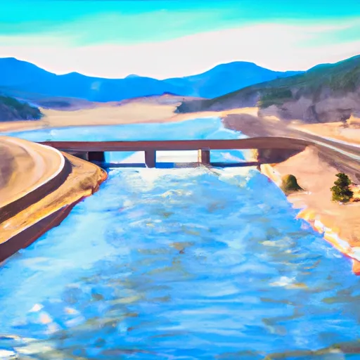
The West Section covers a distance of approximately 14 miles, starting from below McPhee Reservoir and ending at Bradfield Ranch Bridge. The river runs through beautiful canyons, with stunning views of the surrounding mountains. The area is home to various wildlife species, including bighorn sheep and bald eagles.
While the West Section is a popular destination for rafting and kayaking, there are specific regulations that visitors must follow. The area is managed by the Bureau of Land Management, and visitors are required to obtain a permit before entering the river. The use of glass containers and fireworks is prohibited, as is the possession of alcohol by those under 21.
In conclusion, the West Section of the Whitewater River in Colorado is a thrilling and challenging destination for experienced whitewater enthusiasts. With an ideal streamflow range of 500-800 cfs, Class III to IV rapids, and a distance of approximately 14 miles, this section offers a unique and exciting adventure. Visitors must adhere to specific regulations, including obtaining a permit and refraining from using glass containers or possessing alcohol under 21.
Plan your run down to the hour
Same weather feed Snoflo's iOS app uses -- updated continuously from NOAA / yr.no. Watch the precipitation column on the meteogram; rain ahead of a run typically lifts flows 12-48 hours later depending on the basin.
Next 5 days, hour by hour
Temperature line with weather symbols on top, snow + rain accumulation as columns, humidity as a dotted line.
5-day forecast table
Every 3 hours, broken out across temperature, snow, rain, humidity, and wind. Each cell is colour-coded relative to the column min/max.
| Time | Condition | Temp (°F) | Snow (in) | Rain (in) | Humidity (%) | Wind (mps) | Wind dir |
|---|---|---|---|---|---|---|---|
| Loading detailed forecast… | |||||||
15-day temperature & precipitation
Daily temperatures, snow, and rain projected over the next two weeks -- the upstream story that drives next week's flows.
Regional streamflow levels
USGS streamgauges around West Section Line Sec 2, T38n, R16w (Below Mcphee Reservoir) To Bradfield Ranch Bridge -- useful for spotting upstream pulses and gauging which tributary is contributing what.
| Streamgauge | Discharge | View |
|---|---|---|
| Dolores River At Dolores | 165 cfs | → |
| Lost Canyon Creek Near Dolores | · | → |
| Mcelmo Creek Above Trail Canyon Near Cortez | 28 cfs | → |
| Mud Creek At State Highway 32 | 13 cfs | → |
| Mcelmo Creek Near Colorado-Utah State Line | 1 cfs | → |
| Dolores River Near Slick Rock | · | → |
Plan a longer trip
The closest boat launches, other paddle runs, and campgrounds so a day on the water can grow into a full weekend.
Boat launches
- County Road S 16951, Dolores County
- Boat Ramp - Aggregate
- Mountain Sheep Point Rec Site
- Colorado Street Montezuma County
Other river runs
- Dolores Canyon (Bradfield To Slickrock)
- Dolores River - Mcphee To Bedrock Segment In Tres Rios Field Office
- West Dolores---Source To Confluence With Mainstem
Campgrounds
- Bradfield Campground
- Bradfield
- Cabin Canyon
- Ferris Canyon
- Ferris Canyon Campground
- Mountain Sheep Point Dispersed
Fishing spots
Whitewater safety
- Check the flow before you run
- Use the linked-gauge card and Regional Flow panel above. Class ratings change with flow -- a Class III at low water can become Class IV+ at high water.
- Know your skill ceiling
- Pick runs comfortably below your ceiling. Cold-water and big-water runs raise the consequences of any mistake.
- Wear the right gear
- Helmet, PFD, drysuit / wetsuit when water is below 60°F. Throw bag, knife, and whistle on your person, not in the boat.
- Scout, set safety, and run with a team
- Scout new rapids on foot, set safety with throw bags above the consequence pool, and run with at least one other competent paddler.
- Respect the river
- Strainers, undercuts, low-head dams, and wood can kill at any class rating. When in doubt, portage.
Set push alerts in the Snoflo app
Save West Section Line Sec 2, T38n, R16w (Below Mcphee Reservoir) To Bradfield Ranch Bridge as a favorite, set a discharge threshold (e.g. "alert me when flow hits 600 cfs"), and the iOS app pushes the moment the linked gauge crosses.
About West Section Line Sec 2, T38n, R16w (Below Mcphee Reservoir) To Bradfield Ranch Bridge
What's the optimal flow for West Section Line Sec 2, T38n, R16w (Below Mcphee Reservoir) To Bradfield Ranch Bridge?
The optimal flow depends on the section and the craft. Check the Run Details panel for the linked gauge and current status.
How fresh is the cfs reading on this page?
The linked USGS streamgauge reports continuously (every 15 minutes); Snoflo refreshes throughout the day. Hover the streamflow sparkline to read individual datapoints.
What's the whitewater class?
See the Run Details panel for the class rating Snoflo tracks for this run. Class ratings change with flow -- a Class III at low water can become Class IV in high water.
Where do I put in / take out?
Tap Directions in the hero above to open driving directions to the put-in. For shuttle planning, check the Nearby Boat Launches panel and the river run operator's site.
Can I get alerts when flows hit the optimal range?
Yes -- alerts are managed in the Snoflo iOS app. Favorite this run, set a discharge threshold, and you'll get a push the moment the gauge crosses.
Other runs near here
Snoflo-tracked paddle runs within driving distance of West Section Line Sec 2, T38n, R16w (Below Mcphee Reservoir) To Bradfield Ranch Bridge.