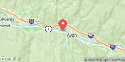
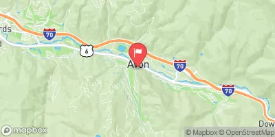
Burns To Dotsero
PLEASE READ: the flow for this strech is incorrect. The gauge used is just downstream from Dotsero where the confluence with the Eagle River is. So the flow on the strech from Burns to Dotsero is not what is shown here. Unfortunately I don't know how to edit the gauge, maybe someone else can do this.
Suggested river levels for paddling this section of the Colorado River are between a bare minimum of 500cfs and a high of 6,000cfs.
River conditions sourced from USGS 09070500, the Colorado River Near Dotsero
Remember only watercraft are permitted
at Burns to Dotsero.
Run Stats
Status | Runnable |
Class Level | I to IV |
Elevation | 6,113 ft |
Run Length | 29.0 Mi |
Gradient | 15 FPM |
Streamflow Discharge | 1310 cfs |
Gage Height | 2.7 ft |
Air Temperature | 52° |
River | Colorado River |
Reporting Streamgage |
Colorado River Near Dotsero
USGS 09070500 |
Rodeo Rapid
Class III- to III |
Pinball Rapid
Class III |
Horse Creek Riffle
Class II to III- |
Gauge | Streamflow | Stage |
---|---|---|
Muddy Crk Blw Wolford Mtn Reser. Nr Kremmling
USGS 09041400 |
61 cfs | 4.5 ft |
Homestake Creek At Gold Park
USGS 09064000 |
5 cfs | 4.0 ft |
Lincoln Creek Bl Grizzly Reservoir
USGS 09073005 |
1 cfs | 1.1 ft |
Arkansas River At Granite
USGS 07086000 |
238 cfs | 2.8 ft |
North Fork Gunnison River Near Somerset
USGS 09132500 |
248 cfs | 2.0 ft |
Blue River Below Green Mountain Reservoir
USGS 09057500 |
322 cfs | 4.1 ft |
Gore Creek At Upper Station
USGS 09065500 |
11 cfs | 2.3 ft |
Arkansas River Below Empire Gulch Near Malta
USGS 07083710 |
105 cfs | 3.1 ft |
Colorado River Near Dotsero
USGS 09070500 |
1,310 cfs | 2.7 ft |
Lake Fork Below Sugar Loaf Reservoir
USGS 07082500 |
3 cfs | 0.3 ft |
Snotel Site | Snowpack | 24hr Change |
---|---|---|
Crosho
SNOTEL 426 |
20" | 5" |
Butte
SNOTEL 380 |
23" | 1" |
silverthorne 21 nw, co
SNOTEL CO-SU-35 |
0.37" | 0" |
North French Creek
SNOTEL 668 |
68" | 0" |
Rabbit Ears
SNOTEL 709 |
40" | 8" |
Ripple Creek
SNOTEL 717 |
57" | 6" |
Brumley
SNOTEL 369 |
33" | 2" |
Chapman Tunnel
SNOTEL 1101 |
30" | 1" |
Whiskey Park
SNOTEL 859 |
53" | -1" |
Mc Clure Pass
SNOTEL 618 |
18" | 3" |
Bear River
SNOTEL 1061 |
29" | 4" |
Park Cone
SNOTEL 680 |
24" | 0" |
Sandstone Rs
SNOTEL 732 |
23" | 1" |
Vail Mountain
SNOTEL 842 |
28" | 1" |
Sage Creek Basin
SNOTEL 1015 |
34" | 3" |
Buffalo Park
SNOTEL 913 |
38" | 4" |
yampa 5.1 s, co
SNOTEL CO-RT-26 |
5.42" | 2.55" |
Kiln
SNOTEL 556 |
24" | 3" |
gothic
SNOTEL GTHC2 |
36.32" | -0.38" |
Old Battle
SNOTEL 673 |
81" | 1" |
Med Bow
SNOTEL 1196 |
94" | 4" |
crested butte 6.2 n, co
SNOTEL CO-GN-18 |
29.46" | -0.07" |
Divide Peak
SNOTEL 449 |
39" | 0" |
Dry Lake
SNOTEL 457 |
31" | 9" |
vail 3.5 e, co
SNOTEL CO-EG-53 |
16.4" | 0.01" |
Upper Taylor
SNOTEL 1141 |
25" | 0" |
North Lost Trail
SNOTEL 669 |
29" | 5" |
Tower
SNOTEL 825 |
91" | 12" |
Elliot Ridge
SNOTEL 1120 |
49" | 4" |
Independence Pass
SNOTEL 542 |
40" | 4" |
glenwood springs 7.0 nw, co
SNOTEL CO-GF-67 |
0.32" | 0" |
Arapaho Ridge
SNOTEL 1030 |
57" | 6" |
Blackhall Mtn
SNOTEL 1119 |
71" | 4" |
Ivanhoe
SNOTEL 547 |
48" | 4" |
Saint Elmo
SNOTEL 1100 |
26" | 0" |
Webber Springs
SNOTEL 852 |
47" | 3" |
Lynx Pass
SNOTEL 607 |
14" | 1" |
Sargents Mesa
SNOTEL 1128 |
35" | 0" |
Little Snake River
SNOTEL 1047 |
45" | 0" |
Trapper Lake
SNOTEL 827 |
14" | 6" |
Beaver Ck Village
SNOTEL 1041 |
17" | 2" |
Campground | Campsites | Reservations | Toilets | Showers | Elevation |
---|---|---|---|---|---|
Stagecoach State Park | 100 | 7,307 ft | |||
Pinball Point | None | 6,457 ft | |||
Gypsum | None | 6,286 ft | |||
Little Mattie | 22 | 7,911 ft | |||
Catamount | None | 6,563 ft |
Ski Area | Snowpack | Air Temperature | 5 Day Forecast |
---|---|---|---|
Buttermilk Mountain | 25" | 35° | 4.78" |
Snowmass | 25" | 35° | 4.78" |
Aspen Mountain | 40" | 34° | 5.84" |
Howelsen Hill Ski Area | 31" | 36° | 5.3" |
Steamboat Ski Resort | 31" | 36° | 5.3" |
Aspen Highlands | 25" | 35° | 4.78" |
River Run | Streamflow | Length | Class |
---|---|---|---|
State Bridge to Two Bridges | 739.0cfs | 4.8 Mi | I to II+ |
Barrel Springs | 1310.0cfs | 4.0 Mi | IV+ to V+ |
Shoshone (Power Plant to Grizzly Creek) | 1310.0cfs | 1.7 Mi | III- to IV |
State Bridge to Burns | 739.0cfs | 20.0 Mi | I to II+ |
Lower Fish Creek | 22.5cfs | 2.5 Mi | IV+ to V |
Lower Eagle (Edwards Water Plant to Eagle) | 134.0cfs | 17.0 Mi | III- to III+ |
Castle Creek | 135.0cfs | 2.0 Mi | IV+ to V- |
Barrel Springs | 1310.0cfs | 4.0 Mi | IV+ to V+ |
Burns to Dotsero | 1310.0cfs | 29.0 Mi | I to IV |
Shoshone (Power Plant to Grizzly Creek) | 1310.0cfs | 1.7 Mi | III- to IV |
Lower Eagle (Edwards Water Plant to Eagle) | 134.0cfs | 17.0 Mi | III- to III+ |
Pumphouse to Double Bridges | 573.0cfs | 12.5 Mi | I to II- |
Catherine Store Section | 304.0cfs | 4.0 Mi | II to II+ |
Carbondale to Westbank (Pink to Black) | 564.0cfs | 7.0 Mi | II |
Avalanche Down | 138.0cfs | 12.0 Mi | III |