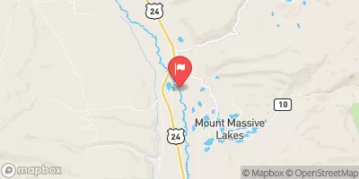
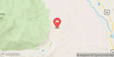
Pine Creek (Granite To Numbers)
Pine Creek was where the most difficult class V water was in the early years of kayaking. Now you can book a commercial trip on this section and be back in your 5 star hotel before dark. Even though the hardcore boaters are running Lake Creek and other steep creeks around, the Pine Creek section of the Arkansas still shouldn't be taken lightly if you decide to run this.
Suggested river levels for paddling this section of the Arkansas River are between a bare minimum of 250cfs and a high of 5,000cfs.
River conditions sourced from USGS 07087050, the Arkansas River Below Granite
Remember only watercraft are permitted
at Pine Creek (Granite to Numbers).
Run Stats
Status | Too Low |
Class Level | III+ to V- |
Elevation | 8,629 ft |
Run Length | 6.0 Mi |
Streamflow Discharge | 808 cfs |
Gage Height | 12.5 ft |
Air Temperature | 68° |
River | Arkansas River |
Reporting Streamgage |
Arkansas River Below Granite
USGS 07087050 |
Dam Drop Rapid
Class IV- to IV |
Pine Creek Rapid
Class IV- to IV |
Gauge | Streamflow | Stage |
---|---|---|
Arkansas River At Salida
USGS 07091500 |
1,030 cfs | 3.7 ft |
Tarryall Creek At Upper Station
USGS 06696980 |
22 cfs | 5.5 ft |
Keystone Gulch Near Dillon
USGS 09047700 |
8 cfs | 2.1 ft |
Hunter Creek Near Aspen
USGS 09074000 |
8 cfs | 1.1 ft |
Halfmoon Creek Near Malta
USGS 07083000 |
57 cfs | 2.1 ft |
Arkansas River Near Nathrop
USGS 07091200 |
988 cfs | 5.1 ft |
Beaver Creek At Avon
USGS 09067000 |
29 cfs | 2.5 ft |
Piney River Below Piney Lake
USGS 09058500 |
60 cfs | 3.8 ft |
Fraser River At Upper Sta
USGS 09022000 |
34 cfs | 1.3 ft |
Black Gore Creek Near Minturn
USGS 09066000 |
43 cfs | 3.5 ft |
Snotel Site | Snowpack | 24hr Change |
---|
Campground | Campsites | Reservations | Toilets | Showers | Elevation |
---|---|---|---|---|---|
North Fork Reservoir | 9 | 11,459 ft | |||
Weston Pass | 14 | 10,277 ft | |||
Halfmoon East | 6 | 9,923 ft | |||
Kite Lake | 5 | 12,043 ft | |||
Camp Hale Memorial | 21 | 9,318 ft | |||
Mount Princeton | 19 | 8,618 ft | |||
Cascade | 22 | 9,033 ft | |||
Dexter | 24 | 9,271 ft | |||
Collegiate Peaks | 56 | 9,837 ft | |||
Halfmoon West | 16 | 9,932 ft | |||
Hornsilver | 7 | 8,843 ft | |||
Matchless | 17 | 9,903 ft | |||
Chalk Lake | 19 | 8,743 ft | |||
Railroad Bridge - Arkansas Headwaters State Rec Area | None | 8,039 ft | |||
Baby Doe | 50 | 9,913 ft | |||
Molly Brown | 49 | 9,897 ft | |||
Angel of Shavano | 20 | 9,147 ft | |||
White Star | 66 | 9,256 ft | |||
Parry Peak | 26 | 9,430 ft | |||
Garfield | 8 | 9,912 ft | |||
Lakeview - Twin Lakes | 27 | 9,511 ft | |||
Silver Dollar | 43 | 9,905 ft | |||
Tabor | 44 | 9,897 ft | |||
Cottonwood Lake | 24 | 9,586 ft | |||
Belle of Colorado | 19 | 9,924 ft | |||
Blodgett | 6 | 8,836 ft | |||
Iron City | 15 | 9,928 ft | |||
Father Dyer | 26 | 9,953 ft |
Ski Area | Snowpack | Air Temperature | 5 Day Forecast |
---|---|---|---|
Beaver Creek Resort | 37" | 72° | 0" |
Keystone Resort | 36" | 58° | 0" |
Monarch Ski & Snowboard Area | 36" | 57° | 0" |
Copper Mountain Resort | 48" | 64° | 0" |
Breckenridge Ski Resort | 48" | 64° | 0" |
Ski Cooper | 29" | 58° | 0" |
Vail | 40" | 65° | 0" |
River Run | Streamflow | Length | Class |
---|---|---|---|
Salida to Rincon | 183.0cfs | 10.0 Mi | II+ to III |
Numbers | 183.0cfs | 4.9 Mi | III+ to IV+ |
Middle Ten Mile | 60.5cfs | 3.0 Mi | III+ to IV |
Breckenridge Whitewater Park (Town Run) | 55.7cfs | 0.25 Mi | II+ to III |
Lower (Bottom Four) | 38.3cfs | 1.0 Mi | V to V+ |
Lower Ten Mile | 60.5cfs | 3.0 Mi | II to III |
Lower Snake | 14.2cfs | 4.0 Mi | III to III+ |
Browns Canyon (Fisherman's Bridge to Stone Bridge) | 808.0cfs | 13.0 Mi | III to IV- |
Fractions | 183.0cfs | 7.0 Mi | III to III+ |
Milk Run | 183.0cfs | 4.0 Mi | II+ to III- |
Pine Creek (Granite to Numbers) | 183.0cfs | 6.0 Mi | III+ to V- |
Upper Ten Mile | 60.5cfs | 2.0 Mi | IV+ to V |
Upper Blue (Blue River CG to Columbine Landing) | 179.0cfs | 3.0 Mi | III to IV- |
Clear Creek of the Arkansas | 12.9cfs | 2.5 Mi | IV+ to V- |
Upper-Upper Ten Mile | 60.5cfs | 3.0 Mi | III+ to IV- |
Buena Vista Whitewater Park | 808.0cfs | 1.0 Mi | II+ to III+ |
Upper Gore Creek | 56.9cfs | 4.0 Mi | II+ to III |
Salida Town Run (Stone Bridge to Salida WW Park) | 183.0cfs | 12.0 Mi | II to III |
Dowd Chute | 150.0cfs | 1.0 Mi | III+ to IV+ |
Upper Gore Creek | 56.9cfs | 4.0 Mi | II+ to III |
Silverthorne Town Run | 42.4cfs | 0.5 Mi | II to III- |
Salida Whitewater Park | 183.0cfs | None Mi | III- to III+ |
The Upper | 38.3cfs | 8.0 Mi | V to V+ |