The Suwannee River Sill At River Mile 238 To The Little River Springs At River Mile 81 River Run
Community Reviews
Been here? Share the conditions.
Reviews, ratings & photos are added in the free Snoflo iOS app — rate a spot, tag the conditions, and your visit is verified by location. Add or manage your reviews from the app.
The Suwannee River Sill At River Mile 238 To The Little River Springs At River Mile 81
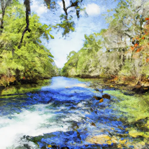
This stretch of the Suwannee River is rated as a Class I-II, providing a moderate challenge for paddlers. The segment has a total mileage of 157 miles, with numerous stopping points and camping locations along the way.
There are several notable rapids and obstacles along the route, including the Big Shoals rapids at River Mile 198.5, which is a Class III rapid that should only be attempted by experienced paddlers. Other rapids of note include the Swift Creek rapids at River Mile 137, and the Fargo rapids at River Mile 106.
There are several regulations that paddlers should be aware of when navigating this segment of the Suwannee River. For example, alcoholic beverages are prohibited on the river, and all paddlers must wear a US Coast Guard-approved personal flotation device. Additionally, there are restrictions on camping and fires in certain areas, so it is important to plan ahead and follow all regulations to ensure a safe and enjoyable trip.
Overall, the Suwannee River Sill at River Mile 238 to the Little River Springs at River Mile 81 offers a thrilling whitewater experience for paddlers of all skill levels. With its ideal streamflow range, moderate class rating, and numerous rapids and obstacles, this stretch of the Suwannee River is a must-visit destination for any whitewater enthusiast.
Plan your run down to the hour
Same weather feed Snoflo's iOS app uses -- updated continuously from NOAA / yr.no. Watch the precipitation column on the meteogram; rain ahead of a run typically lifts flows 12-48 hours later depending on the basin.
Next 5 days, hour by hour
Temperature line with weather symbols on top, snow + rain accumulation as columns, humidity as a dotted line.
5-day forecast table
Every 3 hours, broken out across temperature, snow, rain, humidity, and wind. Each cell is colour-coded relative to the column min/max.
| Time | Condition | Temp (°F) | Snow (in) | Rain (in) | Humidity (%) | Wind (mps) | Wind dir |
|---|---|---|---|---|---|---|---|
| Loading detailed forecast… | |||||||
15-day temperature & precipitation
Daily temperatures, snow, and rain projected over the next two weeks -- the upstream story that drives next week's flows.
Regional streamflow levels
USGS streamgauges around The Suwannee River Sill At River Mile 238 To The Little River Springs At River Mile 81 -- useful for spotting upstream pulses and gauging which tributary is contributing what.
| Streamgauge | Discharge | View |
|---|---|---|
| Suwannee River At Us 441 | 43 cfs | → |
| North Prong St. Marys River At Moniac | · | → |
| Suwannee R Nr Benton Fla | 1,250 cfs | → |
| Satilla River Near Waycross | 394 cfs | → |
| St. Marys River Nr Macclenny | 26 cfs | → |
| Alapaha River At Statenville | 189 cfs | → |
Plan a longer trip
The closest boat launches, other paddle runs, and campgrounds so a day on the water can grow into a full weekend.
Boat launches
- Suwannee River Sill
- Stephen C. Foster State Park
- Suwannee River Visitor Center
- Okefenokee National Wildlife Refuge
Other river runs
- The Headwaters To The Suwannee River Sill At River Mile 238
- Trader's Hill To Ends Approximately 1 Mile Downstream Of U.S. 301 Crossing
- Begins Approximately 1 Mile Downstream Of U.S. 301 Crossing To Ends Approximately 1 Mile Upstream Of Flea Hill, Georgia
- The Confluence Of The North Prong And Middle Prong To Trader's Hill
- Begins Approximately 1 Mile Upstream Of Flea Hill, Georgia To The Bells River Confluence
Campgrounds
Whitewater safety
- Check the flow before you run
- Use the linked-gauge card and Regional Flow panel above. Class ratings change with flow -- a Class III at low water can become Class IV+ at high water.
- Know your skill ceiling
- Pick runs comfortably below your ceiling. Cold-water and big-water runs raise the consequences of any mistake.
- Wear the right gear
- Helmet, PFD, drysuit / wetsuit when water is below 60°F. Throw bag, knife, and whistle on your person, not in the boat.
- Scout, set safety, and run with a team
- Scout new rapids on foot, set safety with throw bags above the consequence pool, and run with at least one other competent paddler.
- Respect the river
- Strainers, undercuts, low-head dams, and wood can kill at any class rating. When in doubt, portage.
Set push alerts in the Snoflo app
Save The Suwannee River Sill At River Mile 238 To The Little River Springs At River Mile 81 as a favorite, set a discharge threshold (e.g. "alert me when flow hits 600 cfs"), and the iOS app pushes the moment the linked gauge crosses.
About The Suwannee River Sill At River Mile 238 To The Little River Springs At River Mile 81
What's the optimal flow for The Suwannee River Sill At River Mile 238 To The Little River Springs At River Mile 81?
The optimal flow depends on the section and the craft. Check the Run Details panel for the linked gauge and current status.
How fresh is the cfs reading on this page?
The linked USGS streamgauge reports continuously (every 15 minutes); Snoflo refreshes throughout the day. Hover the streamflow sparkline to read individual datapoints.
What's the whitewater class?
See the Run Details panel for the class rating Snoflo tracks for this run. Class ratings change with flow -- a Class III at low water can become Class IV in high water.
Where do I put in / take out?
Tap Directions in the hero above to open driving directions to the put-in. For shuttle planning, check the Nearby Boat Launches panel and the river run operator's site.
Can I get alerts when flows hit the optimal range?
Yes -- alerts are managed in the Snoflo iOS app. Favorite this run, set a discharge threshold, and you'll get a push the moment the gauge crosses.
Other runs near here
Snoflo-tracked paddle runs within driving distance of The Suwannee River Sill At River Mile 238 To The Little River Springs At River Mile 81.