Nf Boundary To Taylor's Creek In Cherokee Nf (Tn) River Run
Community Reviews
Been here? Share the conditions.
Reviews, ratings & photos are added in the free Snoflo iOS app — rate a spot, tag the conditions, and your visit is verified by location. Add or manage your reviews from the app.
Nf Boundary To Taylor's Creek In Cherokee Nf (Tn)
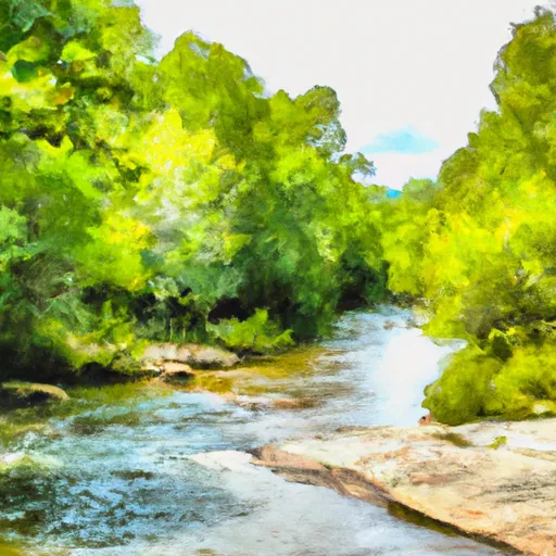
The segment mileage of this run is approximately 7 miles and features several notable rapids and obstacles. Some of the most challenging rapids include Pinball, 3-way, and Squeeze Play. Paddlers must also navigate numerous boulder gardens and tight channels throughout the run.
Specific regulations for this area include a permit requirement for overnight camping and a ban on glass containers and alcohol consumption. Additionally, paddlers must be aware of potential hazards such as fallen trees and swift currents.
Overall, the Whitewater River run offers a thrilling and challenging experience for experienced paddlers. It is important to check the current streamflow conditions and abide by all regulations to ensure a safe and enjoyable trip.
Plan your run down to the hour
Same weather feed Snoflo's iOS app uses -- updated continuously from NOAA / yr.no. Watch the precipitation column on the meteogram; rain ahead of a run typically lifts flows 12-48 hours later depending on the basin.
Next 5 days, hour by hour
Temperature line with weather symbols on top, snow + rain accumulation as columns, humidity as a dotted line.
5-day forecast table
Every 3 hours, broken out across temperature, snow, rain, humidity, and wind. Each cell is colour-coded relative to the column min/max.
| Time | Condition | Temp (°F) | Snow (in) | Rain (in) | Humidity (%) | Wind (mps) | Wind dir |
|---|---|---|---|---|---|---|---|
| Loading detailed forecast… | |||||||
15-day temperature & precipitation
Daily temperatures, snow, and rain projected over the next two weeks -- the upstream story that drives next week's flows.
Regional streamflow levels
USGS streamgauges around Nf Boundary To Taylor's Creek In Cherokee Nf (Tn) -- useful for spotting upstream pulses and gauging which tributary is contributing what.
| Streamgauge | Discharge | View |
|---|---|---|
| Mill Creek Near Crandall | 2 cfs | → |
| Ocoee River At Copperhill | 273 cfs | → |
| Conasauga River Near Eton | 149 cfs | → |
| Holly Creek Near Chatsworth | 24 cfs | → |
| Hiwassee River At Charleston | 10,400 cfs | → |
| Oostanaula Creek Near Sanford | 36 cfs | → |
Plan a longer trip
The closest boat launches, other paddle runs, and campgrounds so a day on the water can grow into a full weekend.
Boat launches
- Sugar Loaf Drive Polk County
- Lake Ocoee Marina
- West Parksville
- East Parksville
- Lake Conasauga Murray County
Other river runs
- Northern Boundary Cohutta Wilderness To Confluence With Conasauga River
- Southern Boundary Cohutta Wilderness Near Peter Cove To Northern Boundary Cohutta Wilderness Near Alaculsy
- Source In Cohutta Wilderness To Nf Boundary North Of Murray's Lake
- Taylors Creek (Rm 74.5) To Nf Boundary (Rm 70.0)
- Apalachia Powerhouse (Rm 53.5) To Us411 Bridge (Rm 43.0)
Campgrounds
- Cottonwood Patch
- Cottonwood Patch Campground
- Sylco
- Sylco Campground
- Hickey Gap Campground
- Parksville Lake Recreation Area
Fishing spots
Whitewater safety
- Check the flow before you run
- Use the linked-gauge card and Regional Flow panel above. Class ratings change with flow -- a Class III at low water can become Class IV+ at high water.
- Know your skill ceiling
- Pick runs comfortably below your ceiling. Cold-water and big-water runs raise the consequences of any mistake.
- Wear the right gear
- Helmet, PFD, drysuit / wetsuit when water is below 60°F. Throw bag, knife, and whistle on your person, not in the boat.
- Scout, set safety, and run with a team
- Scout new rapids on foot, set safety with throw bags above the consequence pool, and run with at least one other competent paddler.
- Respect the river
- Strainers, undercuts, low-head dams, and wood can kill at any class rating. When in doubt, portage.
Set push alerts in the Snoflo app
Save Nf Boundary To Taylor's Creek In Cherokee Nf (Tn) as a favorite, set a discharge threshold (e.g. "alert me when flow hits 600 cfs"), and the iOS app pushes the moment the linked gauge crosses.
About Nf Boundary To Taylor's Creek In Cherokee Nf (Tn)
What's the optimal flow for Nf Boundary To Taylor's Creek In Cherokee Nf (Tn)?
The optimal flow depends on the section and the craft. Check the Run Details panel for the linked gauge and current status.
How fresh is the cfs reading on this page?
The linked USGS streamgauge reports continuously (every 15 minutes); Snoflo refreshes throughout the day. Hover the streamflow sparkline to read individual datapoints.
What's the whitewater class?
See the Run Details panel for the class rating Snoflo tracks for this run. Class ratings change with flow -- a Class III at low water can become Class IV in high water.
Where do I put in / take out?
Tap Directions in the hero above to open driving directions to the put-in. For shuttle planning, check the Nearby Boat Launches panel and the river run operator's site.
Can I get alerts when flows hit the optimal range?
Yes -- alerts are managed in the Snoflo iOS app. Favorite this run, set a discharge threshold, and you'll get a push the moment the gauge crosses.
Other runs near here
Snoflo-tracked paddle runs within driving distance of Nf Boundary To Taylor's Creek In Cherokee Nf (Tn).