Begins Where Pipes First Meet The River And Main Diversion Begins To Mouth At Pacific Ocean River Run
Community Reviews
Been here? Share the conditions.
Reviews, ratings & photos are added in the free Snoflo iOS app — rate a spot, tag the conditions, and your visit is verified by location. Add or manage your reviews from the app.
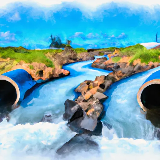
Begins Where Pipes First Meet The River And Main Diversion Begins To Mouth At Pacific Ocean
The river rapids and obstacles include tight chutes, big drops, and steep boulder gardens. The most challenging rapids on this run are the "Hole-in-the-Rock" and "Elevator Shaft." Paddlers should be aware of the strong eddies and currents that can make navigating the rapids more difficult.
There are specific regulations that apply to this area. Paddlers must obtain a permit to access the Whitewater River run, and the number of permits issued per day is limited to protect the environment and ensure the safety of paddlers. Additionally, all paddlers are required to wear a personal flotation device and a helmet while on the river.
In conclusion, the Whitewater River run in Hawaii is a challenging and thrilling experience for experienced paddlers. With its ideal streamflow range, Class III-IV rating, and specific rapids and obstacles, it provides a unique adventure for those seeking an adrenaline rush. However, paddlers must also be aware of the specific regulations in place to protect the environment and ensure their safety.
Plan your run down to the hour
Same weather feed Snoflo's iOS app uses -- updated continuously from NOAA / yr.no. Watch the precipitation column on the meteogram; rain ahead of a run typically lifts flows 12-48 hours later depending on the basin.
Next 5 days, hour by hour
Temperature line with weather symbols on top, snow + rain accumulation as columns, humidity as a dotted line.
5-day forecast table
Every 3 hours, broken out across temperature, snow, rain, humidity, and wind. Each cell is colour-coded relative to the column min/max.
| Time | Condition | Temp (°F) | Snow (in) | Rain (in) | Humidity (%) | Wind (mps) | Wind dir |
|---|---|---|---|---|---|---|---|
| Loading detailed forecast… | |||||||
15-day temperature & precipitation
Daily temperatures, snow, and rain projected over the next two weeks -- the upstream story that drives next week's flows.
Regional streamflow levels
USGS streamgauges around Begins Where Pipes First Meet The River And Main Diversion Begins To Mouth At Pacific Ocean -- useful for spotting upstream pulses and gauging which tributary is contributing what.
| Streamgauge | Discharge | View |
|---|---|---|
| Kaunakakai Gulch At Altitude 75 Feet | · | → |
| Halawa Stream Near Halawa | 19 cfs | → |
| Honokohau Stream Near Honokohau | 26 cfs | → |
| Kahakuloa Stream Near Honokohau | 9 cfs | → |
| Waihee River At Dam Near Waihee | 57 cfs | → |
| Iao Stream At Kepaniwai Park Nr Wailuku | 34 cfs | → |
Plan a longer trip
The closest boat launches, other paddle runs, and campgrounds so a day on the water can grow into a full weekend.
Other river runs
- Headwaters In The Mountain Bogs Between Pepeopae And Pu’U Ali’I Just Above An Elevation Of 4,000 Feet On The Interfluve That Separates Waikolu And Pelekunu Valleys To Ends Where Pipes First Meet The River And Main Diversion Begins
- Headwaters And Includes All Tributaries To Confluence With Pelekunu Stream
- Headwaters And Includes All Tributaries To Confluence With Kapuhi Stream
- Boundary Of Kalaupapa National Historical Park To Mouth At Pacific Ocean
Parks
Whitewater safety
- Check the flow before you run
- Use the linked-gauge card and Regional Flow panel above. Class ratings change with flow -- a Class III at low water can become Class IV+ at high water.
- Know your skill ceiling
- Pick runs comfortably below your ceiling. Cold-water and big-water runs raise the consequences of any mistake.
- Wear the right gear
- Helmet, PFD, drysuit / wetsuit when water is below 60°F. Throw bag, knife, and whistle on your person, not in the boat.
- Scout, set safety, and run with a team
- Scout new rapids on foot, set safety with throw bags above the consequence pool, and run with at least one other competent paddler.
- Respect the river
- Strainers, undercuts, low-head dams, and wood can kill at any class rating. When in doubt, portage.
Set push alerts in the Snoflo app
Save Begins Where Pipes First Meet The River And Main Diversion Begins To Mouth At Pacific Ocean as a favorite, set a discharge threshold (e.g. "alert me when flow hits 600 cfs"), and the iOS app pushes the moment the linked gauge crosses.
About Begins Where Pipes First Meet The River And Main Diversion Begins To Mouth At Pacific Ocean
What's the optimal flow for Begins Where Pipes First Meet The River And Main Diversion Begins To Mouth At Pacific Ocean?
The optimal flow depends on the section and the craft. Check the Run Details panel for the linked gauge and current status.
How fresh is the cfs reading on this page?
The linked USGS streamgauge reports continuously (every 15 minutes); Snoflo refreshes throughout the day. Hover the streamflow sparkline to read individual datapoints.
What's the whitewater class?
See the Run Details panel for the class rating Snoflo tracks for this run. Class ratings change with flow -- a Class III at low water can become Class IV in high water.
Where do I put in / take out?
Tap Directions in the hero above to open driving directions to the put-in. For shuttle planning, check the Nearby Boat Launches panel and the river run operator's site.
Can I get alerts when flows hit the optimal range?
Yes -- alerts are managed in the Snoflo iOS app. Favorite this run, set a discharge threshold, and you'll get a push the moment the gauge crosses.
Other runs near here
Snoflo-tracked paddle runs within driving distance of Begins Where Pipes First Meet The River And Main Diversion Begins To Mouth At Pacific Ocean.