North Branch--Butternut Lake To Confluence With Main Branch River Run
Community Reviews
Been here? Share the conditions.
Reviews, ratings & photos are added in the free Snoflo iOS app — rate a spot, tag the conditions, and your visit is verified by location. Add or manage your reviews from the app.
North Branch--Butternut Lake To Confluence With Main Branch
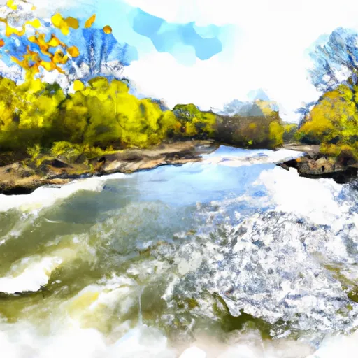
The segment mileage of this river run is approximately 6.5 miles, and it is known for its scenic views and lush forest surroundings. While there are no major rapids or obstacles to overcome on this stretch of the river, paddlers should be aware of potential strainers (branches or logs that can trap paddlers) and the occasional downed tree.
There are specific regulations that must be followed while paddling on the North Branch of the Whitewater River. Paddlers must have a valid water usage stamp and follow all rules and regulations set forth by the Illinois Department of Natural Resources. Additionally, all paddlers are required to wear personal flotation devices (PFDs) while on the river.
Overall, the North Branch of the Whitewater River offers a scenic and moderately challenging paddling experience for those looking to explore the beauty of Illinois' waterways.
Plan your run down to the hour
Same weather feed Snoflo's iOS app uses -- updated continuously from NOAA / yr.no. Watch the precipitation column on the meteogram; rain ahead of a run typically lifts flows 12-48 hours later depending on the basin.
Next 5 days, hour by hour
Temperature line with weather symbols on top, snow + rain accumulation as columns, humidity as a dotted line.
5-day forecast table
Every 3 hours, broken out across temperature, snow, rain, humidity, and wind. Each cell is colour-coded relative to the column min/max.
| Time | Condition | Temp (°F) | Snow (in) | Rain (in) | Humidity (%) | Wind (mps) | Wind dir |
|---|---|---|---|---|---|---|---|
| Loading detailed forecast… | |||||||
15-day temperature & precipitation
Daily temperatures, snow, and rain projected over the next two weeks -- the upstream story that drives next week's flows.
Regional streamflow levels
USGS streamgauges around North Branch--Butternut Lake To Confluence With Main Branch -- useful for spotting upstream pulses and gauging which tributary is contributing what.
| Streamgauge | Discharge | View |
|---|---|---|
| Iron River At County Hwy-424 At Caspian | 69 cfs | → |
| Popple River Near Fence | 51 cfs | → |
| Muskellunge Ck-Muskellunge L Otl-Nr Eagle River | 2 cfs | → |
| Brule River At Us Highway 2 Near Florence | 214 cfs | → |
| Muskellunge Creek Near St. Germain | 9 cfs | → |
| Paint River Nr Alpha | 292 cfs | → |
Plan a longer trip
The closest boat launches, other paddle runs, and campgrounds so a day on the water can grow into a full weekend.
Boat launches
- May Lake
- Luna Lake
- Butternut Lake -- Northeast Access Nr National Forest Rd 2140
- Butternut Lake -- Access At Far South - Nr 4 Duck Lake
- Franklin Lake - Access Adjacent To Us Forest Svc Campground
- Town Of Phelps
Other river runs
- Private Bridge To Highway 55
- Forest Road 2174 To Private Bridge
- Main Branch--Headwaters To Forest Road 2174
- Highway 55 To Forest Road 2169
- 1/4 Mile West Of Highway 55 To Confluence With Main Branch
Whitewater safety
- Check the flow before you run
- Use the linked-gauge card and Regional Flow panel above. Class ratings change with flow -- a Class III at low water can become Class IV+ at high water.
- Know your skill ceiling
- Pick runs comfortably below your ceiling. Cold-water and big-water runs raise the consequences of any mistake.
- Wear the right gear
- Helmet, PFD, drysuit / wetsuit when water is below 60°F. Throw bag, knife, and whistle on your person, not in the boat.
- Scout, set safety, and run with a team
- Scout new rapids on foot, set safety with throw bags above the consequence pool, and run with at least one other competent paddler.
- Respect the river
- Strainers, undercuts, low-head dams, and wood can kill at any class rating. When in doubt, portage.
Set push alerts in the Snoflo app
Save North Branch--Butternut Lake To Confluence With Main Branch as a favorite, set a discharge threshold (e.g. "alert me when flow hits 600 cfs"), and the iOS app pushes the moment the linked gauge crosses.
About North Branch--Butternut Lake To Confluence With Main Branch
What's the optimal flow for North Branch--Butternut Lake To Confluence With Main Branch?
The optimal flow depends on the section and the craft. Check the Run Details panel for the linked gauge and current status.
How fresh is the cfs reading on this page?
The linked USGS streamgauge reports continuously (every 15 minutes); Snoflo refreshes throughout the day. Hover the streamflow sparkline to read individual datapoints.
What's the whitewater class?
See the Run Details panel for the class rating Snoflo tracks for this run. Class ratings change with flow -- a Class III at low water can become Class IV in high water.
Where do I put in / take out?
Tap Directions in the hero above to open driving directions to the put-in. For shuttle planning, check the Nearby Boat Launches panel and the river run operator's site.
Can I get alerts when flows hit the optimal range?
Yes -- alerts are managed in the Snoflo iOS app. Favorite this run, set a discharge threshold, and you'll get a push the moment the gauge crosses.
Other runs near here
Snoflo-tracked paddle runs within driving distance of North Branch--Butternut Lake To Confluence With Main Branch.