2026-02-20T19:00:00-05:00
* WHAT...Heavy mixed precipitation possible. Total snow accumulations between 2 and 5 inches and ice accumulations from a glaze up to two tenths of an inch possible. * WHERE...Alger, Luce, Marquette, and Northern Schoolcraft Counties. * WHEN...From this evening through Friday evening. * IMPACTS...Plan on slippery road conditions. The hazardous conditions will impact the Thursday morning and evening commutes.
Summary
The ideal streamflow range for this segment is 150-400 cfs, which makes it a moderate to difficult class II-III run. The segment starts at the source in Sec 26, T46N, R23 W and ends at the junction with County Road 444. The river runs through a forested area, providing a scenic trip for paddlers.
The rapids on this segment include Rock Garden, Pinball, and The Maze. Rock Garden is a class III rapid that requires precise maneuvering, while Pinball is a bouncy class II rapid. The Maze is a technical class II rapid that requires paddlers to navigate through tight channels.
In terms of regulations, there are no specific regulations for this segment of the river. However, paddlers are encouraged to practice Leave No Trace principles and to respect private property rights while paddling. It is also recommended that paddlers wear personal flotation devices and have proper safety equipment.
Overall, the West Branch of the Whitewater River is a challenging run that offers a beautiful natural setting. Paddlers should be prepared for the technical rapids and varying water levels, and should take precautions to ensure a safe and enjoyable trip.
°F
°F
mph
Wind
%
Humidity
15-Day Weather Outlook
River Run Details
| Last Updated | 2025-05-14 |
| River Levels | 167 cfs (3.74 ft) |
| Percent of Normal | 65% |
| Status | |
| Class Level | ii-iii |
| Elevation | ft |
| Streamflow Discharge | cfs |
| Gauge Height | ft |
| Reporting Streamgage | USGS 04044724 |
5-Day Hourly Forecast Detail
Nearby Streamflow Levels
 Au Train River At Forest Lake
|
137cfs |
 Sturgeon River Near Nahma Junction
|
105cfs |
 Escanaba River At Cornell
|
1620cfs |
 Middle Branch Escanaba River Nr Princeton
|
116cfs |
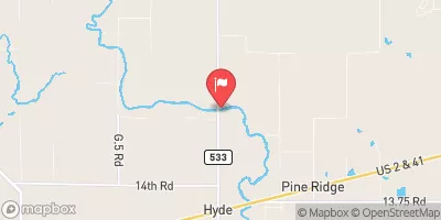 Ford River Near Hyde
|
286cfs |
 Schweitzer Creek Near Palmer
|
1cfs |
Area Campgrounds
| Location | Reservations | Toilets |
|---|---|---|
 Forest Lake State Forest Campground
|
||
 Haymeadow Creek Campground
|
||
 Haymeadow Creek Campsites
|


 West Branch From Source In Sec 26, T46N, R23 W To Junction With County Road 444