Minnewawa Falls To Lake Superior River Run
Community Reviews
Been here? Share the conditions.
Reviews, ratings & photos are added in the free Snoflo iOS app — rate a spot, tag the conditions, and your visit is verified by location. Add or manage your reviews from the app.
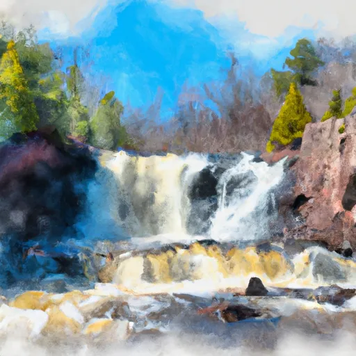
Minnewawa Falls To Lake Superior
The class rating for this stretch of the river is Class III and IV, offering exciting rapids and obstacles for experienced paddlers. The segment mileage is approximately 6.5 miles, with the average run time being around 3-4 hours.
Specific rapids and obstacles along this stretch of the river include the Minnewawa Falls themselves, as well as the "Crazy Sluice" and "Pinball" rapids. These sections offer challenging drops and tight turns, making it a thrilling adventure for those looking for an adrenaline rush.
There are specific regulations to be aware of when paddling this section of the Whitewater River. All paddlers are required to wear a personal flotation device (PFD) at all times, and it is recommended to wear a helmet as well. Additionally, there are restrictions on the use of motorized watercraft on this section of the river.
Plan your run down to the hour
Same weather feed Snoflo's iOS app uses -- updated continuously from NOAA / yr.no. Watch the precipitation column on the meteogram; rain ahead of a run typically lifts flows 12-48 hours later depending on the basin.
Next 5 days, hour by hour
Temperature line with weather symbols on top, snow + rain accumulation as columns, humidity as a dotted line.
5-day forecast table
Every 3 hours, broken out across temperature, snow, rain, humidity, and wind. Each cell is colour-coded relative to the column min/max.
| Time | Condition | Temp (°F) | Snow (in) | Rain (in) | Humidity (%) | Wind (mps) | Wind dir |
|---|---|---|---|---|---|---|---|
| Loading detailed forecast… | |||||||
15-day temperature & precipitation
Daily temperatures, snow, and rain projected over the next two weeks -- the upstream story that drives next week's flows.
Regional streamflow levels
USGS streamgauges around Minnewawa Falls To Lake Superior -- useful for spotting upstream pulses and gauging which tributary is contributing what.
| Streamgauge | Discharge | View |
|---|---|---|
| Presque Isle River Near Tula | 66 cfs | → |
| Black River Near Bessemer | 20 cfs | → |
| West Branch Ontonagon River Near Bergland | 50 cfs | → |
| Ontonagon River Near Rockland | 522 cfs | → |
| Cisco Branch Ontonagon R At Cisco Lake Outlet | 1 cfs | → |
| Bad River Near Odanah | 78 cfs | → |
Plan a longer trip
The closest boat launches, other paddle runs, and campgrounds so a day on the water can grow into a full weekend.
Boat launches
- Black River Harbor
- Eddy Park Road Wakefield
- M 64 Bergland Township
- Railroad Street Bergland
- 107th Engineers Memorial Highway Carp Lake Township
- Mcdonald Dam
Other river runs
- West Branch, Mi State Highway 28 To Cascade Falls
- South Branch,Confluence Of Cisco Branch And Tenmile Creek To Confluence With West Branch
- Footbridge To Forest Road 144
- Headwaters To Footbridge
- Forest Road 144 To Forest Road 148
Campgrounds
- Preque Isle State Campground
- Black River Harbor Recreation Area
- Black River Harbor Campground
- Backcountry Campsite Bc4
- Backcountry Campsite Bc3
- Lc-2
Fishing spots
Whitewater safety
- Check the flow before you run
- Use the linked-gauge card and Regional Flow panel above. Class ratings change with flow -- a Class III at low water can become Class IV+ at high water.
- Know your skill ceiling
- Pick runs comfortably below your ceiling. Cold-water and big-water runs raise the consequences of any mistake.
- Wear the right gear
- Helmet, PFD, drysuit / wetsuit when water is below 60°F. Throw bag, knife, and whistle on your person, not in the boat.
- Scout, set safety, and run with a team
- Scout new rapids on foot, set safety with throw bags above the consequence pool, and run with at least one other competent paddler.
- Respect the river
- Strainers, undercuts, low-head dams, and wood can kill at any class rating. When in doubt, portage.
Set push alerts in the Snoflo app
Save Minnewawa Falls To Lake Superior as a favorite, set a discharge threshold (e.g. "alert me when flow hits 600 cfs"), and the iOS app pushes the moment the linked gauge crosses.
About Minnewawa Falls To Lake Superior
What's the optimal flow for Minnewawa Falls To Lake Superior?
The optimal flow depends on the section and the craft. Check the Run Details panel for the linked gauge and current status.
How fresh is the cfs reading on this page?
The linked USGS streamgauge reports continuously (every 15 minutes); Snoflo refreshes throughout the day. Hover the streamflow sparkline to read individual datapoints.
What's the whitewater class?
See the Run Details panel for the class rating Snoflo tracks for this run. Class ratings change with flow -- a Class III at low water can become Class IV in high water.
Where do I put in / take out?
Tap Directions in the hero above to open driving directions to the put-in. For shuttle planning, check the Nearby Boat Launches panel and the river run operator's site.
Can I get alerts when flows hit the optimal range?
Yes -- alerts are managed in the Snoflo iOS app. Favorite this run, set a discharge threshold, and you'll get a push the moment the gauge crosses.
Other runs near here
Snoflo-tracked paddle runs within driving distance of Minnewawa Falls To Lake Superior.