Jicarilla Apache Reservation Boundary To Confluence With Vaqueros Canyon River Run
Community Reviews
Been here? Share the conditions.
Reviews, ratings & photos are added in the free Snoflo iOS app — rate a spot, tag the conditions, and your visit is verified by location. Add or manage your reviews from the app.
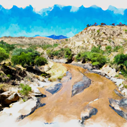
Jicarilla Apache Reservation Boundary To Confluence With Vaqueros Canyon
The Jicarilla Apache Tribe manages the use of this river, and permits are required to access the area. They limit the number of boaters per day and require a Leave No Trace policy. The tribe also requires that all boats have a spare paddle, personal flotation device, and a whistle. There is no camping allowed along the river, and the tribe prohibits the use of glass containers and alcohol.
According to americanwhitewater.org, the 17-mile segment is broken into two sections. The Upper Whitewater River is 7 miles long and has Class II-III rapids. The Lower Whitewater River is 10 miles long and has Class I-II rapids with a few Class III drops. The river is accessible from Highway 84, and the take-out point is near the intersection of Highway 84 and Highway 64.
In conclusion, the Whitewater River run on the Jicarilla Apache Reservation Boundary to Confluence with Vaqueros Canyon in New Mexico is a popular river run with Class II-III rapids, rocky terrain, and specific regulations enforced by the Jicarilla Apache Tribe. Boaters must have a permit, adhere to a Leave No Trace policy, and follow specific gear requirements. The ideal streamflow range for this segment is between 250-500 cfs, and the segment is broken into two parts, Upper and Lower Whitewater River.
Plan your run down to the hour
Same weather feed Snoflo's iOS app uses -- updated continuously from NOAA / yr.no. Watch the precipitation column on the meteogram; rain ahead of a run typically lifts flows 12-48 hours later depending on the basin.
Next 5 days, hour by hour
Temperature line with weather symbols on top, snow + rain accumulation as columns, humidity as a dotted line.
5-day forecast table
Every 3 hours, broken out across temperature, snow, rain, humidity, and wind. Each cell is colour-coded relative to the column min/max.
| Time | Condition | Temp (°F) | Snow (in) | Rain (in) | Humidity (%) | Wind (mps) | Wind dir |
|---|---|---|---|---|---|---|---|
| Loading detailed forecast… | |||||||
15-day temperature & precipitation
Daily temperatures, snow, and rain projected over the next two weeks -- the upstream story that drives next week's flows.
Regional streamflow levels
USGS streamgauges around Jicarilla Apache Reservation Boundary To Confluence With Vaqueros Canyon -- useful for spotting upstream pulses and gauging which tributary is contributing what.
| Streamgauge | Discharge | View |
|---|---|---|
| San Juan River Near Carracas | 44 cfs | → |
| San Juan River Near Archuleta | 859 cfs | → |
| Piedra River Near Arboles | 30 cfs | → |
| Spring Creek At La Boca | 40 cfs | → |
| Los Pinos River At La Boca | 94 cfs | → |
| Rio Chama Below El Vado Dam | 103 cfs | → |
Plan a longer trip
The closest boat launches, other paddle runs, and campgrounds so a day on the water can grow into a full weekend.
Whitewater safety
- Check the flow before you run
- Use the linked-gauge card and Regional Flow panel above. Class ratings change with flow -- a Class III at low water can become Class IV+ at high water.
- Know your skill ceiling
- Pick runs comfortably below your ceiling. Cold-water and big-water runs raise the consequences of any mistake.
- Wear the right gear
- Helmet, PFD, drysuit / wetsuit when water is below 60°F. Throw bag, knife, and whistle on your person, not in the boat.
- Scout, set safety, and run with a team
- Scout new rapids on foot, set safety with throw bags above the consequence pool, and run with at least one other competent paddler.
- Respect the river
- Strainers, undercuts, low-head dams, and wood can kill at any class rating. When in doubt, portage.
Set push alerts in the Snoflo app
Save Jicarilla Apache Reservation Boundary To Confluence With Vaqueros Canyon as a favorite, set a discharge threshold (e.g. "alert me when flow hits 600 cfs"), and the iOS app pushes the moment the linked gauge crosses.
About Jicarilla Apache Reservation Boundary To Confluence With Vaqueros Canyon
What's the optimal flow for Jicarilla Apache Reservation Boundary To Confluence With Vaqueros Canyon?
The optimal flow depends on the section and the craft. Check the Run Details panel for the linked gauge and current status.
How fresh is the cfs reading on this page?
The linked USGS streamgauge reports continuously (every 15 minutes); Snoflo refreshes throughout the day. Hover the streamflow sparkline to read individual datapoints.
What's the whitewater class?
See the Run Details panel for the class rating Snoflo tracks for this run. Class ratings change with flow -- a Class III at low water can become Class IV in high water.
Where do I put in / take out?
Tap Directions in the hero above to open driving directions to the put-in. For shuttle planning, check the Nearby Boat Launches panel and the river run operator's site.
Can I get alerts when flows hit the optimal range?
Yes -- alerts are managed in the Snoflo iOS app. Favorite this run, set a discharge threshold, and you'll get a push the moment the gauge crosses.
Other runs near here
Snoflo-tracked paddle runs within driving distance of Jicarilla Apache Reservation Boundary To Confluence With Vaqueros Canyon.